
San Juan de Santa Bárbara facts for kids
Quick facts for kids
San Juan
|
|
|---|---|
|
District
|
|

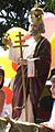
San Juan de Santa Bárbara de Heredia's Patron Saint
|
|

San Juan
Location in Costa Rica
|
|
| Country | |
| Province | Heredia |
| Canton | Santa Bárbara |
| Area | |
| • Total | 4.45 km2 (1.72 sq mi) |
| Elevation | 1,045 m (3,428 ft) |
| Population
(2011)
|
|
| • Total | 7,662 |
| • Density | 1,721.8/km2 (4,459/sq mi) |
| Demonym(s) | Vecino de San Juan, San Juaneño |
| Time zone | UTC−06:00 |
| Postal code |
40403
|
| Climate | Am |
San Juan is a district in Costa Rica. It is part of the Santa Bárbara canton, which is in the Heredia province. The district has two main parts: San Juan Arriba (Upper San Juan) and San Juan Abajo (Lower San Juan).
Contents
A Look Back: San Juan's History
Early Days and Growth
Before Spanish settlers arrived, the area of Santa Bárbara, including San Juan, was home to the Huetares people. Their leader was King Cacique Garabito. When the Spanish came, they first called the area Churruca or Surruco. Nearby cities like Heredia, Barva, and Alajuela grew in the late 1700s. As trade between these cities increased, the canton of Santa Bárbara also developed.
In 1836, an Englishman named John Hale sold his land to people living in what is now San Juan. They bought the land using money earned from growing sugarcane. On December 7, 1848, San Juan became one of the first districts when the fourth canton of Heredia was created.
Building a Community
In 1852, Horacio Morales helped build the first chapel in San Juan. Even so, many people still went to church in Santa Bárbara. By 1885, San Juan had schools for both boys and girls, showing its commitment to education.
San Juan opened the canton's first hydroelectric plant in 1914. This plant was built along the Porrosatí River, which separates San Juan from Santa Bárbara. Later, between 1924 and 1928, during the time Ricardo Jiménez Oreamuno was president, water systems were put in place using water from the Potrerillos River.
What San Juan Makes: Economy
Farming and Local Business
The main way San Juan makes money is through farming, especially coffee. In 1973, San Juan produced over 1,000 kilograms of coffee! There was also a sawmill, so making lumber was another important activity.
Today, San Juan has many local businesses. You can find restaurants and small shops. There's also a special place that processes coffee for many local farmers. San Juan is even famous for a ceviche restaurant located near its main square.
Learning and Culture in San Juan
Schools and Local Talent
San Juan was once featured on a TV show called "Informe Once" (Eleven Report) by Repretel. The show highlighted small businesses in the district, like a farmer and an ice-cream maker. It also showed a traditional Costa Rican country house.
San Juan has two private schools:
- Colegio Bilingüe Nueva Esperanza (New Hope Bilingual High School): Founded in 1993, it was the first private technical school in Costa Rica. This means students learned special computer skills there. In 2009, about 590 students attended this school.
- Puente Verde (Green Bridge).
The main public elementary school is called Tranquilino Saenz Rojas. After elementary school, students from San Juan usually go to Colegio Santa Bárbara High School. Some might also attend high schools in Alajuela. In 2012, a resident named Noelia Villalobos Solórzano won the Rubén Darío Prize from Panama for her great work in education.
How San Juan is Managed
Local Services and Future Plans
The police force from Heredia helps keep San Juan safe. There is also an EBAIS, which is a Basic Medical Care Center. It helps both people living in San Juan and those visiting. San Juan also has a private nursing home.
The local government has thought about helping small businesses in San Juan, especially those run by women and artists. However, their top goal right now is to build a police station right in the district.
San Juan's Location and Nature
Where San Juan Is
San Juan covers an area of 4.45 square kilometers (about 1.7 square miles). It is located at an elevation of 1045 meters (about 3,428 feet) above sea level. This is the lowest point in the canton.
San Juan is directly south of the main town of Santa Bárbara de Heredia. It is divided into two main neighborhoods: San Juan Arriba (Upper San Juan) and San Juan Abajo (Lower San Juan). Other neighborhoods include Cinco Esquinas (Five Points), Villa Margarita, Tierra Santa (Holy Land), and Calle Zapote (Zapote Street). Roads like Routes 123 and 119 pass through San Juan.
Rivers and Environment
The Zanjón River, Quebrada la Claudia, and Porrosatí River all flow through San Juan. During the rainy season, San Juan can sometimes experience flooding. For example, in May 2014, over 100 homes were affected because drainage systems got blocked. Like many places in Costa Rica, San Juan is in an area that has a higher risk of natural events, according to the National Risk Prevention Commission.
Population of San Juan
| Historical population | |||
|---|---|---|---|
| Census | Pop. | %± | |
| 1883 | 507 | — | |
| 1892 | 596 | 17.6% | |
| 1927 | 647 | 8.6% | |
| 1950 | 896 | 38.5% | |
| 1963 | 1,352 | 50.9% | |
| 1973 | 1,830 | 35.4% | |
| 1984 | 3,502 | 91.4% | |
| 2000 | 6,245 | 78.3% | |
| 2011 | 7,662 | 22.7% | |
|
Instituto Nacional de Estadística y Censos |
|||
According to the 2011 census, San Juan had a population of 7,662 people.
Getting Around: Transportation
Road Connections
The following main roads pass through the district:
- National Route 119
- National Route 123


Images for kids
-
San Juan de Santa Bárbara de Heredia's Patron Saint
See also
 In Spanish: San Juan de Santa Bárbara para niños
