
San Pablo District, Paraguay facts for kids
Quick facts for kids
San Pablo
|
|||
|---|---|---|---|
|
|||
 |
|||
| Country | Paraguay | ||
| Department | San Pedro | ||
| Area | |||
| • Total | 603 km2 (233 sq mi) | ||
| Elevation | 227 m (745 ft) | ||
| Population
(2008)
|
|||
| • Total | 4,351 | ||
| • Density | 7.22/km2 (18.7/sq mi) | ||
| Time zone | -4 GMT | ||
| Postal code |
8060
|
||


San Pablo is a district in the San Pedro Department of Paraguay. It includes a village also called San Pablo, or San Pedro de Ycuamandiyú. This village has about 680 people. It is located around 330 kilometers (about 205 miles) from Asuncion, the capital city.
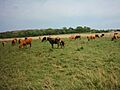
San Pablo is a small district with just over 4,000 people. It is located along the Jejui Guazú river. Most people here work in farming. The soil in San Pablo is very good for growing crops and raising animals.
Contents
Exploring San Pablo's Geography
The district of San Pablo is in the center of the San Pedro Department. In the past, this area lost many of its trees due to deforestation. However, it still has some very rich forests. These forests are important for the local economy.
The region also has areas used for farming. There are also low prairies (grassy lands) that sometimes get flooded by water.
Land Area and Population
San Pablo covers an area of 603 square kilometers (about 233 square miles). It has a population of 4,351 people. This means there are about 7.22 people living in each square kilometer.
Transportation and Communication
San Pablo has several ports, including Puerto Tayi and Puerto La Niña. These ports are important for trading farm products. They also help people travel and communicate with other nearby districts.
Roads and Public Transport
The roads in San Pablo are mostly unpaved. These internal roads connect different parts of the district. They also link San Pablo to other national routes.
Today, San Pablo has public transport services. You can travel between districts. There are also regular services to Asuncion, the country's capital. You can even find transport to cities like Ciudad del Este, Pedro Juan Caballero, and even to Brazil, Argentina, and Chile.
San Pablo's Borders
San Pablo shares its borders with several other districts:
- To the north, it borders the district of San Pedro de Ycuamandiyú. The river Jejui Guazú separates these two areas.
- To the south, you will find the district of Villa del Rosario.
- To the east, it borders the district of Choré.
- To the west, it is next to the district of Antequera.
Waterways and Climate
The district is home to the Jejui Guazú river. This river is known for being one of the least polluted in Paraguay. It also has beautiful white sand beaches.
Weather Patterns
The climate in San Pablo is mostly rainy and humid. The air usually has a lot of moisture, between 70% and 80% humidity. The average temperature is 23°C (73°F). In summer, temperatures can reach 38°C (100°F). In cooler times, they can drop to 10°C (50°F).
Education and Language
San Pablo has schools for elementary and high school students. Children and young people attend these schools regularly.
Sometimes, it can be hard for children to go to school. This is often because families face financial difficulties. This problem especially affects girls and women. Indigenous groups in the area also have access to primary education, but not all children attend regularly.
Many working adults in San Pablo do not have high-level skills. This can make it harder for the area to grow and develop.
Languages Spoken
The main language spoken in San Pablo is Guarani language. About 80% of the people speak it. The other 20% speak a mix of Spanish and Guarani, called Jopara.
Understanding San Pablo's Population

Most of San Pablo's population, about 83.08%, lives in rural areas.
There are 713 households (families) in the district. About 143 of these are in urban areas. The remaining 570 households are in rural areas. This means almost 80% of homes are in the countryside.
Here are some details about the population:
- In 2010, the total population was 4,403 people. Out of these, 2,354 were men and 2,050 were women.
Some important facts about the people living here:
- About 43.5% of the population is under 15 years old.
- On average, women have about 3.6 children.
- About 8.4% of people cannot read or write.
- About 67.6% of people work in the primary sector (like farming).
- About 6.3% work in the secondary sector (like manufacturing).
- About 25.1% work in the tertiary sector (like services).
- About 67.3% of jobs are in agriculture.
- About 78.4% of homes have electricity.
- About 41.0% of homes have running water.
Population Numbers
The district of San Pablo has 4,351 residents. There are 2,324 men and 2,027 women. This means about 53.3% of the population is male and 46.6% is female.
An organization called INDERT (formerly IBR) has set up a colony here. This colony covers 6,495 hectares (about 16,050 acres) and has 400 plots of land.
San Pablo's Economy
San Pablo has had lower economic indicators compared to some other districts. However, in recent years, there have been good improvements. These changes are helping people have a better quality of life.
A large part of the population (77.9%) in San Pablo is considered poor. On average, a family earns about 408,487 Guarani per month. This is about 73,834 Guarani per person.
The economy of San Pablo mainly relies on farming. This has grown a lot because the soil is very fertile. New farming projects have also helped. The main crops grown here are:
- cotton
- tobacco
- soybeans
- mate (a type of tea)
- cassava (a root vegetable)
- sunflower
- Sour oranges and sweet oranges
Local Government
The current mayor of San Pablo is Mr. Quentin Bernardino Gonzalez Guerrero. He was elected for the period from 2006 to 2010.
Fun Things to Do: Tourism
The best place to visit in San Pablo is the beaches along the Jejui Guazú river. The water here is very clean. The white sand beaches make it a great spot to cool off and relax during the summer.
How to Get to San Pablo
If you are traveling from Asuncion, you should take Route II Marshal José Félix Estigarribia. Follow this road to the city of Coronel Oviedo. From there, take Route III General Elizardo Aquino to the district of Choré. Then, continue west for about 35 kilometers (about 22 miles) to reach San Pablo.
Images for kids
-
San Pedro, a nearby city
See also
 In Spanish: San Pablo (Paraguay) para niños
