
Santa Teresa, San Jose facts for kids
Quick facts for kids
Santa Teresa
|
|
|---|---|
|
Neighborhood of San Jose
|
|
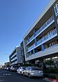
.jpg)   _(cropped).jpg)  Top: Ramac Park; middle: shops on Village Oaks Dr; apartments on Palmia Ave; bottom: view of the Santa Teresa Hills from Ascent Apartments; apartments on Vía del Oro.
|
|

Santa Teresa
Location in San Jose, California
|
|
| Country | United States |
| State | California |
| County | Santa Clara |
| City | San Jose |
Santa Teresa is a neighborhood in San Jose, California, located in the southern part of the city. It was started in 1834 as Rancho Santa Teresa by the Bernal family. Today, Santa Teresa is mostly a place where people live. It is also home to many big tech companies from Silicon Valley.
This area is the southernmost urban part of San Jose. To its south is the protected Coyote Valley. The Santa Teresa Hills are to its west, and the Bayshore Freeway (Highway 101) is to its east.
Contents
Discovering Santa Teresa's Past
.jpg)
Santa Teresa began in 1834 as Rancho Santa Teresa. This was a special land grant given by Governor José Figueroa to Don José Joaquín Bernal. He was a retired soldier who came to California in 1776. José Joaquín Bernal had already been living in the area since 1826.
He named the area Santa Teresa because he believed the healing waters of the Santa Teresa Spring were a gift from Saint Teresa of Ávila. She was a Spanish saint from the 1500s. Rancho Santa Teresa quickly became a lively place for Californio families in the southern Santa Clara Valley. They often had fiestas with Fandango dancing and big feasts.
After Don José Joaquín passed away, his son, Don Bruno Bernal, took over the rancho. His other two brothers, Agustín and Juan Pablo, started businesses outside of Santa Teresa. During the California Gold Rush, Agustín and Juan Pablo sold their cattle to miners. Don Bruno stayed home and managed the rancho.
Don Bruno became a very important person in the region. He ran the rancho until he died in 1863. Today, part of the original rancho is kept as the Rancho Santa Teresa Historic District. The first adobe house of the rancho burned down a long time ago.
In 1844, a peace agreement called the Treaty of Santa Teresa (Tratado de Santa Teresa) was signed at the rancho. This agreement temporarily stopped fighting between Governor Manuel Micheltorena and a group led by former Governor Juan Bautista Alvarado.
RAMAC Park is named after the IBM 305 RAMAC. This was the first computer to use a disk drive. It was created at the IBM Santa Teresa Lab in the 1950s.
Exploring Santa Teresa's Location
.jpg)

Santa Teresa is located in the southern part of San Jose. The Santa Teresa Hills separate it from Almaden Valley to the west. To the north of Coyote Valley, Santa Teresa is separated from the Madrone neighborhood of Morgan Hill.
To the northeast of Santa Teresa is Edenvale. To the northwest is Blossom Valley. Tulare Hill acts as a natural barrier between the southern tip of Santa Teresa and Coyote Valley.
The Cottle Transit Village is a special "Urban Village" within Santa Teresa. It is located in the north-central part of the neighborhood.
Parks and Green Spaces
.jpg)
Santa Teresa has several parks where you can enjoy nature and outdoor activities:
- Santa Teresa County Park
- Palmia Park
- Los Paseos Park
- George Page Park
- Ramac Park
- Raleigh Linear Park
- Avenida España Park
- Black Mountain Bowmen
Schools and Learning


Most of Santa Teresa is served by the Oak Grove School District. This district includes:
- Taylor Elementary School
- Santa Teresa Elementary School
- Bernal Intermediate School
- Santa Teresa High School
The very southern parts of Santa Teresa are served by the Morgan Hill Unified School District. This district runs two schools in Santa Teresa:
- Los Paseos Elementary School
- Martin Murphy Middle School
Getting Around Santa Teresa

Santa Teresa has three stations for the VTA light rail system. This makes it easy to travel around the area:
- Cottle station on Cottle Road (in central Santa Teresa)
- Santa Teresa station on Santa Teresa Boulevard (in southern Santa Teresa)
- Snell station on Snell Road (serves both western Santa Teresa and Blossom Valley)
Important Places to See
- Kaiser San Jose Medical Center
- Santa Teresa County Park
- Rancho Santa Teresa Historic District
Santa Teresa in Stories
Santa Teresa is the fictional home of Kinsey Millhone in Sue Grafton's "Alphabet" series of detective novels. However, in these books, Santa Teresa is described as a town in Santa Barbara County, far from the real Santa Teresa.
Images for kids
-
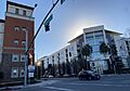
Intersection of Charlotte & Raleigh
-
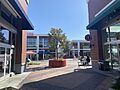
Shops on Coronado Ave
-
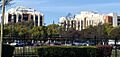
Kaiser San Jose Medical Center
-
San Jose PD Southern Police Station
-
Apartments on Charlotte
-
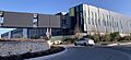
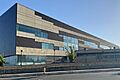
Equinix San Jose campus
.jpg)

.jpg)
.jpg)

.jpg)
