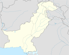
Sarai Alamgir Tehsil facts for kids
Quick facts for kids
Sarai Alamgir Tehsil
تحصیل سرائے عالمگیر |
|
|---|---|
| Country | |
| Province | Punjab |
| District | Gujrat District |
| Towns | 4 |
| Union councils | 9 |
| Area | |
| • Tehsil | 575 km2 (222 sq mi) |
| Population
(2023)
|
|
| • Tehsil | 247,333 |
| • Density | 304/km2 (790/sq mi) |
| • Urban | 55,007 |
| • Rural | 192,326 |
| Time zone | UTC+5 (PST) |
| • Summer (DST) | UTC+5 (PDT) |
Sarai Alamgir Tehsil (which means 'subdivision' or 'area' in Urdu) is one of four main parts of the Gujrat District in Pakistan. It sits on the eastern side of the Jhelum River, right across from the bigger town of Jhelum. To its east, you'll find the Upper Jhelum Canal.
Contents
What is Sarai Alamgir Tehsil?
Sarai Alamgir Tehsil is like a smaller administrative area within a larger district. It helps manage local services and communities. It's located in the Punjab province of Pakistan.
Where is Sarai Alamgir Tehsil?
Sarai Alamgir Tehsil is found in the southern part of the city of Gujrat. It is part of the Punjab province in Pakistan.
History of Sarai Alamgir
The main town of Sarai was started by the Mughal emperor Aurangzeb. He chose this spot because it was important for travel and trade. It was located on the famous Grand Trunk Road and near the Jhelum River. It was also close to Kashmir.
Sarai Alamgir was officially made a 'Tehsil' in 1993. This gave it its own local government.
Climate and Weather
Sarai Alamgir Tehsil has a mild climate. This means the weather is generally pleasant.
Summer Weather
In summer, temperatures can get quite hot, sometimes reaching 48 degrees Celsius (about 118 degrees Fahrenheit). However, these very hot periods usually don't last too long.
Winter Weather
The winter months are very nice and comfortable. Temperatures rarely drop below 2 degrees Celsius (about 36 degrees Fahrenheit).
How Sarai Alamgir Tehsil is Managed
The Tehsil Municipal Administration (TMA) is the group that runs Sarai Alamgir Tehsil. It's like a local council.
Who is in Charge?
The TMA has an Administrator who leads it. There's also a Tehsil Municipal Officer and other officials. They all work together to manage the area.
Union Councils
Sarai Alamgir Tehsil is divided into 9 smaller areas called Union Councils. These are local communities that help with administration.
- Mandi Bhalwal
- Bagh Nagar
- Karyala
- Simbli
- Khohar
- Sarai Alamgir-I
- Sarai Alamgir-II
- Thill Bakohal
- Baisa
Getting Around (Transport)
Sarai Alamgir Tehsil has good ways to travel.
Air Travel
The closest international airport is in Islamabad. It is about 127 kilometers (about 79 miles) away.
Other Ways to Travel
There are also other good transport options. These include a railway station for trains. The historic Grand Trunk Road passes through the area. You can also travel by boat on the Jhelum River. The Upper Jhelum Canal is another waterway.
Interesting Places Nearby
Sarai Alamgir is located at an important historical crossroads. It's where the old Grand Trunk Road meets the Jhelum River.
Historical Sites
Close by, you can find the huge Mangla Dam. There's also the site of the Battle of the Hydaspes. This was a famous battle involving Alexander the Great. He also founded the city of Alexandria Bucephalous nearby. Another amazing site is the massive Rohtas Fort.
Related Places


