
Scheduled monuments in Greater London facts for kids
A scheduled monument is a really old and important place or building in the United Kingdom. It's like a special treasure that the government protects so it doesn't get changed without permission. These places are super important for understanding history and archaeology. Historic England helps find these amazing sites. Once a place is "scheduled," it means it's officially recognized as nationally important and gets special care to keep it safe for future generations.
Contents
Discovering London's Hidden History
Greater London is full of amazing historical sites, many of which are "scheduled monuments." These are places that tell us stories about what life was like long ago, from Roman times to the World Wars. Let's explore some of these cool spots!
Ancient Roman and Medieval Sites
London has a deep history, going all the way back to the Romans. Many scheduled monuments are from this period or the Middle Ages.
Roman Discoveries
- London Wall: Imagine a huge wall that once protected the Roman city of Londinium! Sections of this ancient wall are still around today, like near Tower Hill and Aldermanbury. You can even see parts of it in basements or underground car parks.
- Roman Amphitheatre: Did you know there was a Roman amphitheatre in London? It's located under the Guildhall Yard. This was where people watched exciting shows and events, maybe even gladiators!
- Roman Bath Houses: The Romans loved their baths! You can find remains of Roman bath houses in places like Shadwell and under Billingsgate Market. These were public places where Romans would relax and socialize.
- Brockley Hill Romano-British pottery and settlement: Near Stanmore, this site shows where Romans and local Britons lived and made pottery. It's like a window into their daily lives.
Medieval Castles, Abbeys, and Manors
The Middle Ages also left many marks on London.
- Tower of London: This famous castle is one of London's most iconic scheduled monuments. It has been a royal palace, a prison, and a fortress. It's full of incredible stories!
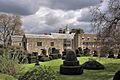
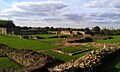
- Barking Abbey: In Barking, you can find the ruins of a large medieval abbey. Abbeys were important religious buildings where monks or nuns lived and worked.
- Lesnes Abbey: Another beautiful abbey ruin is in Abbey Wood. It's a peaceful place to imagine what life was like hundreds of years ago.
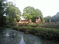
- Fulham Palace moated site: This site in Fulham was once a moated manor house, surrounded by water for protection. Many manor houses across London, like Headstone Manor in Harrow, also had moats.
- Eltham Palace: This palace in Eltham was a favourite royal residence in medieval times. It has a stunning Great Hall.
- Winchester Palace: In Southwark, you can see the remains of this grand medieval palace that belonged to the Bishops of Winchester.


Royal Residences and Grand Estates
London has always been home to royalty and important figures, leaving behind impressive buildings.
- Hampton Court Palace: This magnificent palace in Hampton Wick was a favourite of King Henry VIII. It's a huge site with incredible history and beautiful gardens.
- Kensington Palace: Located in Kensington, this palace has been a royal residence for centuries and is still used by the Royal Family today.
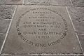
- Queen's House: In Greenwich Park, this beautiful building was designed for Queen Anne of Denmark. It's a stunning example of early classical architecture.
- Chiswick House: This lovely villa in Chiswick is a great example of 18th-century English architecture and garden design.


Industrial and Modern Heritage
Not all scheduled monuments are ancient. Some protect important sites from more recent history, like the Industrial Revolution or World War II.
- Kempton Park Pumping Station: In Hanworth, this site has huge steam engines that once helped provide water to London. It's a fantastic example of Victorian engineering.
- Brunel's Thames Tunnel Pumping Engine House: In Rotherhithe, this building is part of the world's first tunnel built under a major river. It's a testament to amazing engineering.
- Second World War anti-aircraft gun emplacements, Beckton: These sites in Beckton show where guns were placed to defend London from air attacks during World War II.
- World War II fighter pens at RAF Kenley: At the former RAF Kenley airfield, you can find special shelters called "fighter pens" that protected aircraft during the war.


.jpg)
Earthworks and Ancient Landscapes
Some scheduled monuments are not buildings at all, but features in the landscape.
- Grim's Ditch: This ancient earthwork, or long ditch, runs through parts of Harrow. It was likely a boundary or defensive line from the Iron Age.
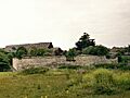
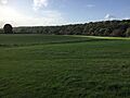
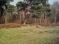
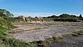
- Caesar's Camp, Wimbledon Common: This is an Iron Age hillfort, a type of ancient settlement surrounded by earth banks and ditches. It's a great place to imagine early communities.
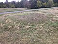
- Croham Hurst round barrow: In South Croydon, this is an ancient burial mound, likely from the Bronze Age. It tells us about how people buried their dead thousands of years ago.

.JPG)
These are just a few examples of the many scheduled monuments across Greater London. Each one holds a piece of history, waiting to be discovered and protected for everyone to learn from.
Images for kids
-
The ruins of Barking Abbey.
-
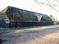
Upminster Tithe Barn, now a museum.
-
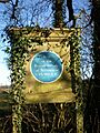
A plaque marking the Roman site at Brockley Hill.
-
Camlet Moat in Trent Park.
-
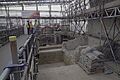
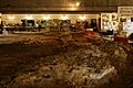
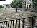
Archaeological dig at The Curtain Playhouse site.
-
The site of The Theatre Playhouse.
-
Remains of the Priory and Hospital of St Mary Spital.
-
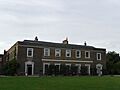
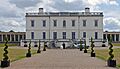
Fulham Palace, once a moated site.
-
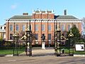
Kensington Palace.
-
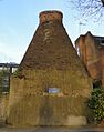
Pottery kiln in Walmer Road.
-
Hall Place, Bexley.
-
Howbury moated site.
-
Lesnes Abbey ruins.
-
Faesten Dic, a medieval frontier work.
-
The moated site at Down Barns Farm.
-
Horsenden Hill.
-
The moated site of Northolt Manor.
-
Windmill Bridge in Hanwell.
-
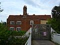
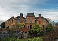
Headstone Manor, now Harrow Museum.
-
The impressive Kempton Park Pumping Station.
-

Chiswick House.
-
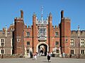
The grand entrance to Hampton Court Palace.
-
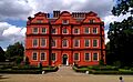
Kew Palace.
-
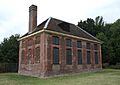
The Old Brew House in Bushy Park.
-
Medieval moated site near Brackenbury Farm.
-
Shrewsbury Barrow, Shooter's Hill.
-
Burial mound on Winns Common.
-
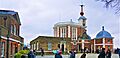
The Royal Observatory, Greenwich.
-
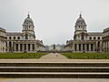
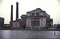
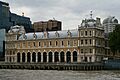
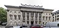
Greenwich Hospital (now RN College).
-
The elegant Queen's House.
-
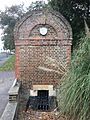
West Grove Conduit House.
-
Eltham Palace.
-
Romano-Celtic temple in Greenwich Park.
-
Anglo-Saxon cemetery in Greenwich Park.
-
Greenwich Palace (Palace of Placentia).
-
Scadbury Manor moated site.
-
Romano-British site, Wickham Court Farm.
-
Inside Crofton Roman Villa.
-
Camp on Keston Common.
-
Roman villa at Warbank, Keston.
-
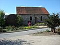
Ruxley old church.
-
Benedictine nunnery of St Mary, Clerkenwell.
-
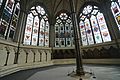
The Chapter House and Pyx Chamber, Westminster Abbey.
-
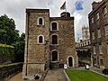
The Jewel Tower.
-

Earthworks at Caesar's Camp, Wimbledon.
-
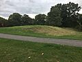
Morden Park Mound.
-
The Augustinian Priory of St Mary at Merton.
-
Roman villa east of Beddington Park.
-
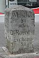
Milestone in Sutton High Street.
-
Milestone outside No. 135 Cheam Road.
-
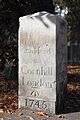
Milestone in Brighton Road.
-
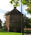
Dovecote, Beddington Park.
-
Elmers End moated site.
-
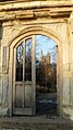
St John the Baptist's Church gateway.
-
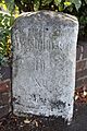
The marker stone at Croham Hurst Round Barrow.
-
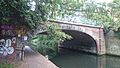
Bonner Hall Bridge, Regent's Canal.
-
Three Colt Bridge, Gunmaker's Lane.
-
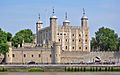
The famous Tower of London.
-
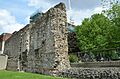
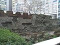
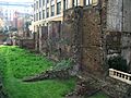
London Wall section near Tower Hill.
-
Site of the launch ways of the SS Great Eastern.
-
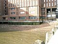
London Wall section.
-
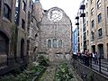
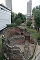
Bermondsey Abbey buildings.
-
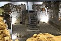
Remains of Winchester Palace.
-
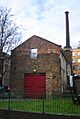
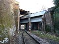
The Brunel Museum pumping engine house.
-
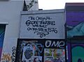
The Globe Theatre.
-
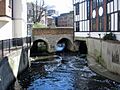
Clattern Bridge.
-
World War II fighter pens at RAF Kenley.
-
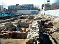
Baynard's Castle site.
-
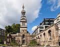
Remains of St Pancras Church.
-
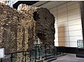
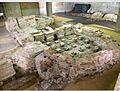
Structures below Billingsgate Market.
-
Queenhithe dock.
-

Cannon Street Station, site of Roman governor's palace.
-
Site of The London Greyfriars.
-
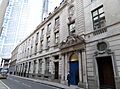
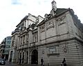
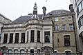
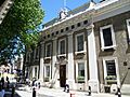
Goldsmiths' Hall.
-
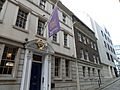
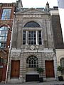
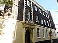
Innholders' Hall.
-
Merchant Taylors' Hall.
-
Painter Stainers' Hall.
-
Skinners' Hall.
-
Tallow Chandlers' Hall.
-
Vintners' Hall.
-
Watermen's Hall.
-
Roman wall in basement of 90 Gracechurch Street.
-
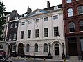
Barnard's Inn Hall.
-
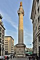
The Monument.
-
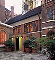
Inner Temple Hall Buttery.
-
London Wall section bounding All Hallows Churchyard.
-
London Wall section at Newgate Street.
-
Roman hypocaust and building on site of Coal Exchange.
-
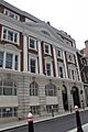
Stationers' Hall.
-
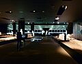
Roman amphitheatre at Guildhall Yard.
-
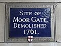
London Wall section at Moor Gate.
-
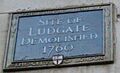
London Wall section at Ludgate Hill.
-
Apothecaries' Hall.
-
Armourers' and Brasiers' Hall.
-
Dyers' Hall.
-
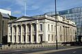
Fishmongers' Hall.
-
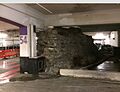
London Wall section in underground car park.
-
London Wall section at St Alphage Garden.
-
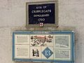
Site of Cripple Gate.
-
London Wall section at Monkwell Square.
-
London Wall section at Noble Street.


.jpg)


.jpg)


.jpg)

.jpg)


.jpg)


_-_geograph.org.uk_-_1221760.jpg)


_by_W_Jupp.jpg)


.jpg)


.JPG)


.jpg)


.JPG)
