Scott's Gulf facts for kids
Scott's Gulf is a large canyon located in White County, Tennessee. It follows the Caney Fork River as it flows from the top of the Cumberland Plateau down to the eastern Highland Rim. This canyon stretches for about 18 miles (29 km).
This wild part of the river is a special natural area. It has a mostly untouched deciduous forest, many beautiful waterfalls, interesting caves, and other cool rock formations. The river also has exciting Class IV and Class V whitewater rapids, which are very challenging for rafting.
About 10,000 acres (40 km²) of Scott's Gulf are owned by the State of Tennessee. Most of this land is part of the Bridgestone/Firestone Centennial Wilderness, which is looked after by the TWRA. Another important part is the Virgin Falls State Natural Area, managed by the TDEC through Fall Creek Falls State Park.
Contents
Exploring Scott's Gulf: Geography
The Caney Fork River starts near Campbell Junction in Cumberland County, Tennessee. It flows gently south across the Cumberland Plateau. Near the old mining town of Clifty, the river turns southwest and begins to carve out Scott's Gulf. Here, the river drops almost 700 feet (213 m) in just over 5 miles (8 km).
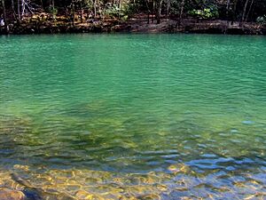
After this steep drop, the river meets Bee Creek at the bottom of the gorge. It then calms down and turns west through the gorge's quiet western part. This area has very steep walls and clear, blue-green water. After leaving Scott's Gulf, the Caney Fork River joins Cane Creek and the Calfkiller River. It then flows into another amazing gorge at Rock Island State Park.
Why the River Sometimes Disappears
During the summer and fall, the Caney Fork River often looks completely dry in some parts. This happens from above Virgin Falls all the way to the end of Scott's Gulf. The river's water actually sinks into the limestone riverbed and flows through underground cave passages. It then comes out again at a large spring.
So, for about half the year (winter and spring), the Caney Fork flows like a normal river. But for the other half (summer and fall), the river flows completely underground for several miles! This is a feature of "karst geology," which means the area has lots of limestone. Karst areas often have sinking streams, dry creek beds, caves, and big springs.
Mountains and Formations Around the Gulf
Scott's Gulf is surrounded by tall sections of the Plateau. On the north side, these rise steeply from the Caney Fork River's banks. They go from about 850 feet (259 m) up to 1,700 feet (518 m) at the edge of the Plateau.
To the northeast is Chestnut Mountain. Little Chestnut Mountain is in the north-central part. On the northwest is Pine Mountain, which looks like a narrow backbone. Scott's Pinnacle stands tall in the southern part of Scott's Gulf.
Amazing Natural Features
Virgin Falls: A Unique Waterfall
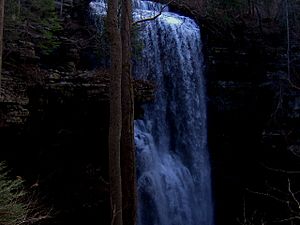
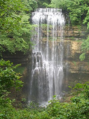
Virgin Falls is one of the most famous and special places in the area. Water comes out of an underground stream on the south side of Little Chestnut Mountain. It then drops 110 feet (34 m) and disappears underground again!
The water for Virgin Falls comes from Virgin Falls Cave. The lower entrance to this cave is about 150 feet (46 m) upstream from the top of the falls. Virgin Falls Cave is mostly one very large passage, about 30 feet (9 m) wide and 40 feet (12 m) high. At the bottom of Virgin Falls, the water flows about 10 feet (3 m) and then falls into a big hole, which is the entrance to Virgin Falls Pit. From the bottom of this pit, the water flows through more cave passages and comes out as a spring at the base of the Cumberland Escarpment.
The amount of water at Virgin Falls changes a lot. It can be just a tiny trickle in late summer and early fall (the dry season). But it can become a huge, powerful waterfall during late winter and early spring (the wet season). For many years, no one knew where all that water came from in the wet season. But a geologist named Nicholas C. Crawford did special dye tests. He proved that the water comes from a sinking creek in Lost Creek Cove, which is almost 3 miles (5 km) to the north!
Lost Creek Cove is a "polje," which is a very large, closed dip in the ground where all the water drains underground. One of the sinking creeks in Lost Cove reappears at Virgin Falls. Another one reappears at Lost Creek Falls, which is 1.8 miles (2.9 km) west of Virgin Falls. This area has a very complex and interesting underground water system. Cavers and geologists have studied it for many years.
Other Cool Spots to See
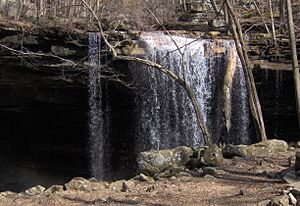
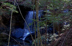
- Big Laurel Falls is on Big Laurel Creek, about a mile (1.6 km) above where the creek meets the Caney Fork. There's a big limestone cave behind these falls.
- Sheep Cave/Sheep Falls is a 90-foot (27 m) waterfall and a cave near Virgin Falls. It's located on the slopes of Little Chestnut Mountain.
- Lost Creek Falls and Lost Creek Cave are a 60-foot (18 m) waterfall and a large cave system. They are a few miles above the old community of Dodson, near the western end of the gorge. This area is part of the Lost Creek State Natural Area.
- Polly Branch is a stream that drains the eastern part of Chestnut Mountain. It flows into the Caney Fork just above where the river meets Bee Creek. There are five small waterfalls along this stream, including Jenny Branch Falls, Bee Branch Falls, and Upper, Middle, and Lower Polly Branch Falls.
- Copper Cascades is a fast-flowing part of the Caney Fork River. It's just above where Polly Branch meets the river.
A Look Back: History of Scott's Gulf
People started settling in the Scott's Gulf area as early as the late 1700s. One of the first settlers was James Davis, who was there by 1783. Later, in 1805, the Cherokee people gave up this land and much of the surrounding area in the Third Treaty of Tellico.
More settlers soon arrived and created two small communities called Dodson and Bethesda. These early settlers used the strong flow of the Caney Fork River and nearby waterfalls to power their grist mills, which ground grain. The oldest mill in the county was along Lost Creek. Even though the river provided a lot of power, the mills were often washed away when the river flooded.
The Bon Air Hotel and Coal Mining
In 1840, an architect named Christopher Haufmann built the Bon Air Hotel just north of Scott's Gulf. The hotel was at a high point on the Plateau, almost 2,000 feet (610 m up). In 1842, John B. Rodgers bought the hotel. He hoped to make it a health resort because of the cool summer air and natural mineral springs. The hotel had some success at first, but it was destroyed during the American Civil War.
In 1886, a businessman named George Dibrell started the Bon Air Coal, Iron, and Lumber Company. He wanted to use the area's natural resources. Dibrell managed to get the railroad extended from Sparta. As the need for coal grew in the early 1900s, Bon Air became a busy place. Mining operations moved south into Scott's Gulf. New mining towns like DeRossett, Clifty, and Eastland grew up along the edge of the Plateau above the Caney Fork. However, this boom ended with the Great Depression in the 1930s. Today, there's not much left from the area's coal mining past.
Protecting the Wilderness
In the 1960s, Firestone, Inc. bought a large piece of land above Scott's Gulf. They planned to build a retreat for their employees. But when Bridgestone bought Firestone, these plans were stopped. In the 1980s and 1990s, Bridgestone/Firestone tried to sell the property. However, they stopped trying to sell it when local people protested. A rumor had spread that a buyer wanted to cut down all the trees in the area.
In the late 1990s, the company gave most of its land to the state of Tennessee. They had one condition: the land had to be used for low-impact activities, and no buildings could be built in the gorge. The Virgin Falls Pocket Wilderness Area was also given to the state by Bowater in 1978, with similar conditions.
Visiting Scott's Gulf: Access and Trails
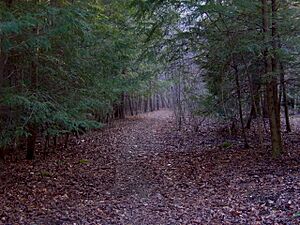
Many hiking trails wind through Scott's Gulf. Most of the trails open to the public are on the north side. Some trails are not perfectly maintained, but they are usually well-marked. Most of the marked trailheads are along Scott's Gulf Road. This road crosses part of Chestnut Mountain, a few miles south of U.S. Route 70 between Sparta and Crossville.
The trails in the Centennial Wilderness (like Polly Branch and Yellow Bluff) are open all year, except during hunting season. The Virgin Falls State Natural Area is open all year round.
Popular Hiking Trails
- The Virgin Falls Trail goes west from Scott's Gulf Road toward Big Laurel Creek. It passes Big Laurel Falls and then drops quickly to the Caney Fork river bottom. There, the trail splits. One path goes east to the Caney Fork Trail, and the other goes west up Little Chestnut Mountain to Virgin Falls.
- The Polly Branch Trail system follows Polly Branch and covers much of the stream's area. One path leads to a cliff overlooking the Bee Branch valley. Another goes north across Chestnut Mountain. This trail connects with the Caney Fork Trail near where Polly Branch meets the river.
- The Caney Fork Trail follows an old miners' path at the bottom of the gorge. It connects the Polly Branch and Virgin Falls trail systems.
 | Calvin Brent |
 | Walter T. Bailey |
 | Martha Cassell Thompson |
 | Alberta Jeannette Cassell |


