Caney Fork River facts for kids
Quick facts for kids Caney Fork River |
|
|---|---|

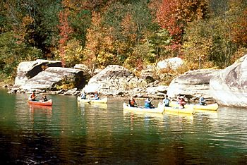
Canoeing on the upper Caney Fork
|
|

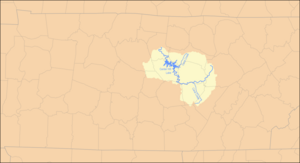
Caney Fork watershed
|
|
| Country | United States |
| State | Tennessee |
| Physical characteristics | |
| Main source | Near Campbell Junction in Cumberland County 1,960 ft (600 m) 36°02′36″N 85°09′30″W / 36.04333°N 85.15833°W |
| River mouth | Cumberland River (Old Hickory Lake) at Carthage 446 ft (136 m) 36°14′20″N 85°56′29″W / 36.23889°N 85.94139°W |
| Length | 143 mi (230 km) |
| Basin features | |
| Basin size | 1,771 sq mi (4,590 km2) |
| Tributaries |
|
The Caney Fork River is a river in central Tennessee, United States. It helps drain a large part of the Cumberland Plateau and Highland Rim areas. This river is a major branch of the Cumberland River. It is also part of the larger Ohio and Mississippi river systems.
The Caney Fork River is about 143 miles (230 km) long. Its watershed, or the area of land that drains into it, covers 1,771 square miles (4,587 km²). This area includes parts of eleven counties. Many towns, like Monterey, Sparta, and Smithville, are partly drained by this river.
The Caney Fork flows through two large artificial lakes: Center Hill Lake and Great Falls Lake. The river's basin is home to many protected natural areas. These include state wilderness areas, special interpretive sites, and a wildlife management area. Two state parks, Edgar Evins State Park and Rock Island State Park, are right along the river. Three other parks, Fall Creek Falls State Park, Burgess Falls State Park, and South Cumberland State Park, are also in its basin. The river is a very popular spot for fun activities like canoeing and kayaking.
The name "Caney Fork" comes from the thick cane breaks (a type of tall grass) that grew along the river's banks. European explorers saw these dense cane fields when they first arrived in the area.
Contents
Exploring the Caney Fork River's Journey
The Caney Fork River starts in Cumberland County. This is about 6 miles (10 km) west-northwest of Crossville. From there, it flows southwest into White County.
The River's Descent: Scott's Gulf
In southeastern White County, the river drops off the Cumberland Plateau. It flows through a deep, steep valley called Scott's Gulf. This is a remote area west of a mountain known as Scott Pinnacle. Further downstream, near the Dodson community, the river forms the border between White and Van Buren County. Here, it is joined by the Calfkiller River and other smaller streams.
Great Falls Lake and Dam
Great Falls Lake is where the Caney Fork, Collins River, and Rocky River meet. This lake was created by the Great Falls Dam. The Tennessee Valley Authority (TVA) now owns and operates this dam. It is special because it's the only dam outside the Tennessee River system directly run by the TVA.
The dam creates a small but very deep lake. This is because the rivers have carved deep gorges into the land. In the early 1900s, this area was a popular resort. Today, there are only a few cabins left, as bigger, more modern resorts have taken its place. The dam is named after the Great Falls of the Caney Fork. These falls happen as the river drops from the Highland Rim down to the Nashville Basin. Rock Island State Park is located on this lake. It was built on the site of old woolen mills from the 1800s.
Center Hill Lake and Dam
Below Great Falls Dam, the water is usually calm. This is because of the United States Army Corps of Engineers' Center Hill Dam project. This dam is in DeKalb County further downstream. It was built in the late 1950s. Unlike Great Falls Dam, this project flooded several small communities. It also covered thousands of acres of farmland. A very scenic bridge on State Route 56 crosses this lake. Edgar Evins State Park is located along its shores.
Fishing and Wildlife Below the Dams
Below Center Hill Dam, the river flows into Smith County. Interstate 40 crosses the river five times in a short distance here. This part of the river is a great spot for fishing. The Tennessee Wildlife Resources Agency (TWRA) regularly adds fish like Rainbow, Brown, and Brook trout here. It is known as one of the best trout rivers in Tennessee.
The river's mouth is where it flows into the Cumberland River. This is near the town of Carthage. The Cumberland River here is famous for its excellent striper fishing.
Caney Fork River in Music
The Caney Fork River has even inspired musicians!
- The bluegrass band Balsam Range has a song called "Caney Fork River." It is on their album "Last Train to Kitty Hawk."
- Canadian folksinger Old Man Luedecke also has a song titled "Caney Fork River." You can find it on his album "My Hands Are On Fire and Other Love Songs."
 | Janet Taylor Pickett |
 | Synthia Saint James |
 | Howardena Pindell |
 | Faith Ringgold |

