Falling Water River facts for kids
Quick facts for kids Falling Water River |
|
|---|---|
 |
|
| Country | United States |
| State | Tennessee |
| Physical characteristics | |
| Main source | Welch Hollow near Monterey 1,640 ft (500 m) 36°08′48″N 85°16′45″W / 36.14667°N 85.27917°W |
| River mouth | Center Hill Lake (Caney Fork) northeast of Smithville 646 ft (197 m) 36°01′01″N 85°41′31″W / 36.01694°N 85.69194°W |
| Length | 46.8 mi (75.3 km) |
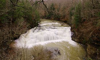
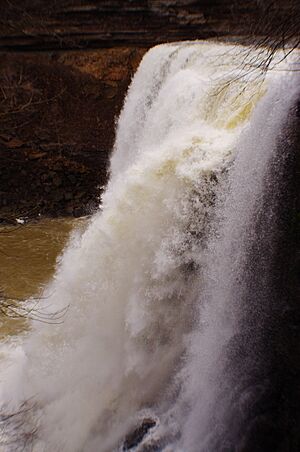
The Falling Water River is a stream in east-central Middle Tennessee, in the United States. It is about 46.8-mile-long (75.3 km). The river starts near Monterey at the edge of the Cumberland Plateau. It then flows across the Eastern Highland Rim before dropping into the Nashville Basin. Finally, it flows into Center Hill Lake along the Caney Fork. The river is famous for Burgess Falls, a 136-foot (41 m) waterfall it flows over near its end.
Contents
The River's Journey
The Falling Water River begins in Welch Hollow, which is a valley west of Monterey in eastern Putnam County. It drops over 600 feet (180 m) as it leaves this valley. The river then goes under Interstate 40. After that, it flows into City Lake. This lake is a reservoir, which is like a big storage tank for water. City Lake provides water for the nearby city of Cookeville.
After City Lake Dam, the river goes under U.S. Highway 70N. It then turns southwest through the countryside of southern Putnam County. The river makes many sharp turns before going under Tennessee Highway 111. It then enters northern White County. The river winds through a rural area, passing north and west of the Upper Cumberland Regional Airport.
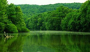
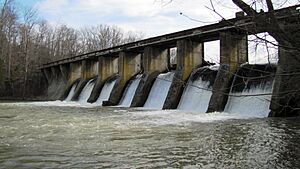
The river then reaches the border between Putnam and White counties again. It flows into Burgess Falls Lake. This lake is another reservoir, built in the 1920s to make electricity for Cookeville. The river passes under State Highway 135 just before the dam. After the dam, the river enters a deep valley called a gorge. Here, it flows over three waterfalls. The last and biggest is the 136 feet (41 m) Burgess Falls. This is where the river drops from the Highland Rim to the Nashville Basin.
At the bottom of Burgess Falls, the river flows into Center Hill Lake. This lake was created by the U.S. Army Corps of Engineers building the Center Hill Dam. The river passes a spot where Putnam, White, and DeKalb counties meet. It continues southwest into DeKalb County. The Falling Water River finally joins the Caney Fork River in Center Hill Lake.
Where the River's Water Comes From
The Falling Water River has a drainage area of 191 square miles. This means it collects water from an area that size. The river is part of a much larger system of rivers. Its water eventually flows into the Caney Fork, then the Cumberland, the Ohio, and finally the mighty Mississippi!
Smaller streams that flow into the Falling Water River are called tributaries. These include Cleghorn Creek, which flows into City Lake. Pigeon Roost Creek joins near the Putnam-White county line. Glade Creek flows into Burgess Falls Lake. Cane Creek joins the river after Burgess Falls. Taylor Creek and Dry Creek are also tributaries, flowing into the parts of the river that are now part of Center Hill Lake.
The River's Rocky Path
The Falling Water River mostly flows across the Eastern Highland Rim. This area has rolling hills and is made of a type of rock called limestone. The river has carved deep valleys into this rock over time.
Downstream from Burgess Falls Dam, the river enters a gorge. This gorge is made of strong limestone that resists erosion. This is why the three waterfalls formed here. At Burgess Falls, the river drops from a hard rock ledge onto older rock below. There's also a layer of shale rock between these two types of limestone.
Other interesting rock formations are found along the river's tributaries. Window Cliff is a place with natural arches that look over a waterfall on Cane Creek. Fancher Falls is an 80-foot (24 m) waterfall located on Taylor Creek.
A Look Back in Time
For many years, people used the power of the Falling Water River. In the 1800s, its strong current turned gristmills, which were machines that ground grain into flour.
In 1921, the city of Cookeville started building the Burgess Falls Dam. This dam was meant to create electricity for the city. But in June 1928, a huge flood caused part of the dam to break. It also destroyed the building that made electricity. The dam was rebuilt and kept providing power until 1944. At that time, Cookeville started buying electricity from the Tennessee Valley Authority, a government agency.
In 1946, Cookeville built the City Lake Dam. This dam helped make sure the city had a steady supply of water. The U.S. Army Corps of Engineers, a group that builds and manages public works, finished the Center Hill Dam in 1948.
Fun Things to Do Here
You can enjoy the outdoors at the Falling Water River! Burgess Falls State Park and a 350-acre (140 ha) state natural area protect the land around Burgess Falls and Burgess Falls Lake. The Burgess Falls Dam is an important historical site and is listed on the National Register of Historic Places.
There are places to access the river for fun. The Cookeville Dock, off State Highway 135, lets you get to the Center Hill Lake part of the river. The Johnson Chapel Recreation Area, run by the Corps of Engineers, is another access point. If you like camping, there's a simple campground called Cane Hollow, located off Highway 135.
The City of Cookeville also has a 35-acre (14 ha) park along City Lake. This park is off Bridgeway Drive and has a boat ramp, so you can launch your boat and explore the lake.
 | Kyle Baker |
 | Joseph Yoakum |
 | Laura Wheeler Waring |
 | Henry Ossawa Tanner |


