Smith County, Tennessee facts for kids
Quick facts for kids
Smith County
|
|
|---|---|

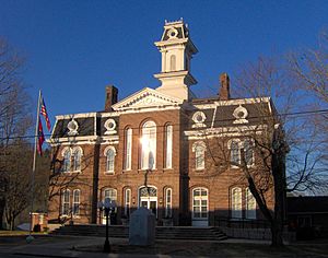
Smith County Courthouse in Carthage
|
|

Location within the U.S. state of Tennessee
|
|
 Tennessee's location within the U.S. |
|
| Country | |
| State | |
| Founded | 1799 |
| Named for | Daniel Smith |
| Seat | Carthage |
| Largest town | Carthage |
| Area | |
| • Total | 325 sq mi (840 km2) |
| • Land | 314 sq mi (810 km2) |
| • Water | 11 sq mi (30 km2) 3.4%% |
| Population
(2020)
|
|
| • Total | 19,904 |
| • Density | 61/sq mi (24/km2) |
| Time zone | UTC−6 (Central) |
| • Summer (DST) | UTC−5 (CDT) |
| Congressional district | 6th |
Smith County is a county in the state of Tennessee, USA. In 2020, about 19,904 people lived here. Smith County is in the middle part of Tennessee. Its main town, or county seat, is Carthage. The county was started in 1799. It is named after Daniel Smith, a hero from the American Revolutionary War. He also made the first map of Tennessee and was a United States senator.
Smith County is part of the larger Nashville area. This means it's connected to the big cities of Nashville, Murfreesboro, and Franklin.
Contents
A Look Back at Smith County
Smith County was created in 1799. It was formed from a part of Sumner County. The county was named after Daniel Smith, who was a U.S. Senator. He also used to be the Secretary of the Southwest Territory.
There was a big debate about where the main town should be. People argued between Bledsoesborough and William Walton's ferry. In 1804, people voted for Walton's spot. A town called Carthage was planned there the next year.
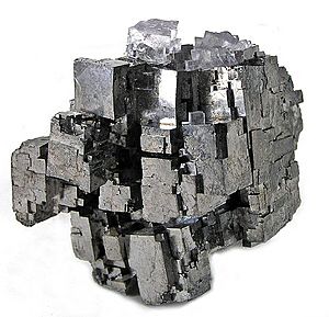
Smith County was also home to a large mine. This mine produced a substance called saltpeter. Saltpeter was used to make gunpowder. Piper Cave, near Monoville, still has parts of old saltpeter processing areas. Most saltpeter mining in Tennessee happened during the War of 1812 and the Civil War.
Where is Smith County?

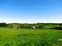
Smith County covers about 325 square miles. Most of this area is land, about 314 square miles. The rest, about 11 square miles, is water. The county is in a special area. It's between the hilly Highland Rim to the east and the flatter Nashville Basin to the west.
The Caney Fork river joins the Cumberland River in Carthage. These are the main rivers flowing through the county. The Cordell Hull Dam on the Cumberland River is also near Carthage.
Neighboring Counties
Smith County shares borders with these counties:
- Macon County (north)
- Jackson County (northeast)
- Putnam County (east)
- DeKalb County (southeast)
- Wilson County (west)
- Trousdale County (northwest)
Protected Areas
Part of the Cordell Hull Wildlife Management Area is in Smith County. This area helps protect nature and wildlife.
Main Roads
These are some of the important roads in Smith County:
 I-40
I-40 US 70N
 SR 25
SR 25 SR 53
SR 53 SR 80
SR 80 SR 85
SR 85 SR 141
 SR 263
 SR 264
Who Lives in Smith County?
| Historical population | |||
|---|---|---|---|
| Census | Pop. | %± | |
| 1800 | 4,294 | — | |
| 1810 | 11,649 | 171.3% | |
| 1820 | 17,580 | 50.9% | |
| 1830 | 19,906 | 13.2% | |
| 1840 | 21,179 | 6.4% | |
| 1850 | 18,412 | −13.1% | |
| 1860 | 16,357 | −11.2% | |
| 1870 | 15,994 | −2.2% | |
| 1880 | 17,799 | 11.3% | |
| 1890 | 18,404 | 3.4% | |
| 1900 | 19,026 | 3.4% | |
| 1910 | 18,548 | −2.5% | |
| 1920 | 17,134 | −7.6% | |
| 1930 | 15,473 | −9.7% | |
| 1940 | 16,148 | 4.4% | |
| 1950 | 14,098 | −12.7% | |
| 1960 | 12,059 | −14.5% | |
| 1970 | 12,059 | 0.0% | |
| 1980 | 14,935 | 23.8% | |
| 1990 | 14,143 | −5.3% | |
| 2000 | 17,712 | 25.2% | |
| 2010 | 19,166 | 8.2% | |
| 2020 | 19,904 | 3.9% | |
| U.S. Decennial Census 1790-1960 1900-1990 1990-2000 2010-2014 |
|||
2020 Census Information
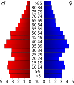
The 2020 United States census counted 19,904 people living in Smith County. There were 7,603 households and 5,409 families.
| Race | Number | Percentage |
|---|---|---|
| White (non-Hispanic) | 18,054 | 90.71% |
| Black or African American (non-Hispanic) | 356 | 1.79% |
| Native American | 61 | 0.31% |
| Asian | 84 | 0.42% |
| Other/Mixed | 831 | 4.18% |
| Hispanic or Latino | 518 | 2.6% |
Towns and Communities
Smith County has several towns and smaller communities.
Towns
- Carthage (This is the county seat)
- Gordonsville
- South Carthage
Unincorporated Communities
- Brush Creek
- Chestnut Mound
- Defeated
- Difficult
- Dixon Springs
- Elmwood
- Enigma
- Hickman
- Kempville
- Lancaster
- New Middleton
- Pleasant Shade
- Riddleton
- Rome
- Stonewall
- Sykes
Learning in Smith County
The Smith County School System runs nine schools. They help students from pre-kindergarten all the way through high school.
- Carthage Elementary School, Carthage (PreK–4)
- Defeated Elementary School, Defeated (PreK–8)
- Forks River Elementary School, Elmwood (PreK–8)
- Gordonsville Elementary School, Gordonsville (3–6)
- Gordonsville High School, Gordonsville (7–12)
- New Middleton Elementary School, New Middleton (PreK–2)
- Union Heights Elementary School, Rome (PreK–8)
- Smith County Middle School, South Carthage (5–8)
- Smith County High School, Carthage (9–12)
Some schools have changed their grade levels over the years. For example, Pleasant Shade Elementary School closed in 2007. Cox Davidson Elementary closed in the 1950s. New Middleton Elementary and Gordonsville Elementary also changed their grade ranges in 2017.
Images for kids
See also
 In Spanish: Condado de Smith (Tennessee) para niños
 | Claudette Colvin |
 | Myrlie Evers-Williams |
 | Alberta Odell Jones |


