
Scott County, Arkansas facts for kids
Quick facts for kids
Scott County
|
|
|---|---|

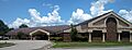
Scott County Courthouse in Waldron
|
|

Location within the U.S. state of Arkansas
|
|
 Arkansas's location within the U.S. |
|
| Country | |
| State | |
| Founded | November 5, 1833 |
| Named for | Andrew Scott |
| Seat | Waldron |
| Largest city | Waldron |
| Area | |
| • Total | 898 sq mi (2,330 km2) |
| • Land | 892 sq mi (2,310 km2) |
| • Water | 5.8 sq mi (15 km2) 0.6%% |
| Population
(2020)
|
|
| • Total | 9,836 |
| • Density | 10.953/sq mi (4.2291/km2) |
| Time zone | UTC−6 (Central) |
| • Summer (DST) | UTC−5 (CDT) |
| Congressional district | 4th |
Scott County is a county located in the state of Arkansas. It is in the western part of Arkansas. In 2020, about 9,836 people lived there. The main town and county seat is Waldron.
Scott County was created on November 5, 1833. It was the 28th county formed in Arkansas. The county was named after Andrew Scott. He was a judge on the Supreme Court of the Arkansas Territory.
Contents
Exploring Scott County's Geography
Scott County covers a total area of about 898 square miles. Most of this area, about 892 square miles, is land. The rest, about 5.8 square miles, is water.
Main Roads in Scott County
Several important roads pass through Scott County. These roads help people travel around the county and to other places.
 Future Interstate 49
 U.S. Highway 71
 U.S. Highway 270
 Highway 23
 Highway 28
 Highway 80
 Highway 250
Neighboring Counties
Scott County shares its borders with several other counties. These are its neighbors:
- Sebastian County (to the northwest)
- Logan County (to the northeast)
- Yell County (to the east)
- Montgomery County (to the southeast)
- Polk County (to the south)
- Le Flore County, Oklahoma (to the west)
Protected Natural Areas
Part of the Ouachita National Forest is located in Scott County. This is a large protected area with lots of trees and nature.
Scott County's Population History
The number of people living in Scott County has changed over many years. Here is how the population has grown and shrunk:
| Historical population | |||
|---|---|---|---|
| Census | Pop. | %± | |
| 1840 | 1,694 | — | |
| 1850 | 3,083 | 82.0% | |
| 1860 | 5,145 | 66.9% | |
| 1870 | 7,483 | 45.4% | |
| 1880 | 9,174 | 22.6% | |
| 1890 | 12,635 | 37.7% | |
| 1900 | 13,183 | 4.3% | |
| 1910 | 14,302 | 8.5% | |
| 1920 | 13,232 | −7.5% | |
| 1930 | 11,803 | −10.8% | |
| 1940 | 13,300 | 12.7% | |
| 1950 | 10,057 | −24.4% | |
| 1960 | 7,297 | −27.4% | |
| 1970 | 8,207 | 12.5% | |
| 1980 | 9,685 | 18.0% | |
| 1990 | 10,205 | 5.4% | |
| 2000 | 10,996 | 7.8% | |
| 2010 | 11,233 | 2.2% | |
| 2020 | 9,836 | −12.4% | |
| 2023 (est.) | 9,851 | −12.3% | |
| U.S. Decennial Census 1790–1960 1900–1990 1990–2000 2010 |
|||

In 2020, the 2020 United States census counted 9,836 people living in Scott County. There were 3,944 households and 2,569 families. Most people in the county are White. There are also smaller groups of Native American, Asian, Black or African American, and Pacific Islander people. About 7.6% of the population is Hispanic or Latino.
Towns and Places in Scott County
Scott County has a few towns and other communities where people live.
Cities in Scott County
Special Communities
- Boles is a census-designated place. This means it's a community that is counted by the census but isn't an official city or town.
Townships in Scott County

Townships are smaller areas within a county. Scott County has several townships, each with its own name. Townships in Arkansas are the divisions of a county. Each township includes unincorporated areas; some may have incorporated cities or towns within part of their boundaries. Arkansas townships have limited purposes in modern times. However, the United States Census does list Arkansas population based on townships (sometimes referred to as "county subdivisions" or "minor civil divisions"). Townships are also of value for historical purposes in terms of genealogical research. Each town or city is within one or more townships in an Arkansas county based on census maps and publications. The townships of Scott County are listed below; listed in parentheses are the cities, towns, and/or census-designated places that are fully or partially inside the township.
Images for kids
-
Scott County Courthouse in Waldron
See also
 In Spanish: Condado de Scott (Arkansas) para niños
