Seathwaite Fell facts for kids
Quick facts for kids Seathwaite Fell |
|
|---|---|

Seathwaite Fell from Seathwaite.
|
|
| Highest point | |
| Elevation | 632 m (2,073 ft) |
| Prominence | c. 31 m |
| Parent peak | Great End |
| Listing | Hewitt, Nuttall, Wainwright (see below) |
| Geography | |
| Location | Cumbria, England |
| Parent range | Lake District, Southern Fells |
| OS grid | NY227097 |
| Topo map | OS Landrangers 89, 90, Explorers OL4, OL6 |
| Listed summits of Seathwaite Fell | ||||
| Name | Grid ref | Height | Status | |
|---|---|---|---|---|
| Seathwaite Fell South Top | NY227094 | 631 m (2,070 ft) | Nuttall | |
| Seathwaite Fell 'Traditional' Top | NY229102 | 601 m (1,971 ft) | Wainwright | |
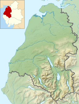
Seathwaite Fell is a rugged mountain in the beautiful Lake District area of Cumbria, England. It stands tall above the small village of Seathwaite at the very top of Borrowdale valley. It's a popular spot for hikers and offers amazing views.
Contents
Seathwaite Fell: A Mountain with Many Tops
Seathwaite Fell is a very rocky mountain. It has several small peaks along its main ridge. One of these peaks, at 601 meters (1,971 feet), is very easy to see from the valley below.
Which Top is the "Real" Summit?
The famous guidebook writer, Alfred Wainwright, chose this 601-meter peak as the main summit in his books. He knew it wasn't the highest point, but it was the one people usually thought of as the top. This is why some mountain lists, like the "Wainwrights," are different from others.
Other lists, like the "Nuttalls" and "Hewitts," focus on the absolute highest points. The true highest point of Seathwaite Fell is 632 meters (2,073 feet) tall. It's located near the middle of the fell. This higher point is listed as a Nuttall and a Hewitt, but not a Wainwright.
To make things even more interesting, there's a third peak to the south, which is 631 meters (2,070 feet) high. This peak, sometimes called Seathwaite Fell South Top, is also a Nuttall. So, the "traditional" Wainwright summit is actually the third highest point on the fell!
Exploring Seathwaite Fell's Landscape
Seathwaite Fell is like a northern arm reaching out from a bigger mountain called Great End. It sits between two streams that flow into the River Derwent. These streams are Styhead Gill to the west and Grains Gill to the east. They meet at a place called Stockley Bridge, right below the front of the fell.
Water Features and Crags
Styhead Gill flows down from Sty Head, which is a popular path for walkers. Near the top of this path is Styhead Tarn, a small mountain lake. Styhead Tarn gets its water from Sprinkling Tarn, another beautiful lake nestled between Seathwaite Fell and Great End. Because of these tarns and gills, Seathwaite Fell is almost completely surrounded by water.
The front of the fell, above Stockley Bridge, has two layers of rocky cliffs. These are called Aaron Crags and Black Waugh. There's also a long line of cliffs along the eastern side, above Grains Gill. The western side is rough but slopes down more gently to Styhead Gill.
Summit Views
The top ridge of Seathwaite Fell has many small rocky bumps and several tiny lakes, called tarns. None of these tarns have names on maps.
Both the "traditional" northern peak and the highest point (632 meters) have small piles of stones called cairns. From both, you can see great views to the north, looking down into the upper part of Borrowdale valley. If you look south, you get a close-up view of the tall cliffs of Great End.
The Rocks of Seathwaite Fell
The top of Seathwaite Fell is made of a type of rock called volcaniclastic sandstone. This rock formed from volcanic ash and bits of rock that settled down. There's also a band of different rock, called andesite and porphyry, that runs north from Sprinkling Tarn. Lower down the northern slope, you can find coarser sandstone and breccia.
Britain's Wettest Spot!
The nearby village of Seathwaite is famous for its rain! It gets about 3,552 millimeters (about 140 inches) of rain every year. This makes it the wettest place in England where rainfall is measured. The rain gauge used for this measurement is actually on the slope of Seathwaite Fell, just above the village.
On November 20, 2009, Seathwaite set a new UK record for rainfall in 24 hours. It received an amazing 314.4 millimeters (about 12.4 inches) of rain! Records for this area go all the way back to 1914.
How to Climb Seathwaite Fell
Most people start their climb from Seathwaite village. You can follow a path from Stockley Bridge towards Styhead Tarn. After about a kilometer, you'll pass a waterfall called Taylorgill Force. From there, you head southwest over rocky ground to reach the northern summit, which has a small cairn.
You can then follow a path along the ridge to the south. If you want to reach the highest point or the south top, you'll need to take a short detour from this path. Another way to climb the fell is to go to Sprinkling Tarn first (from Esk Hause or Sty Head) and then walk back along the ridge.
 | Bayard Rustin |
 | Jeannette Carter |
 | Jeremiah A. Brown |


