Great End facts for kids
Quick facts for kids Great End |
|
|---|---|

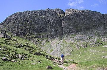
Great End from the top of Grains Gill
|
|
| Highest point | |
| Elevation | 910 m (2,990 ft) |
| Prominence | 56 m (184 ft) |
| Parent peak | Ill Crag |
| Listing | Hewitt, Wainwright, Nuttall |
| Geography | |
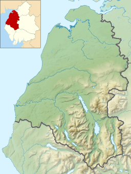
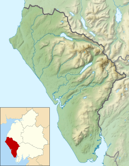
| Location | Cumbria, England |
| Parent range | Lake District, Southern Fells |
| OS grid | NY226084 |
| Topo map | OS Landrangers 89, 90, Explorer OL6 |
| Listed summits of Great End | ||||
| Name | Grid ref | Height | Status | |
|---|---|---|---|---|
| Round How | NY218081 | 741 m (2,431 ft) | Nuttall | |
Great End is a famous mountain in the Lake District in England. It's the most northern peak in the Scafell mountain range. If you look at it from the south, it just seems like another part of the mountain chain.
But from the north, Great End looks huge! It has a very impressive north face that rises high above Sprinkling Tarn, which is a beautiful lake. This area is a popular spot for people who like to camp outdoors. The steep north face also attracts many climbers who enjoy a challenge.
A famous writer named Alfred Wainwright once wrote about Great End in his guidebooks. He said that places like Great End are what make the Lake District special for walkers. He felt these magnificent places are what people remember most and want to return to.
Contents
What Great End Looks Like
The north-eastern side of Great End has very steep cliffs. These cliffs are about 600 feet (180 meters) tall. They have deep cracks and channels called gullies. Because of how they face, the sun doesn't hit them very often. This means that snow can stay in these gullies well into the spring season.
If you look at the cliffs from below, you'll see a few main gullies. These include South East Gully, Central Gully, and Cust's Gully. To the west of these cliffs, there's a ridge that slopes down gently. This ridge is called The Band. It also has a noticeable cut across it.
On the western side of The Band, there's a deep valley called Skew Gill. This is a small stream that flows into Lingmell Beck, which goes towards Wasdale. At the bottom of The Band, the ridge continues to Seathwaite Fell. This area has many small lakes called tarns. The biggest one is Sprinkling Tarn. Its interesting shoreline makes it a great place to take photos of the cliffs.
Sty Head: A Meeting Point
Sty Head is a very important place for walkers in the Lake District. It's a low point, or "col," between Great End and Great Gable. Its height is about 1,560 feet (475 meters). Today, the name Sty Head usually refers to the path that crosses this area.
This path connects two popular starting points for mountain walks: Wasdale Head and Seathwaite. Sty Head is also like a crossroads for walkers. Other paths lead directly up Great Gable or follow the stream from Sprinkling Tarn up to Esk Hause.
Paths and Views
From the summit of Great End, the land slopes down towards Lingmell Beck. A popular path called the Corridor Route crosses this side. This path is often used by people heading to Scafell Pike from Sty Head. Above this path, you'll find a smaller peak called Round How. There's also a tiny, clear lake called Lambfoot Dub nearby.
To the south, a ridge connects Great End to the Scafells. This path goes over a slightly lower area and then climbs up over Ill Crag and Broad Crag. A clear path leads across this rocky ground to the top of Scafell Pike. To the east of the first dip, there's an area called Calf Cove. Its gentle slopes lead down to Esk Hause.
The very top of Great End has two piles of stones, called cairns, that are almost the same height. The one towards the north-west is closer to the edge of the cliff. It offers the best views. Looking north along Borrowdale, the view is amazing. The entire view from the summit is excellent. You can also carefully go to the top of the gullies for exciting views down the mountain face.
What Great End is Made Of
The top part of Great End is made of special rock layers. These layers are called Esk Pike Formation. They are made of very fine volcanic clay and silt. Below this, you can see another type of rock called Lincomb Tarns Formation. This rock is made of volcanic ash and small rock pieces that have been welded together. You can see this rock clearly on the large north face of the mountain.
How to Climb Great End
You can climb Great End from several different places. One way is from Sty Head Tarn by following The Band. Another way is from Wasdale Head by following Lingmell Gill and Spouthead Gill. You can also start from Borrowdale via Grains Gill.
Other routes include starting from Great Langdale via Rossett Gill and Esk Hause, or from Eskdale. If you are already on the main path between Esk Hause and Scafell Pike, it's easy to climb Great End. You only need to take a short detour of about 400 meters.
Cust's Gully: A Climbing Challenge
Cust's Gully is located on the western side of Great End's cliffs. It is named after a climber and artist from the 1800s named Arthur Cust. He was known for his watercolor drawings of famous mountains like the Matterhorn.
Cust's Gully is a Grade 1 rock climb, which means it's a challenging route for climbers. It can also be a difficult obstacle for walkers trying to go up from Sprinkling Tarn. Arthur Cust made the first recorded winter climb of this gully in 1880. However, people think he might have climbed it even earlier than that.
 | Misty Copeland |
 | Raven Wilkinson |
 | Debra Austin |
 | Aesha Ash |


