Serra del Montsià facts for kids
Quick facts for kids Serra del Montsià |
|
|---|---|
 |
|
| Highest point | |
| Elevation | 764 m (2,507 ft) |
| Listing | Mountains in Catalonia |
| Geography | |
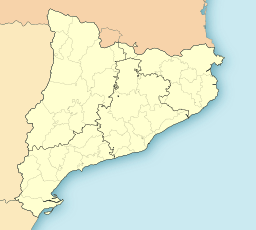
| Location | Montsià (Catalonia) |
| Parent range | Catalan Mediterranean System, Southern zone |
| Geology | |
| Mountain type | karstic |
| Climbing | |
| Easiest route | drive |

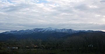
The Serra del Montsià is a mountain range in Catalonia, a region in Spain. It stretches for about 14.5 kilometers and is a very important natural landmark in its area. This mountain range gives its name to the Montsià, which is the southernmost county in Catalonia. Its highest point is a peak called La Torreta, which is 764 meters tall.
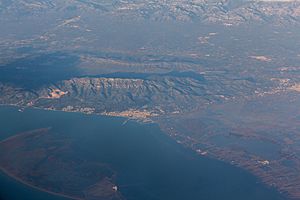
The Serra del Montsià runs from the northeast to the southwest. It is located south of the Ebre river, which forms its northern border. Because it's quite tall and right next to the Mediterranean Sea, it stands out in the landscape. To the south, the Sénia River marks its end. If you look at the mountain range from the town of Santa Bàrbara, its shape might remind you of a dragon!
Long ago, ancient people called the Ilercavones lived in this area. You can still find remains of their villages on some of the hills in this mountain range. More recently, in the second half of the 1900s, a small village named La Selleta was built by people from Germany on a hill below the Serra del Montsià.
Nature and Wildlife in Montsià
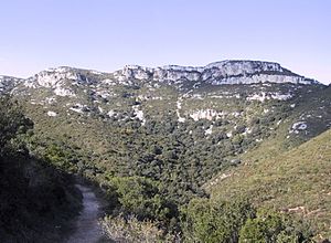
This mountain range is covered with a type of dense shrubland called Maquis shrubland. On the lower parts of the slopes, farmers grow olive, almond, and carob trees.
Unfortunately, on the southeastern side of the mountains, there is a large limestone quarry. A quarry is a place where stone is dug out of the ground. This quarry has changed a large part of the natural area.
The Serra del Montsià is also special for animals. It marks the northernmost place where you can find the Iberian Ribbed Newt in the eastern part of the Iberian Peninsula. This means it's the furthest north these newts live in this region.
How the Montsià Mountains Formed
The Serra del Montsià is a karstic formation. This means it's made of limestone and has many natural features like caves and deep holes (sometimes called shafts). Even though it's right by the sea, it's actually part of the Catalan Pre-Coastal Range. These mountains were formed about 25 million years ago during a huge period of mountain building called the Alpine orogeny. This was when large parts of the Earth's crust pushed together, creating many mountain ranges, including the Alps.
The highest point is la Torreta del Montsià, standing at 764 meters. However, another peak called the Mola cima looks like the tallest from many places, especially around Ulldecona and along the road between Barcelona and Valencia. This is because of its distinct triangular shape.
Other important peaks in the range include la Foradada. This peak is north of la Torreta and offers amazing views over the Ebre River Delta, where the river meets the sea. There's also the rocky Mata-redona peak.
Geologically, the Serra del Montsià is very similar to another set of mountains further south. These mountain ranges and valleys form a natural transition between the Catalan Mediterranean System and the Iberian System.
See also
 In Spanish: Sierra del Montsiá para niños
 | Laphonza Butler |
 | Daisy Bates |
 | Elizabeth Piper Ensley |


