Sgurra Bhreac (Nova Scotia) facts for kids
Quick facts for kids Sgurra Bhreac |
|
|---|---|
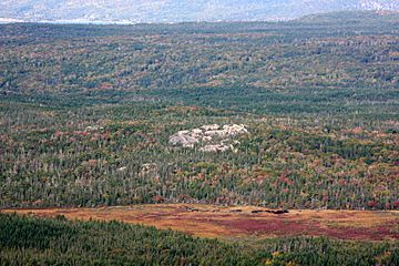
| the Big Rock | |

Sgurra Bhreac lies in the East Bay Hills
|
|
| Highest point | |
| Elevation | 222 m (728 ft) |
| Prominence | 212 m (696 ft) |
| Naming | |
| Etymology | name means spotted or pitted ridge or rock in Gaelic |
| Geography | |
| Parent range | East Bay Hills |
| Topo map | NTS O11/F16 |
| Climbing | |
| Easiest route | drive / hike |
Sgurra Bhreac is a cool mountain peak in Nova Scotia, Canada. People sometimes call it the "Big Rock." It's part of the East Bay Hills on Cape Breton Island. These hills are actually an extension of the huge Appalachian mountain chain.
Sgurra Bhreac is a big rock that sticks out about 50 meters (164 feet) from the ground. It's the highest point on Cape Breton Island south of the Bras d'Or Lake. The top of the peak is 222 meters (728 feet) high!
Contents
Where is Sgurra Bhreac Located?
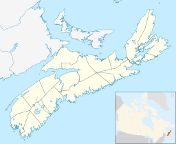
Sgurra Bhreac is about 30 kilometers (19 miles) west of Sydney. It's inland from a community called Big Pond. The peak is also about 1 kilometer (0.6 miles) southwest of East of Rock Lakes.
You can get pretty close to the peak by driving on back roads. One road is Glengarry Road, and another is an unnamed road to the north. After that, you'll need to hike the rest of the way to the top.
What Does the Name "Sgurra Bhreac" Mean?
The word "Sgurra" comes from Gaelic. It means "hill." You might hear "Sgurr" or "Sgùrr na" in the names of mountains in Scotland.
In Canada, using "Sgurra" in a place name is pretty rare. It's mostly found in Nova Scotia. The full name, Sgurra Bhreac, means "spotted" or "pitted ridge or rock" in Gaelic. It can also mean "speckled peak."
The name Sgurra Bhreac was officially chosen for this big rock on December 2, 1924. A local newsletter about history and nature, published from 2004 to 2010, also used the name "Sgurra Breac."
Survey Marker at the Top
At the very top of Sgurra Bhreac, there's a special marker. It's called a survey station from Natural Resources Canada. This station helps mapmakers measure the Earth accurately.
The station has three markers. Two are metal disks, and one is a copper bolt. This survey station was first set up before 1921. It was made even more accurate in 1969 and 1970.
Hiking and Geocaching Fun
Sgurra Bhreac is a popular spot for hiking and geocaching. It can be a bit challenging to reach the top, but the view is amazing!
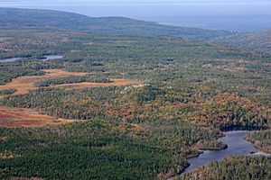
From the summit, you can see so much. You can spot Sydney and Glace Bay. You can also see the beautiful Bras d'Or Lake and the Mira River. Plus, you'll see Loch Lomond, the huge Atlantic Ocean, and many other lakes, ridges, valleys, and bogs. It's a fantastic place to explore!
 | Valerie Thomas |
 | Frederick McKinley Jones |
 | George Edward Alcorn Jr. |
 | Thomas Mensah |


