Shahbazpur Union, Sarail facts for kids
Quick facts for kids
Shahbazpur
|
|
|---|---|
| Country | |
| Division | Chittagong Division |
| District | Brahmanbaria District |
| Upazila | Sarail Upazila |
| Area | |
| • Total | 23.2 km2 (9.0 sq mi) |
| Population
(2011)
|
|
| • Total | 29,757 |
| • Density | 1,282.6/km2 (3,322/sq mi) |
| Time zone | UTC+6 (Bangladesh Time) |
| Postal code |
3431
|
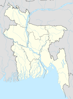
Shahbazpur (Bengali: শাহবাজপুর) is a community in eastern Bangladesh. It is a "union parishad," which is a type of local council area. Shahbazpur is part of Sarail Upazila, a sub-district. This sub-district is located within the Brahmanbaria District. The district itself is in the Chittagong Division.
Contents
About Shahbazpur
Where is Shahbazpur?
Shahbazpur Union covers an area of about 5,724 acres. This is roughly 23.2 square kilometers. It is located in the beautiful country of Bangladesh.
People and Homes
In 2011, there were 5,606 homes in Shahbazpur Union. The total number of people living there was 29,757. More than half of the working people, about 53.8%, worked in farming. The ability to read and write for people aged 7 and older was 47.1%. This was a little lower than the national average of 51.8% for Bangladesh.
How Shahbazpur is Run
Shahbazpur Union is divided into four smaller areas called "mauzas." These areas are Bara Dhitpur, Jadabpur, Noagoan, and Sahbazpur.
Getting Around
Shahbazpur Union is located on the N2 national highway. This important road connects two major cities: Dhaka and Sylhet. This makes it easy for people to travel to and from Shahbazpur.
Learning in Shahbazpur
One important school in the area is Shahbazpur Multilateral High School. It was started a long time ago, in 1907. This school helps many young people in Shahbazpur get an education.
Famous Faces
- Nurul Amin was an important person from Shahbazpur. He served as the Prime Minister of Pakistan during the time of the Bangladesh Liberation War.
 | Laphonza Butler |
 | Daisy Bates |
 | Elizabeth Piper Ensley |


