
Shandon, California facts for kids
Quick facts for kids
Shandon
|
|
|---|---|
.jpg)
The Serra Chapel in Shandon.
|
|

Location in San Luis Obispo County and the state of California
|
|
| Country | |
| State | |
| County | San Luis Obispo |
| Area | |
| • Total | 2.989 sq mi (7.742 km2) |
| • Land | 2.946 sq mi (7.630 km2) |
| • Water | 0.043 sq mi (0.112 km2) 1.44% |
| Elevation | 1,040 ft (317 m) |
| Population
(2010)
|
|
| • Total | 1,295 |
| • Density | 433.26/sq mi (167.27/km2) |
| Time zone | UTC-8 (Pacific (PST)) |
| • Summer (DST) | UTC-7 (PDT) |
| ZIP code |
93461
|
| Area code(s) | 805 |
| FIPS code | 06-71134 |
| GNIS feature IDs | 249342, 2408721 |
Shandon is a small community in San Luis Obispo County, California, United States. It is a "census-designated place" (CDP), which means it's a special area used for gathering population information. In 2010, about 1,295 people lived there. Shandon is located near the San Juan River.
Contents
Where Did Shandon Get Its Name?

The name "Shandon" comes from a town that was mentioned in a magazine called Harper's Magazine way back in 1891.
Geography of Shandon
.jpg)
Shandon is located in a valley called the San Juan Valley. This is where two creeks, San Juan Creek and Cholame Creek, meet up. When they join, they form the Estrella River. This river then flows west until it meets the Salinas River near Paso Robles.
Shandon is also found where two main roads, Highway 41 and Highway 46, come together. These highways merge for about six miles. The famous San Andreas Fault, a major crack in the Earth's crust, crosses these highways about six miles from Shandon.
The exact location of Shandon is 35°39′22″N 120°22′44″W / 35.65611°N 120.37889°W.
The area of Shandon is about 3 square miles (7.7 square kilometers). Most of this area is land, with a small part being water.
Shandon's Climate and Weather
Shandon has a special kind of weather called a hot-summer Mediterranean climate. This means it has very hot and dry summers. The winters are cool and wet.
Because Shandon is located away from the coast, the temperature can change a lot between day and night. Sometimes, the difference can be as much as 40 degrees Celsius (72 degrees Fahrenheit) in the summer!
| Climate data for Shandon (Paso Robles Municipal Airport) | |||||||||||||
|---|---|---|---|---|---|---|---|---|---|---|---|---|---|
| Month | Jan | Feb | Mar | Apr | May | Jun | Jul | Aug | Sep | Oct | Nov | Dec | Year |
| Mean daily maximum °F (°C) | 60.3 (15.7) |
63.4 (17.4) |
66.4 (19.1) |
73.6 (23.1) |
81.1 (27.3) |
88.8 (31.6) |
93.9 (34.4) |
93.7 (34.3) |
89.1 (31.7) |
80.5 (26.9) |
67.8 (19.9) |
60.8 (16.0) |
76.6 (24.8) |
| Daily mean °F (°C) | 48.0 (8.9) |
51.1 (10.6) |
53.5 (11.9) |
57.3 (14.1) |
63.3 (17.4) |
69.4 (20.8) |
73.8 (23.2) |
73.7 (23.2) |
70.0 (21.1) |
62.5 (16.9) |
52.7 (11.5) |
47.1 (8.4) |
60.2 (15.7) |
| Mean daily minimum °F (°C) | 35.6 (2.0) |
38.7 (3.7) |
40.5 (4.7) |
41.0 (5.0) |
45.4 (7.4) |
50.0 (10.0) |
53.7 (12.1) |
53.7 (12.1) |
50.8 (10.4) |
44.4 (6.9) |
37.5 (3.1) |
33.3 (0.7) |
43.7 (6.5) |
| Average rainfall inches (mm) | 2.83 (72) |
2.87 (73) |
2.66 (68) |
0.68 (17) |
0.23 (5.8) |
0.02 (0.51) |
0.01 (0.25) |
0.06 (1.5) |
0.36 (9.1) |
0.51 (13) |
1.12 (28) |
1.73 (44) |
13.08 (332) |
| Source: → | |||||||||||||
People of Shandon (Demographics)

In 2010, Shandon had a population of 1,295 people. This was an increase from 986 people in 2000.
- Population Growth: The number of people living in Shandon grew by over 300 between 2000 and 2010.
- Diversity: In 2010, about 65% of the people were White. About 27% were from other races, and 3% were from two or more races. Over half of the people (53.5%) were of Hispanic or Latino background.
- Households: There were 371 households in 2010. Many of these (50.4%) had children under 18 living there. Most households (59%) were married couples.
- Age Groups: About one-third of the population (32.3%) was under 18 years old. The average age in Shandon was about 30.6 years.
- Housing: Most homes in Shandon (64.4%) were owned by the people living in them, while others were rented.
What Shandon Does (Economy & Services)
The main way people in this part of the county make a living is through farming.
- Agriculture: Many large vineyards, like Arciero and French Camp Vineyards, are important places for jobs in the area.
- Firefighters: Shandon has a team of 15 paid-call firefighters. They respond to emergencies when needed. There is also a CalFire station in town.
- Transportation: The California Department of Transportation (Caltrans) has a local office in Shandon.
- Schools: Shandon is home to the Shandon Unified School District. This district includes Shandon Elementary, Shandon High School, and Parkfield Elementary.
- Post Office: You can find the Shandon Post Office on East Centre Street.
Shandon Schools and Sports
Public education in Shandon is managed by the Shandon Joint Unified School District.
High School Sports
The sports teams at Shandon High School are called the Outlaws. They play in the Coast Valley League.
Team Championships
- In 1979, the Girls Basketball team won the Southern Section/Small School Division championship.
Team Runner-Up
- In 1998, the Football team was a finalist in the Southern Section/8-Man Small Division.
Famous People From Shandon
- William P. Clark, Jr.: He was a very important person in the U.S. government. He served as Deputy Secretary of State, National Security Advisor, and Secretary of the Interior. He lived near Shandon until he passed away in 2013.
- Nessie Early: She was the National FFA Secretary from 2008 to 2009. She also lives in Shandon.
Images for kids
-
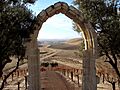
View of Shandon from the Serra Chapel.
See also
 In Spanish: Shandon (California) para niños
