Sheep Mesa (Park County, Wyoming) facts for kids
Quick facts for kids Sheep Mesa |
|
|---|---|
| Highest point | |
| Elevation | 11,590 ft (3,530 m) |
| Geography | |
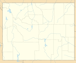
| Location | Park County, Wyoming, U.S. |
| Parent range | Absaroka Range, Shoshone National Forest |
| Topo map | USGS Sheep Mesa |
| Climbing | |
| Easiest route | Scramble |
Sheep Mesa is a mountain peak found in the Absaroka Range in the state of Wyoming, United States. It stands tall at about 11,590 feet (3,533 meters) above sea level. This mountain is located in Park County, Wyoming, within the beautiful Shoshone National Forest.
Contents
Exploring Sheep Mesa
Sheep Mesa is an interesting part of the Absaroka Range. It sits at the southern end of a place called Blackwater Canyon. The mountain is also at the very beginning of the streams that flow into Blackwater Creek. This area is known for its rugged and wild beauty.
Where is Sheep Mesa Located?
Sheep Mesa is in the northwestern part of Wyoming. It's part of the Absaroka Mountains, which stretch across parts of Wyoming and Montana. These mountains are famous for their volcanic origins and sharp, rocky peaks.
Nearby Peaks and Features
Just about one mile (1.6 kilometers) south of Sheep Mesa, you'll find another mountain called Fortress Mountain. These peaks are close to each other in the vast wilderness. The area around Sheep Mesa is mostly undeveloped. It is a great place for wildlife and outdoor adventures.
The Absaroka Range
The Absaroka Range is a large mountain range in the Rocky Mountains. It covers parts of Wyoming and Montana. These mountains were formed by ancient volcanoes. This gives them a unique look with many steep cliffs and deep valleys.
Wildlife in the Absaroka Range
The Absaroka Range, including the area around Sheep Mesa, is home to many animals. You might see grizzly bears, black bears, elk, moose, and bighorn sheep. There are also many different kinds of birds. This makes the area important for wildlife conservation.
Shoshone National Forest
Sheep Mesa is located within the Shoshone National Forest. This forest was the first national forest in the United States. It was created in 1891. The forest protects a huge area of mountains, forests, and rivers. It provides habitats for wildlife and opportunities for people to enjoy nature.
Activities Near Sheep Mesa
While Sheep Mesa itself is a remote peak, the surrounding Shoshone National Forest offers many activities. People can go hiking, camping, and wildlife watching. It's a place where you can experience the wilderness.
Hiking and Scrambling
For experienced hikers, reaching the top of Sheep Mesa might be a challenge. The easiest way to climb it is often described as a "scramble." This means you might need to use your hands to help you climb over rocks. It's not a simple walk.
Protecting the Environment
When visiting areas like Sheep Mesa, it's important to follow "Leave No Trace" principles. This means packing out all your trash and respecting wildlife. It helps keep the natural environment clean and healthy for everyone.
 | Selma Burke |
 | Pauline Powell Burns |
 | Frederick J. Brown |
 | Robert Blackburn |


