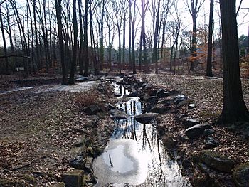
Shellpot Creek facts for kids
Quick facts for kids Shellpot Creek |
|
|---|---|

Shellpot Creek at Tarleton Park
|
|
|
Location of Shellpot Creek mouth
|
|
| Other name(s) | Tributary to Delaware River |
| Country | United States |
| State | Delaware |
| County | New Castle |
| City | Bellefonte, Delaware |
| Physical characteristics | |
| Main source | divide between Shellpot Creek and Brandywine Creek Between Grubb and Shipley Road in Brandywine Hundred. 340 ft (100 m) 39°49′19″N 75°31′55″W / 39.82194°N 75.53194°W |
| River mouth | Delaware River Bellefonte, Delaware 0 ft (0 m) 39°44′05″N 75°30′16″W / 39.73472°N 75.50444°W |
| Length | 8.7 miles |
| Basin features | |
| Progression | southeast |
| River system | Delaware River |
| Basin size | 9.32 square miles (24.1 km2) |
| Tributaries |
|
Shellpot Creek is a small river, also called a tributary, that flows into the big Delaware River in New Castle County, Delaware. It's an important waterway in the area, even though it's not very long.
Contents
About Shellpot Creek
Shellpot Creek starts in a place called Brandywine Hundred and flows towards the southeast. It travels for about 8.7 miles (which is about 14 kilometers) before it reaches the Delaware River.
Where Does it Start and End?
The creek begins between Grubb Road and Shipley Road, near Naaman's Road. This spot is about 340 feet (104 meters) above sea level. It then flows southeast and empties into the Delaware River near Edgemoor. The point where it joins the Delaware River is at sea level.
For a long time, before 1938, Shellpot Creek actually flowed into another creek called Brandywine Creek. But then, its path was changed so it would flow directly into the Delaware River instead.
What is a Watershed?
A watershed is like a giant bowl or area of land where all the rain and snowmelt drain into a common stream, river, or lake. Shellpot Creek's watershed is about 9.32 square miles (24.1 square kilometers). This area is mostly made up of suburban neighborhoods.
Shellpot Creek is part of a larger group of watersheds in Delaware called the "Piedmont Basin." This basin includes other important creeks like the Christina River, Brandywine Creek, Red Clay Creek, White Clay Creek, and Naamans Creek.
Water Flow and Flooding
Water from rain and other sources, called storm-water, flows into Shellpot Creek from many places. This includes water from New Castle County, the Calpine Edge Moor Power Plant, and even parts of the City of Wilmington.
Shellpot Creek can sometimes experience big floods. For example, during a storm called Tropical Storm Allison (1989), the amount of water flowing in the creek increased a lot. It went from about 1,300 gallons per minute to over 3.6 million gallons per minute! That's a huge amount of water, showing how quickly the creek can swell during heavy rains.
What's in a Name?
The name "Shellpot" likely comes from an old Swedish phrase, Sköllpadde Fallet. This phrase means "Turtle Falls." So, the creek might have been a place where turtles were often seen, or where there were small waterfalls that looked like turtle shells. Over time, the name changed and was also known as "Schillpades," "Skilpot," and "Shilpot."
 | James Van Der Zee |
 | Alma Thomas |
 | Ellis Wilson |
 | Margaret Taylor-Burroughs |


