White Clay Creek facts for kids
Quick facts for kids White Clay Creek |
|
|---|---|

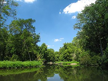
White Clay Creek running through Newark, Delaware
|
|
|
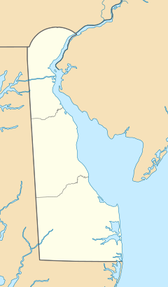
Location of White Clay Creek mouth
|
|
| Other name(s) | Tributary to Christina River |
| Country | United States |
| State | Pennsylvania, Delaware |
| Counties | Chester, New Castle |
| City | Newark, DE |
| Physical characteristics | |
| Main source | West Branch White Clay Creek Penn Township, Chester County, Pennsylvania 39°48′57″N 75°52′09″W / 39.81583°N 75.86917°W |
| 2nd source | Middle Branch White Clay Creek Londonderry Township, Chester County, Pennsylvania 39°51′40″N 75°52′20″W / 39.86111°N 75.87222°W |
| River mouth | Christina River New Castle County, Delaware 0 ft (0 m) 39°41′51″N 75°37′19″W / 39.69750°N 75.62194°W |
| Length | 18.5 mi (29.8 km) |
| Basin features | |
| Basin size | 107 sq mi (280 km2) |
| Tributaries |
|
| Type: | Scenic, Recreational |
| Designated: | October 24, 2000 |
The White Clay Creek is a beautiful stream that flows for about 18.5 miles (29.8 km). It is a tributary of the Christina River. This means it's a smaller stream that flows into a larger river. You can find it in southern Pennsylvania and northern Delaware in the United States.
This creek is famous for its pretty views and is mostly protected by the government. The area around White Clay Creek, called its watershed, covers about 107 square miles (277 km²). Nearly 100,000 people live in this area. The watershed includes parts of Chester County, Pennsylvania and New Castle County, Delaware.
The Pennsylvania part of the watershed still feels like the countryside. However, the Delaware part has more towns and buildings. The name "White Clay Creek" might come from the white dirt, called sediment, that washes into the creek from the hills in Chester County.
Most of the creek is in the Piedmont region. This area has rolling hills, flat-topped lands, and stream valleys. The southern part of the creek, near Newark, is in the Atlantic Coastal Plain. This is a flatter area with many large wetlands where the land meets the water. White Clay Creek flows into the Christina River at a place called Churchman’s Marsh.
Contents
Exploring the Branches of White Clay Creek
The White Clay Creek is formed by several smaller streams, called branches. Let's learn about each one.
East Branch: A Journey Through Towns
The East Branch is about 13.5 miles (21.7 km) long. It starts near a small village called Upland in West Marlborough Township. As it flows south, it goes through Avondale. Here, another stream called Trout Run joins it.
After Avondale, an old railroad track, the Pomeroy and Newark Railroad, used to follow the creek. This railroad stopped running in 1939. Further south, after Egypt Run joins, the creek starts to wind through a narrow valley. It passes through Landenberg, which used to be a town with many mills.
The creek then leaves the narrow valley and enters a wider one. Here, Broad Run flows into it, just before the creek enters the White Clay Creek Preserve. Finally, the East Branch meets the main White Clay Creek in the Preserve, at a place that was once a community called Yeatman.
Middle Branch: Winding Through the Hills
The Middle Branch is about 11.4 miles (18.3 km) long. It begins in Londonderry Township. It flows south along the western edge of West Grove. Then it turns east, then south again, and finally east again to meet Indian Run.
After that, it turns south and cuts sharply through the hills near Chesterville. This is where it meets the West Branch to form the main part of White Clay Creek.
West Branch: From Kelton to the Main Stem
The West Branch is the shortest of the three, at about 8.0 miles (12.9 km) long. It starts near Kelton. It flows south and east through New London Township. It slowly turns east until it meets the Middle Branch. Together, they create the main stem of White Clay Creek.
The Main Stem: Flowing to the Christina River
The main part of White Clay Creek begins where the West and Middle branches meet. From there, it flows into a narrow valley and then into the White Clay Creek Preserve. It meets the East Branch at Yeatman.
The creek continues south through the White Clay Creek Preserve. It then enters New Castle County, Delaware and White Clay Creek State Park. This is about 12 miles (19 km) west of Wilmington. There are trails next to the creek, and some of them use parts of the old Pomeroy & Newark railroad path. These trails follow the creek to the edge of Newark.
The creek then turns east, and two more streams, Middle Run and Pike Creek, join it. As it gets closer to the Christina River, the valley opens up. It passes by Delaware Park.
Next, Mill Creek flows into it, followed by its biggest tributary, Red Clay Creek. The combined streams turn southwest and then back east. They loop around a piece of land called Bread and Cheese Island. This island was formed by the Red Clay, White Clay, and Hershey Run streams. Just after passing the island, White Clay Creek flows into the Christina River. This is about 5 miles (8 km) southwest of Wilmington at Churchman's Marsh.
History and Nature of White Clay Creek
The White Clay Creek area has many interesting historical sites. You can find old lime kilns, which were used to make lime, and mills from the 1800s. These mills used the power of the creek's water to grind grain or saw wood.
The lower part of the creek has some of the biggest remaining Piedmont forests in Delaware. These forests are home to many important animals and plants. One special animal found here is the bog turtle, which is an endangered species. This means there are very few of them left in the world.
In the year 2000, the United States Congress decided to protect about 190 miles (306 km) of White Clay Creek and its smaller streams. They made it part of the National Wild and Scenic River program. This program helps to keep rivers in their natural state for everyone to enjoy.
 | Kyle Baker |
 | Joseph Yoakum |
 | Laura Wheeler Waring |
 | Henry Ossawa Tanner |


