
White Clay Creek State Park facts for kids
Quick facts for kids White Clay Creek State Park |
|
|---|---|
|
IUCN Category III (Natural Monument)
|
|

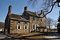
Bryan's Field trailhead of White Clay Creek State Park, from the Possum Hill Area parking lot
|
|

White Clay Creek State Park
Location in Delaware
|
|
| Location | New Castle, Delaware, United States |
| Area | 3,300 acres (13 km2) |
| Elevation | 108 ft (33 m) |
| Established | 1968 |
| Named for | White Clay Creek |
| Governing body | Delaware Department of Natural Resources and Environmental Control |
| Website | White Clay Creek State Park |
White Clay Creek State Park is a large park in Delaware, United States. It covers about 3,647 acres (about 14.7 square kilometers) in New Castle County. The park is located near the city of Newark. It is named after the White Clay Creek that flows through it.
North of this park, in Pennsylvania, is the White Clay Creek Preserve. These two parks used to work together to protect the creek. Now, they are managed separately. The White Clay Creek itself is special. It is part of the National Park Service's National Wild and Scenic Rivers System. This means it is protected for its natural beauty.
The park has about 37 miles (60 kilometers) of trails. You can use these trails for hiking and mountain biking. They are open every day of the year. You can find parking at several spots. There is a small fee to park from March 1 to November 30. The park also has old buildings and a nature center. It is part of a large natural area called the Northeastern coastal forests ecoregion.
Contents
Park History: Saving the Creek
Early Plans for a Dam
After World War II, people worried about not having enough water in northern Delaware. There were ideas to build a dam on the White Clay Creek. This dam would have flooded the valley to create a big lake for water. A company called Pennsylvania Railroad started buying land for this dam.
In 1956, a company called DuPont bought this land. They also bought more land in the valley. They wanted to stop houses from being built there. By the early 1960s, the dam idea was moving forward. But many people in both Delaware and Pennsylvania did not like this plan.
People Fight for the Park
Local people and groups like the United Automobile Workers union and the Sierra Club led the fight against the dam. They were worried about harming nature. They also did not want to lose beautiful open spaces for fun. In 1965, a group called the White Clay Watershed Association was formed. Their goal was to stop the dam.
How the Park Started
White Clay Creek State Park began in 1968. It was a small park for recreation. People who cared about nature kept pushing for more land to be protected. In the early 1970s, the state bought over 150 acres (0.6 square kilometers) more land. This made the park bigger. In 1975, the park was renamed Walter S. Carpenter, Jr. State Park. This was to honor a former president of DuPont. By the mid-1970s, fewer people supported the dam.
Growing the Park with DuPont's Help
Since the dam plan was not going to happen, the National Park Service suggested something new. They encouraged DuPont to give land to Delaware and Pennsylvania. This land would create a joint park. Delaware Senator Joe Biden helped make this happen. He talked with DuPont and both states. DuPont then gave 1,234 acres (about 5 square kilometers) to Pennsylvania. They gave 528 acres (about 2.1 square kilometers) to Delaware. This land became the bi-state White Clay Creek Preserve.
More Land for Protection
In 1988, the family of S. Hallock du Pont decided to sell some of their large estate. They planned to sell 850 acres (about 3.4 square kilometers) out of 2,000 acres. Delaware Governor Michael Castle wanted to protect this open space. He started buying 321 acres (about 1.3 square kilometers) of the land. This land would connect Walter Carpenter State Park and the White Clay Creek Preserve. It would also connect to the Middle Run Valley Natural Area, a park run by the county.
Governor Castle said this purchase was more than just a connection. He said it would protect northern Delaware from too much building. The purchase was finished in the early 1990s. In 1995, Walter S. Carpenter, Jr. State Park, the Delaware part of the White Clay Creek Preserve, and the du Pont estate lands were all joined. They were renamed White Clay Creek State Park.
In 1998, the state bought another 500 acres (about 2 square kilometers). This was the Judge Hugh M. Morris Estate. It was next to the Middle Run Valley Natural Area. This purchase made the park over 3,000 acres (about 12 square kilometers) in total.
Special Protection for the Creek
In 2000, the U.S. Congress gave White Clay Creek a special honor. They included it in the National Park Service's National Wild and Scenic River program. This was the first time an entire watershed (all the land that drains into a river) got this protection. This special title helps protect the land in the valley even more.
The Mason–Dixon Line in the Park
The famous Mason–Dixon line goes through White Clay Creek State Park. This line was surveyed a long time ago to mark borders. The park has several historic spots related to this line.
Important Markers
The starting point of the survey is called the "post mark'd west." It is in Bryan's Field, inside the park. Charles Mason, one of the surveyors, wrote about this spot. He said it was 15 miles south of Philadelphia. It was on land owned by Mr. Alexander Bryan. Today, a monument marks this spot. S. Hallock du Pont donated it in 1952. You can find it along the Bryan's Field trail.
Another important spot is the "arc corner." This was also surveyed by Mason and Dixon. An 1892 monument marks it. There are plans to build a trail. This trail will connect White Clay Creek State Park to a special monument from 1849. This monument shows where the borders of Delaware, Pennsylvania, and Maryland meet.
The Mason-Dixon Trail
The Mason-Dixon Trail also goes through the park. It enters from the White Clay Creek Preserve. Then it continues through the park towards Newark.
Nearby State Parks to Explore
- Alapocas Run State Park (New Castle County)
- Auburn Valley State Park (New Castle County)
- Brandywine Creek State Park (New Castle County)
- Elk Neck State Park (Maryland)
- Fair Hill Natural Resources Management Area (Maryland)
- Fort Delaware State Park (New Castle County)
- Fort DuPont State Park (New Castle County)
- Fort Mott State Park (New Jersey)
- Fox Point State Park (New Castle County)
- Lums Pond State Park (New Castle County)
- Marsh Creek State Park (Pennsylvania)
- Ridley Creek State Park (Pennsylvania)
- Susquehanna State Park (Maryland)
- Susquehannock State Park (Pennsylvania)
- Wilmington State Parks (New Castle County)
- White Clay Creek Preserve (Pennsylvania)
Images for kids
-
Judge Morris house

