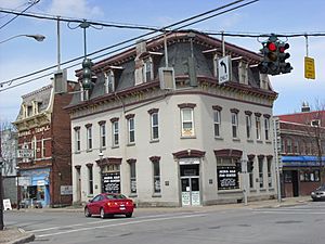
Sherburne (village), New York facts for kids
Quick facts for kids
Sherburne, New York
|
|
|---|---|

Downtown Sherburne
|
|
| Country | United States |
| State | New York |
| County | Chenango |
| Town | Sherburne |
| Area | |
| • Total | 1.52 sq mi (3.94 km2) |
| • Land | 1.52 sq mi (3.94 km2) |
| • Water | 0.00 sq mi (0.00 km2) |
| Elevation | 1,047 ft (319 m) |
| Population
(2020)
|
|
| • Total | 1,360 |
| • Density | 895.33/sq mi (345.61/km2) |
| Time zone | UTC-5 (Eastern (EST)) |
| • Summer (DST) | UTC-4 (EDT) |
| ZIP code |
13460
|
| Area code(s) | 607 |
| FIPS code | 36-66883 |
| GNIS feature ID | 0965062 |
Sherburne is a small village located in Chenango County, New York, in the United States. In 2010, about 1,367 people lived there. It's part of the larger town of Sherburne and is found north of a city called Norwich.
Contents
Sherburne's Early History
The first people to settle in the area that is now the town of Sherburne arrived around 1792. The village of Sherburne itself was officially created in 1830.
Where is Sherburne Located?
Sherburne is found a little southwest of the center of the town of Sherburne. Its exact location is 42.679302 degrees north and 75.497518 degrees west.
Land Area of the Village
According to the United States Census Bureau, the village covers a total area of about 3.9 square kilometers (or 1.5 square miles). All of this area is land, with no water.
Rivers and Roads
The Chenango River flows along the western edge of the village. This river flows south and eventually joins the Susquehanna River.
Two important roads meet in the village: Route 12 and NY-80.
- Route 12 goes south about 11 miles (18 km) to Norwich, which is the main city of the county. It also goes north about 36 miles (58 km) to Utica.
- NY 80 goes east about 12 miles (19 km) to New Berlin and west about 13 miles (21 km) to Otselic.
How Many People Live in Sherburne?
The number of people living in Sherburne has changed over the years. Here's a look at the population counts from different years:
| Historical population | |||
|---|---|---|---|
| Census | Pop. | %± | |
| 1880 | 944 | — | |
| 1890 | 960 | 1.7% | |
| 1900 | 899 | −6.4% | |
| 1910 | 960 | 6.8% | |
| 1920 | 1,104 | 15.0% | |
| 1930 | 1,077 | −2.4% | |
| 1940 | 1,192 | 10.7% | |
| 1950 | 1,604 | 34.6% | |
| 1960 | 1,647 | 2.7% | |
| 1970 | 1,613 | −2.1% | |
| 1980 | 1,561 | −3.2% | |
| 1990 | 1,531 | −1.9% | |
| 2000 | 1,455 | −5.0% | |
| 2010 | 1,367 | −6.0% | |
| 2020 | 1,360 | −0.5% | |
| U.S. Decennial Census | |||
In the year 2000, there were 1,455 people living in the village. There were 648 households, and 351 of these were families. The average household had about 2.21 people, and the average family had about 2.99 people.
Age Groups in the Village
In 2000, the population was spread out by age:
- 25.6% were under 18 years old.
- 7.1% were between 18 and 24 years old.
- 27.4% were between 25 and 44 years old.
- 21.6% were between 45 and 64 years old.
- 18.4% were 65 years old or older.
The average age of people in the village was 38 years.
See also
 In Spanish: Sherburne (villa) para niños
 | May Edward Chinn |
 | Rebecca Cole |
 | Alexa Canady |
 | Dorothy Lavinia Brown |


