Sheridan, South Dakota facts for kids
Quick facts for kids
Sheridan, South Dakota
Golden City
|
|
|---|---|
| Country | United States |
| State | South Dakota |
| County | Pennington |
| Founded | 1875 |
| Named for | Philip Sheridan |
| Elevation | 4,626 ft (1,410 m) |
| Time zone | UTC-7 (Mountain Standard Time (MST)) |
| • Summer (DST) | UTC-6 (MDT) |
| GNIS feature ID | 1264593 |
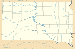
Sheridan was once a small town in Pennington County, South Dakota. It was first called Golden City. This town was important because it was the first county seat (the main town for local government) for Pennington County from 1877 to 1878. Today, you can't see Sheridan because it's underwater, beneath Sheridan Lake.
Contents
History of Sheridan
How Sheridan Started and Grew
Sheridan began as a place where people dug for gold in the Black Hills. It was planned in the spring of 1875 and first named Golden City. It was one of the very first gold towns, or mining camps, in the Black Hills.
Many mines were in the area, like the Queen Bee and Calumet. In 1875, one of the first rich areas for placer mining was found here. Placer mining is a way to find gold by washing it out of sand or gravel. That October, miners found about $3,000 worth of gold.
By February 1876, Golden City had many people living there. It had four stores and lots of houses. A stagecoach line, which was like an old bus route, connected Deadwood to Denver. This line went through Golden City, helping the town grow even more.
In 1877, the town's name changed to Sheridan. This was to honor U.S. Army General Philip Sheridan. It also became the temporary county seat for Pennington County. The people living there built a courthouse in late 1877. In October of that year, the first U.S. Circuit Court meeting west of the Missouri River happened in Sheridan.
Sheridan's Decline and Disappearance
Later, the circuit court moved to Deadwood. The stagecoach line also changed its path, no longer going through Sheridan. In 1878, the county seat moved to Rapid City.
In the mid-1880s, a big fire destroyed many buildings in Sheridan. By 1920, only 10 people lived there. The nearby mines were also running out of gold. Because of these things, Sheridan slowly became a ghost town.
In 1939, Spring Creek was dammed up. This created the new Sheridan Lake. The old town of Sheridan was then covered by the lake's water.
Today, almost nothing remains of Sheridan. One house that belonged to Johnny and Kit Good was moved before the lake was made. It was moved about six miles (9.7 km) south to the edge of a small field. This house once had 12 outside doors.
Geography of Sheridan
Sheridan is located in the Black Hills of Pennington County. It is about eight miles (12.9 km) north of Hill City. You can find its general area along U.S. Route 385.
The old town of Sheridan is now about 20 feet (6.1 meters) under the surface of Sheridan Lake. Spring Creek flows into the north end of Sheridan Lake. The old Good house, which was moved, is on the east side of U.S. 385. It is six miles south of the lake and 1.5 miles (2.4 km) north of Hill City.
 | Delilah Pierce |
 | Gordon Parks |
 | Augusta Savage |
 | Charles Ethan Porter |


