Sheshequin Path facts for kids
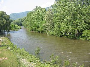
The Sheshequin Path was an important Native American trail in Pennsylvania. It connected two Native American villages: "French Margaret's Town" (near modern Williamsport) and "Sheshequin" (in modern Ulster Township). The path mostly followed Lycoming Creek and Towanda Creek. It was a useful shortcut between the two main branches of the Susquehanna River. Both Native Americans and early settlers used this path for travel.
What's in a Name?
The name Sheshequin comes from the Lenape language word Sheshequanink. This means "at the place of the gourd rattle." Gourd rattles were special tools used in religious ceremonies held there.
Another name for the trail was the "Lycoming Path." This name came from Lycoming Creek, which the path followed for a long distance. Lycoming Creek also gave its name to Lycoming County. The word Lycoming comes from the Lenape word Legaui-hanne, meaning "sandy stream."
A shorter path near Sheshequin was called "St. Joseph's Path." People believe it was named after August Gottlieb Spangenberg, a Moravian Bishop who was also known as "Brother Joseph."
Where Did the Path Go?
Native American trails often had several starting points, and the Sheshequin Path was no different. In Lycoming County, there were three main branches that all led to Lycoming Creek. These branches connected to the Great Shamokin Path, another major trail along the West Branch Susquehanna River.
The main part of the Sheshequin Path followed Lycoming Creek north. It went past places like Hepburnville, Cogan Station, and Trout Run. Today, much of this route is followed by U.S. Route 15. From Trout Run, the path continued north to the start of Lycoming Creek in Bradford County.
From there, the path crossed a swampy area to reach the start of Towanda Creek. It then followed Towanda Creek northeast through places like Canton (where Pennsylvania Route 14 is now) and East Canton. The path continued past Leroy, West Franklin, Powell, and Monroeton, until it reached the mouth of Towanda Creek at modern Towanda.
From Towanda, the path followed the Susquehanna River north to Sheshequin. From Sheshequin, it continued north into New York to reach the Iroquois people. Today, Pennsylvania Route 414 and U.S. Route 220 follow parts of this historic path.
History of the Path
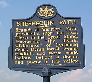
The Sheshequin Path was known for being easy to travel because it mostly went through flat creek valleys. However, these narrow valleys also meant the path could flood easily, especially along Lycoming Creek. People even believed that Bohemia Mountain, near the start of Lycoming Creek, was home to an "evil spirit" because of all the thunderstorms there.
A famous traveler named Conrad Weiser often used the Sheshequin Path. He made many journeys to meet with the Six Nations of the Iroquois. His notes about his travels are a main source of information about the path. For example, in 1737, he traveled the path with an Iroquois leader named Shikellamy through deep snow.
In 1745, a group of Moravians, including Bishop Spangenberg, also traveled the path. Spangenberg described it as a "Dismal Wilderness" that was "full of wood and trees." He said it was so thick that sometimes you could barely see twenty paces ahead.
The Sheshequin Path was used by both sides during the American Revolutionary War. In 1778, after a conflict in the Wyoming Valley, an American officer named Colonel Hartley led 200 men north along the path. They went on a mission as far as Queen Esther's Town, which they destroyed. This showed how useful these Native American paths were for military movements. Later, Sullivan's Expedition in 1779 used similar paths to destroy many Native American villages.
The Sheshequin Path was also part of the Underground Railroad until the American Civil War started in 1861. Escaped slaves would sometimes walk in creeks to hide their scent from dogs that might be chasing them.
 | Georgia Louise Harris Brown |
 | Julian Abele |
 | Norma Merrick Sklarek |
 | William Sidney Pittman |


