Shotley facts for kids
Quick facts for kids Shotley |
|
|---|---|
 St Mary's Church |
|
| Area | 8.13 km2 (3.14 sq mi) |
| Population | 2,342 (2011) |
| • Density | 288/km2 (750/sq mi) |
| OS grid reference | TM236351 |
| District |
|
| Shire county | |
| Region | |
| Country | England |
| Sovereign state | United Kingdom |
| Post town | Ipswich |
| Postcode district | IP9 |
| Dialling code | 01473 |
| EU Parliament | East of England |
| UK Parliament |
|
Shotley is a lovely village located in Suffolk, England. It's about 8 kilometers (5 miles) south-east of the larger town of Ipswich. Shotley is part of the Babergh area.
The village gives its name to the Shotley peninsula. This is a piece of land surrounded by water on three sides, sitting between two rivers: the River Stour and the River Orwell. The wider Shotley area includes the main village and two other smaller places called Shotley Gate and Church End. In 2011, about 2,342 people lived here.
Contents
Exploring Shotley Village
The main village of Shotley is about a mile northwest from the very tip of the peninsula. It sits along the B1456 road, which locals call "the Street." In 2018, around 854 people lived in the village itself.
A Look Back in Time
Shotley has a long history! It was even mentioned in the Domesday Book of 1086. This was a very old survey of England ordered by William the Conqueror. The book listed Shotley (called "Scoteleia" back then) and a nearby place called Kirkton.
Important Places in Shotley
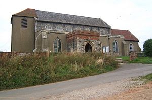
You'll find a school just outside the village, about half a kilometer to the east. Near the school is Oldhall Road, which leads north to St Mary's Church. This church is next to a large naval cemetery. The Commonwealth War Graves Commission looks after this cemetery. It has graves from both World War I and World War II. Many of the graves belong to young people who trained at HMS Ganges (a former Royal Navy training center). There is also a special memorial for sailors who died from Harwich submarines during World War I.
Close to the church, you can see Shotley Hall. Another interesting spot is Rose Farm, located south of the village.
Getting Involved in the Community
The Shotley Parish Council holds meetings every third Thursday of the month (except August). These meetings happen at the village hall at 7:15 PM. Everyone is welcome to attend and see what's happening in the community!
Shotley Gate and Local Attractions
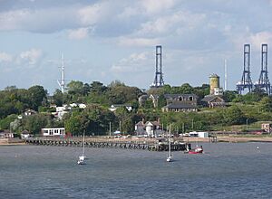
Shotley Gate is a settlement located at the very tip of the Shotley peninsula, south of the main village. It's a key part of the area.
The Famous HMS Ganges
Shotley Gate is home to the former HMS Ganges. This was a very important Royal Navy training center where boys learned to become sailors. It was known as RNTE Shotley.
Places to Eat and Visit
If you're looking for a place to eat or relax, Shotley has a few options:
- The Rose public house is in the village of Shotley.
- The Bristol Arms public house is in Shotley Gate, close to Shotley Pier.
- The Shipwreck public house is at Shotley Marina in Shotley Gate. This marina is a popular spot for visitors.
Getting Around by Ferry
During the summer, you can take a special ferry service from Shotley Marina. This ferry can carry up to 12 passengers and travels between Shotley Marina, Harwich, and Felixstowe. It's a great way to see the area from the water!
Historic Buildings and Sites
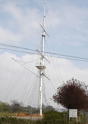
Shotley has several historic buildings. These include the old Martello towers, which were small defensive forts built a long time ago. You can also see the ceremonial mast from the former HMS Ganges. Shotley Cottage, located southeast of the village, was a radio station during World War I. The Suffolk Historic Environment Record lists over 200 important historical sites and monuments in Shotley!
If you enjoy walking, the St Mary's Church Walking Club in Shotley meets on the second Sunday of every month.
The Future of HMS Ganges Site
There have been plans to redevelop the old HMS Ganges site since 2000. Originally, there were ideas to build retirement homes there. The future of the site is still being decided, but permission for development has been granted in principle.
Notable People from Shotley
Admiral Sir Charles Dare, a famous naval officer, spent his last years in Shotley. He passed away there in 1924.
See also
 In Spanish: Shotley para niños
 | Anna J. Cooper |
 | Mary McLeod Bethune |
 | Lillie Mae Bradford |


