Silers Bald facts for kids
Quick facts for kids Silers Bald |
|
|---|---|

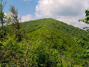
The summit of Silers Bald, looking west from the Narrows.
|
|
| Highest point | |
| Elevation | 5,607 ft (1,709 m) |
| Prominence | 337 ft (103 m) [1] |
| Geography | |
| Location | Swain County, North Carolina / Sevier County, Tennessee, U.S. |
| Parent range | Great Smoky Mountains |
| Topo map | USGS Silers Bald |
| Climbing | |
| Easiest route | Appalachian Trail west from Clingmans Dome |
Silers Bald is a mountain found in the western part of the Great Smoky Mountains. It is located in the southeastern United States. This mountain is a popular spot for hikers. Many people visit because it is close to Clingmans Dome. Also, the famous Appalachian Trail goes right over it.
Silers Bald sits on the top ridge of the Smokies. To its west is Thunderhead Mountain. To its east is Clingmans Dome. The border between Tennessee and North Carolina crosses the very top. This means the mountain is split between Sevier County, Tennessee and Swain County, North Carolina.
The mountain rises about 2,500 feet (762 meters) from its northern base. This area is near Fish Camp Prong of Little River. It rises about 3,000 feet (914 meters) from its southern base. This part is near Forney Creek.
For many years, Silers Bald was a grassy bald. This means it had open, grassy areas on its top. This was true for most of the 1800s and early 1900s. However, it was likely covered in trees before European settlers arrived. Because of this, the park service does not keep the bald grassy. The Great Smoky Mountains National Park only maintains two other grassy balds. These are Gregory Bald and Andrews Bald.
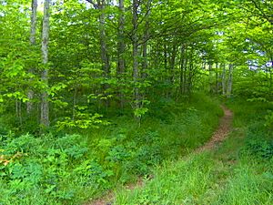
A narrow path for the Appalachian Trail is kept clear. This path crosses the summit for hikers. There is still a small bald area at the very top. It is about 30 feet (9 meters) wide. Here, the Appalachian Trail makes a sharp turn. Some grassy meadows can still be seen on the mountain's western side.
What is Silers Bald Made Of?
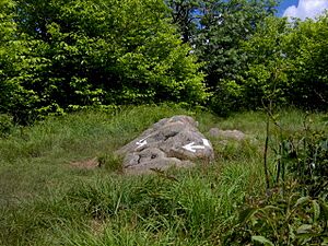
Silers Bald is mostly made of a type of rock called Thunderhead sandstone. A small pile of this rock forms the very top of the mountain. This sandstone is part of the Ocoee Supergroup. It was formed from ocean sediments almost a billion years ago.
The mountain, like most of the Smokies, was created about 200 million years ago. This happened when the North American and African land plates crashed into each other. This huge collision pushed the rock upwards. This event is known as the Appalachian orogeny.
The History of Silers Bald
Silers Bald is not often mentioned in old Cherokee stories. However, a special rock carving, called a petroglyph, was found near the top in 1917. A scientist named Arnold Guyot probably measured the mountain's height in 1859. He was surveying the Smokies' crest. He might have called it "Big Stone Mountain." Guyot listed this mountain as 5,614 feet (1,711 meters) tall. He said it was somewhere between Mount Buckley and Thunderhead.
Silers Bald is named after Jesse Siler. He was an important person from North Carolina. He used to let his sheep and cattle graze on top of the mountain in the 1800s. Another mountain, Siler Bald, in the Nantahala Mountains, was named after Jesse's brother, William. Albert Mountain, also to the south, was named after Jesse's nephew, Albert Siler.
By the late 1800s, Silers Bald was the far eastern end of a huge grassy pasture. This pasture stretched for several miles along the western ridge of the Smokies. It went all the way to Russell Field, which overlooks Cades Cove. The mountain is mentioned several times in a book called Our Southern Highlanders by Horace Kephart. He described it as the last stop before entering a very wild, wooded area.
Kephart wrote about a herder's small cabin near modern Big Chestnut Bald. This was about six miles (10 km) east of Thunderhead. He said:
...there is just one shack, at Siler's Meadow. It is down below the summit, hidden in timber, and you would never have seen it. Even if you had, you would have found it as bare as a last year's mouse nest, for nobody ever goes there except for a few bear-hunters. From there onward for forty miles is an uninhabited wilderness so rough that you could not make seven miles a day in it to save your life..."
Laura Thornborough was a writer who visited Silers Bald in the 1930s. She remembered it as a giant meadow:
Silers is one of the mysterious grassy balds, or mountain-top meadows, and an outstanding vantage point commanding spectacular views.
How to Get to Silers Bald
The easiest way to reach Silers Bald is to start at the Clingmans Dome tower trail. You can find this trail from the Forney Ridge Parking Lot. Follow it to the tower. From the tower, you then follow the Appalachian Trail west. After just over four miles (6 km), you will reach the summit of Silers Bald.
This part of the trail goes up and down a lot. You will cross Mt. Buckley, which is a part of Clingmans Dome. You will also cross Jenkins Knob and a ridge called "The Narrows." This ridge has only a few trees.
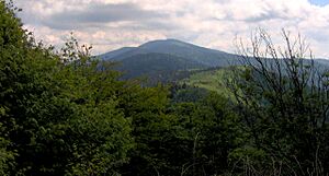
At the top of Silers Bald, there is a small, unmarked path. This path goes a few yards to a cliff on the mountain's northwest side. From this cliff, you can see a wide, 180-degree view of the northern Smokies. You can clearly see Mount Le Conte to the east. You can also see Thunderhead Mountain to the west.
See also
 In Spanish: Silers Bald para niños
 | William M. Jackson |
 | Juan E. Gilbert |
 | Neil deGrasse Tyson |


