Thunderhead Mountain facts for kids
Quick facts for kids Thunderhead Mountain |
|
|---|---|
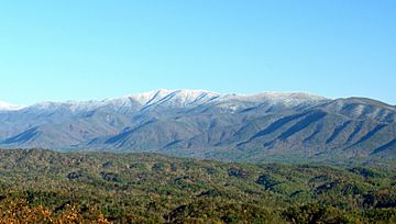
A snow-capped Thunderhead Mountain of the Great Smoky Mountains range rises above Cades Cove in Blount County, Tennessee
|
|
| Highest point | |
| Elevation | 5,527 ft (1,685 m) |
| Prominence | 1,087 ft (331 m) |
| Listing | Highest point in Blount County |
| Geography | |
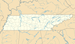
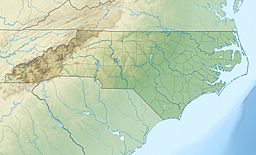
| Location |
|
| Parent range | Great Smoky Mountains |
| Topo map | USGS Thunderhead Mountain |
| Climbing | |
| Easiest route | Lead Cove Trail, Bote Mountain Trail and Appalachian Trail |
Thunderhead Mountain is a tall mountain, standing 5,527 feet (about 1,685 meters) high. It is located in the western part of the Great Smoky Mountains. This mountain sits right on the border between Tennessee and North Carolina. It is a very important landmark in the Western Smokies area.
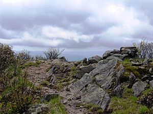
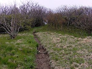
A famous hiking path, the Appalachian Trail, goes right over the top of Thunderhead Mountain. This makes it a popular spot for hikers. One part of the mountain's top ridge is called Rocky Top. This name is shared with a well-known Tennessee state song.
Thunderhead Mountain rises about 3,500 feet (1,067 meters) from its northern base. It rises about 3,000 feet (914 meters) from its southern base. The mountain has three main peaks. The lowest peak is Rocky Top, which is 5,440 feet (1,658 meters) high. The highest peak is the one farthest east, at 5,527 feet (1,685 meters). Thunderhead is the highest point in Blount County, Tennessee. It is also the highest point on the Appalachian Trail when coming from the south, until the trail reaches Silers Bald, which is about 10 miles (16 km) to the east.
The mountain got its name in the 1800s. It likely refers to the sudden and strong storms that often hit the high parts of the Smokies. A writer named Laura Thornborough hiked Thunderhead in the 1930s. Her guide, Sam Cook, explained the name:
"It'll be thunderin' and lightnin' on Thunderhead when it's clear on every other peak on top o' Smoky, and that's how it got its name."
How Thunderhead Mountain Was Formed
Thunderhead Mountain is made of a type of rock called precambrian sandstone. This sandstone is part of something called the Ocoee Supergroup. These rocks were formed from old ocean sediments. This happened a very long time ago, between 500 million and one billion years ago.
The mountain itself was created about 200 million years ago. This happened during an event called the Appalachian orogeny. This is when the North American and African land plates crashed into each other. This huge crash pushed the rock layers upwards, forming the mountains we see today.
History of Thunderhead Mountain
James Spence was one of the first known settlers in this area. He cleared land about 2 miles (3 km) west of the mountain. This area is now known as Spence Field. By the late 1800s, cows grazing had turned Thunderhead into a grassy bald. This means it was a treeless, open area.
Thunderhead is one of the few mountains that kept its original name in Arnold Guyot's survey. Guyot was a scientist who mapped the Smokies in 1859. He measured Thunderhead's height as 5,520 feet (1,682 meters). This was very close to today's measurement, off by only seven feet (2 meters).
During the Civil War, some people from East Tennessee tried to start a new settlement. They called it "New World" and built it on the mountain's north side. However, this settlement did not last very long. It was located near a spot called Chimney Rocks.
In the early 1900s, groups started buying land in the Smokies to protect it. Thunderhead became a popular hiking spot for visitors. John W. Oliver, whose family were among the first European settlers in Cades Cove, began leading hikes up the mountain in 1924. The path he used is still mostly the same as the Bote Mountain Trail-Appalachian Trail route used today.
After the Great Smoky Mountains National Park was created, trees and plants started growing back. They covered much of the Smokies' high ridges west of Clingmans Dome. Today, the park lets Thunderhead return to its natural state. A narrow path is kept open across the mountain top for hikers on the Appalachian Trail.
How to Reach Thunderhead Mountain
To reach Thunderhead Mountain, you can use the Bote Mountain Trail. This trail starts on Little River Road. It goes up about 7 miles (11 km) to the top of the Smokies. There, it meets the Appalachian Trail at Spence Field. From Spence Field, it's about 2 miles (3 km) to the very top of Thunderhead.
The Lead Cove Trail is another option. It also starts on Little River Road, near Cades Cove. This trail is a shorter way to the summit. It skips the first 4 miles (6 km) of the Bote Mountain Trail. From the Lead Cove trailhead, it's about 7 miles (11 km) to the summit.
The Anthony Creek Trail also starts from the Cades Cove campground. It also bypasses the first 4 miles (6 km) of the Bote Mountain Trail. From the Anthony Creek trailhead, it's about 7.5 miles (12 km) to the summit of Thunderhead.
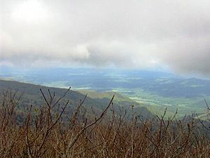
While the main summit of Thunderhead is covered with trees, Rocky Top offers amazing views. From Rocky Top, you can see all around the western Smokies.
 | Mary Eliza Mahoney |
 | Susie King Taylor |
 | Ida Gray |
 | Eliza Ann Grier |


