
Blount County, Tennessee facts for kids
Quick facts for kids
Blount County
|
|||
|---|---|---|---|

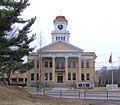
Blount County Courthouse in Maryville
|
|||
|
|||

Location within the U.S. state of Tennessee
|
|||
 Tennessee's location within the U.S. |
|||
| Country | |||
| State | |||
| Founded | 1795 | ||
| Named for | William Blount | ||
| Seat | Maryville | ||
| Largest city | Maryville | ||
| Area | |||
| • Total | 567 sq mi (1,470 km2) | ||
| • Land | 559 sq mi (1,450 km2) | ||
| • Water | 7.8 sq mi (20 km2) 1.4%% | ||
| Population
(2020)
|
|||
| • Total | 135,280 | ||
| • Estimate
(2023)
|
141,456 |
||
| • Density | 238.59/sq mi (92.12/km2) | ||
| Time zone | UTC−5 (Eastern) | ||
| • Summer (DST) | UTC−4 (EDT) | ||
| Congressional district | 2nd | ||


Blount County is a county in the eastern part of Tennessee, a state in the United States. In 2020, about 135,280 people lived there. The main city and county seat is Maryville. Blount County is also part of the larger Knoxville metropolitan area.
Contents
- Blount County's Story: A Look at Its History
- Exploring Blount County's Geography
- Who Lives in Blount County? Demographics
- Blount County's Economy: How People Make a Living
- Learning in Blount County: Schools and Colleges
- Getting Around: Transportation in Blount County
- Fun Places: Parks in Blount County
- Communities in Blount County
- Images for kids
- See also
Blount County's Story: A Look at Its History
For many thousands of years, the land that is now Blount County was home to Native American tribes, especially the Cherokee people. White settlers started arriving in the late 1700s.
How Blount County Was Formed
On July 11, 1795, Blount County became the 10th county in Tennessee. It was created by splitting parts of Knox and Jefferson Counties. The county was named after William Blount, who was the governor of the area at the time. Its county seat, Maryville, was named after his wife, Mary Grainger Blount. It took until 1819 for a treaty to help settle the differences between the new settlers and the Cherokee people.
Blount County During the Civil War
Like most counties in East Tennessee, Blount County did not want to leave the United States before the American Civil War. On June 8, 1861, when Tennessee voted on whether to join the Confederacy, Blount County residents voted strongly against it. They voted 1,766 to 414 to stay with the Union. During the war, people from areas like Cades Cove (who supported the Union) and Hazel Creek (who supported the Confederacy) would often raid each other's communities.
Changes Over Time
Blount County's borders have changed many times. In 1870, a large part of western Blount County was used to create Loudon County and parts of other counties. Also, the creation of the Great Smoky Mountains National Park in 1936 greatly changed how the southeastern part of Blount County was used, even though its official borders didn't change.
The local newspaper, The Daily Times, has been published in Maryville since 1883.
In 2015, a freight train carrying dangerous materials derailed in Blount County. About 5,000 people living near the derailment had to leave their homes for a short time.
Exploring Blount County's Geography


Blount County covers about 567 square miles. Most of this area is land, with about 7.8 square miles covered by water.
Mountains and Valleys
The southern part of Blount County is home to the Great Smoky Mountains. This area is protected as part of the Great Smoky Mountains National Park. The highest point in Blount County is Thunderhead Mountain, which is about 5,527 feet tall. Another famous spot is Gregory Bald, a large grassy area.
The northern part of the county is known for its long, narrow ridges and rolling hills. These are often called "The Foothills" because they lead up to the Smokies. Chilhowee Mountain is a key ridge that runs through the middle of the county.
Hidden Coves and Caves
The mountainous southern part of Blount County has many quiet valleys called Appalachian coves.
- Cades Cove is the most famous. It's a popular part of the national park, known for its old community buildings and lots of wildlife, especially white-tailed deer.
- Townsend is a city located in Tuckaleechee Cove.
- The community of Walland is in Millers Cove.
Blount County also has two large caves:
- Tuckaleechee Caverns is a cave that people can visit.
- Bull Cave is the deepest cave in Tennessee, going down about 924 feet.
Rivers and Lakes
The Tennessee River forms part of Blount County's border to the northwest. This part of the river is actually Fort Loudoun Lake, a lake created by the Tennessee Valley Authority.
The Little Tennessee River flows along part of Blount County's southern border. It has three artificial lakes: Tellico, Chilhowee, and Calderwood.
The Little River flows from deep inside the Smokies through the middle of the county. Where it meets its Middle Prong, there's a popular swimming spot called the "Townsend Wye."
Important Natural Features
- Great Smoky Mountains
- Chilhowee Mountain
- Thunderhead Mountain
- Gregory Bald
- Fort Loudoun Lake
- Chilhowee Lake
- Little River
- Little Tennessee River
Neighboring Counties
Blount County shares its borders with several other counties:
- Knox County, Tennessee (north)
- Sevier County, Tennessee (east)
- Swain County, North Carolina (southeast)
- Graham County, North Carolina (south)
- Monroe County, Tennessee (southwest)
- Loudon County, Tennessee (west)
Protected Natural Areas
Parts of Blount County are protected areas:
Who Lives in Blount County? Demographics
| Historical population | |||
|---|---|---|---|
| Census | Pop. | %± | |
| 1800 | 5,587 | — | |
| 1810 | 12,098 | 116.5% | |
| 1820 | 11,258 | −6.9% | |
| 1830 | 11,028 | −2.0% | |
| 1840 | 11,745 | 6.5% | |
| 1850 | 12,424 | 5.8% | |
| 1860 | 13,270 | 6.8% | |
| 1870 | 14,237 | 7.3% | |
| 1880 | 15,985 | 12.3% | |
| 1890 | 17,589 | 10.0% | |
| 1900 | 19,206 | 9.2% | |
| 1910 | 20,809 | 8.3% | |
| 1920 | 28,800 | 38.4% | |
| 1930 | 33,989 | 18.0% | |
| 1940 | 41,116 | 21.0% | |
| 1950 | 54,691 | 33.0% | |
| 1960 | 57,525 | 5.2% | |
| 1970 | 63,744 | 10.8% | |
| 1980 | 77,700 | 21.9% | |
| 1990 | 85,969 | 10.6% | |
| 2000 | 105,823 | 23.1% | |
| 2010 | 123,010 | 16.2% | |
| 2020 | 135,280 | 10.0% | |
| 2023 (est.) | 141,456 | 15.0% | |
| U.S. Decennial Census 1790-1960 1900-1990 1990-2000 2010-2020 |
|||

In 2020, Blount County had 135,280 people living in 50,813 households. Most residents were White (about 87%). Other groups included Black or African American (2.6%), Asian (0.95%), and Hispanic or Latino (4.2%).
Blount County's Economy: How People Make a Living
In the early days, most settlers in Blount County were farmers who grew just enough food for their families. The first big industry was lumber, especially from the mountains in the eastern part of the county.
This large-scale logging eventually led to the creation of the Great Smoky Mountains National Park. Today, manufacturing is very important. Blount County has over 100 manufacturing plants.
The largest employer in the county is Denso Manufacturing Tennessee Inc., which employs about 3,000 people.
Learning in Blount County: Schools and Colleges

Public schools in Blount County are part of the Blount County Schools system. However, the cities of Maryville and Alcoa have their own separate school systems. There are also private schools like Maryville Christian School.
Blount County is home to two colleges:
- Maryville College is a liberal arts college founded in 1819.
- Pellissippi State Community College has a campus in Blount County.
Getting Around: Transportation in Blount County
Blount County has several ways to get around.
Public Transportation
The East Tennessee Human Resource Agency (ETHRA) offers a public transit system. This service provides door-to-door transportation by request across about 16 counties in East Tennessee.
Air Travel
The main airport serving the area is McGhee Tyson Airport (TYS).
Major Roads
Blount County is connected by several important highways:
- Interstate highways: Interstate 140 (Pellissippi Parkway)
- U.S. highways: US Route 129, US Route 321, US Route 411, US Route 441
- State highways: Tennessee State Route 33, Tennessee State Route 35, Tennessee State Route 72, Tennessee State Route 73, Tennessee State Route 115, Tennessee State Route 162
- US Park Service Roads: Foothills Parkway, Little River Road, Cades Cove Loop Road
Fun Places: Parks in Blount County
Besides the famous Great Smoky Mountains National Park, Blount County has many local parks and recreation centers. Most of these are in the cities of Alcoa and Maryville.
Some of these parks include:
- Amerine Park (Maryville)
- Bicentennial Greenbelt Park (Maryville)
- Eagleton Park (Maryville)
- Everett Park (Maryville)
- Howe Street Park (Alcoa)
- Louisville Point Park (Louisville)
- Pearson Springs Park (Maryville)
- Sandy Springs Park (Maryville)
- Springbrook Park (Alcoa)
An organization called Keep Blount Beautiful helps keep the parks and other areas clean. They work with local recycling services to reduce pollution and improve the health of ecosystems in Blount County and nearby areas.
Communities in Blount County


Blount County has several cities, towns, and smaller communities.
Cities
- Alcoa
- Friendsville
- Maryville (county seat)
- Rockford
- Townsend
Towns
- Louisville
- Vonore (partly in Blount County)
Census-Designated Places (CDPs)
These are areas that are like towns but are not officially incorporated as cities or towns.
- Eagleton Village
- Seymour (partly in Blount County)
- Walland
- Wildwood
Smaller Communities (Unincorporated)
Former Communities
Some communities that once existed in Blount County are now gone, often because of the creation of the national park or other developments.
Images for kids
-
Blount County Courthouse in Maryville
See also
 In Spanish: Condado de Blount (Tennessee) para niños
