Happy Valley, Blount County, Tennessee facts for kids
Quick facts for kids
Happy Valley
|
|
|---|---|
Happy Valley
|
|
| Country | United States |
| State | Tennessee |
| County | Blount |
| Population
(2000)
|
|
| • Total | 529 |
| Time zone | UTC-5 (Eastern (EST)) |
| • Summer (DST) | UTC-4 (EDT) |
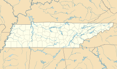
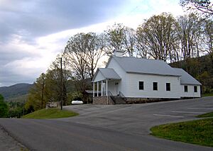
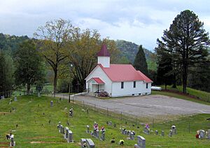
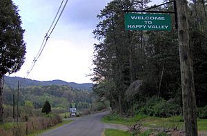
Happy Valley is a small community in Blount County, Tennessee. It's located close to the amazing Great Smoky Mountains National Park. Even though it's not an official town, about 529 people lived there in 2000. It uses the ZIP Code 37878.
Contents
Exploring Happy Valley's Location
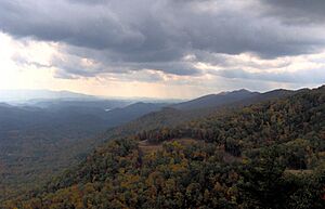
Happy Valley sits in a narrow valley with the same name. It's on the edge of the Great Smoky Mountains. To the north of Happy Valley is Chilhowee Mountain. This long ridge stretches for about 56 kilometers (35 miles). It lies between two rivers: the Little Tennessee River and the Little Pigeon River.
To the south, the valley is surrounded by lower ridges. These include Pine Mountain to the southwest and Hatcher Mountain to the southeast. They run almost parallel to Chilhowee Mountain. Cades Cove is located just south of Hatcher and Pine Mountain. Happy Valley Ridge forms the eastern side of the valley. It separates Happy Valley from Lake in the Sky and the community of Top of The World.
Abrams Creek starts in Cades Cove. It flows northwest through a gap between Pine Mountain and Hatcher Mountain. Before reaching Happy Valley, the creek turns southwest. It then flows for several more miles. Finally, it empties into Chilhowee Lake, which is part of the Little Tennessee River. Happy Valley has two main streams, Mill Creek and Bell Branch. Both of these flow into Abrams Creek.
Happy Valley Road is the main way to get into the area. This road connects U.S. Route 129 with the Look Rock section of Foothills Parkway. You can find the road right after the parkway ends along US-129.
A Look at Happy Valley's Past
Early Days and Explorers
It's believed that a Spanish explorer named Juan Pardo traveled through Happy Valley in October 1567. Pardo was trying to reach a village called Coosa in northern Georgia. He left a place called Chiaha on October 13. He marched southwest across the foothills of the Great Smokies. He crossed the Little River where Walland is today. Then he camped at what is now Lake in the Sky. From there, he continued through Happy Valley. His goal was to reach the village of Chalahume at the mouth of Abrams Creek.
In the 1700s, Happy Valley was likely part of a Cherokee trail system. These trails connected the Overhill towns along the Little Tennessee River. They also led to the Tuckaleechee Villages in modern Townsend. The trails also went to tribal hunting grounds in Cades Cove. The Overhill town of Chilhowee was across from the mouth of Abrams Creek. This town likely took the place of the Chalahume village that Pardo mentioned. Abrams Creek was named after Old Abraham of Chilhowee. He was an important Overhill chief in the 1780s.
How Happy Valley Was Settled
The first permanent European-American settler in Happy Valley was Robert Rhea. He arrived in the valley around 1823. Rhea had fought in the American Revolution and the War of 1812. He was looking for a peaceful place to live out his later years. For almost 40 years after Rhea arrived, Happy Valley was known as Rhea's Valley.
In the 1830s, a businessman from Cades Cove named Daniel Davis Foute built a road. This road connected his iron forge in Cades Cove to his resort hotel at Montvale Springs. The road was called the Cooper Road, named after its builder, Joe Cooper. It followed Abrams Creek from Cades Cove into Happy Valley. Then it crossed Chilhowee Mountain at Murray Gap, near Look Rock. From there, it went down to Montvale Springs. For many years, people from Cades Cove used this road. They drove cattle back and forth between markets in Maryville and the grassy areas on top of the western Smokies.
After the American Civil War (1861–1865), many settlers moved to Happy Valley. They came from Carter County, Tennessee. Around this time, the valley, which was known as Rhea Valley, got the name "Happy Valley." The name might have come from Happy Valley in Carter County. That was where many of these new settlers had lived before.
The National Park and Protecting the Area
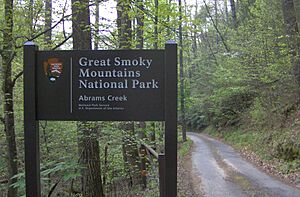
In 1926, groups that wanted to protect nature started buying land. Their goal was to create the Great Smoky Mountains National Park. The park officially opened in 1934. The park's boundary runs along the south side of Happy Valley. It includes all of Abrams Creek. Today, there's a campground and a ranger station where Kingfisher Creek and Abrams Creek meet. Some of the old roads, like the Cooper Road to Cades Cove, became hiking trails.
In 2006, a group called "Save Chilhowee Mountain" tried to stop a large housing project. They were worried that water runoff from the new homes would pollute Abrams Creek. This pollution could harm three types of fish that are in danger of disappearing. The construction company said they followed all the rules. They also said they got advice from environmental experts. The project was given initial approval by the Blount County Planning Commission in May 2006.
 | Kyle Baker |
 | Joseph Yoakum |
 | Laura Wheeler Waring |
 | Henry Ossawa Tanner |


