
Vonore, Tennessee facts for kids
Quick facts for kids
Vonore
|
||
|---|---|---|

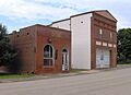
Community center and city hall in Vonore
|
||
|
||

Location of Vonore in Monroe County, Tennessee.
|
||
| Country | United States | |
| State | Tennessee | |
| County | Monroe and Blount County, Tennessee | |
| Established | 1890s | |
| Incorporated | 1965 | |
| Named for | Combination of von and ore | |
| Government | ||
| • Type | Mayor-aldermanic | |
| Area | ||
| • Total | 11.75 sq mi (30.44 km2) | |
| • Land | 8.81 sq mi (22.82 km2) | |
| • Water | 2.94 sq mi (7.61 km2) | |
| Elevation | 837 ft (255 m) | |
| Population
(2020)
|
||
| • Total | 1,574 | |
| • Density | 178.62/sq mi (68.97/km2) | |
| Time zone | UTC-5 (Eastern (EST)) | |
| • Summer (DST) | UTC-4 (EDT) | |
| ZIP code |
37885
|
|
| Area code(s) | 423 | |
| FIPS code | 47-77480 | |
| GNIS feature ID | 2406807 | |

Vonore is a town located in the southeastern part of Tennessee. It's mostly in Monroe County, but a small part is also in Blount County, Tennessee. In 2020, about 1,574 people lived here. You can find the town hall, library, and emergency services like the police and fire departments on Church Street.
Contents
History of Vonore
Vonore is built where the Little Tennessee River and the Tellico River meet. This area has been home to people for thousands of years. It was once a major center for many Cherokee towns.
Ancient Settlements and Cherokee Towns
This region is rich in ancient history. The Icehouse Bottom site, now underwater, was used by early people as far back as 7500 B.C. Another important site, Rose Island, was home to a large settlement around 1000 B.C. to 1000 A.D. Later, the Cherokee had a town there called Mialoquo.
Just south of modern Vonore was a big village called Toqua. This village was active from about 1000 to 1600 A.D. Some people think it might be "Tali," a village visited by Spanish explorer Hernando de Soto in 1540. The Cherokee also had a town at Toqua.
The area was part of the traditional lands of the Cherokee people. Before states like Tennessee existed, the Cherokee lived here. By the 1700s, they had many towns along the Little Tennessee River. These included Tanasi, which gave Tennessee its name, and Chota. Chota was a very important "mother town" for the Overhill Cherokee. English traders called these places "Overhill Towns" because they crossed the Appalachian Mountains to reach them.

A famous Cherokee chief named Dragging Canoe came from Mialoquo. This town was just north of where the US-411 bridge is today. Another important Cherokee town was Tuskegee. It was near Fort Loudoun. Sequoyah, who created the Cherokee writing system, was born in Tuskegee around 1770.
Fort Loudoun and the Tellico Blockhouse
In 1756, the British built Fort Loudoun. This fort was part of their plan to team up with the Cherokee during the French and Indian War. It was one of the first big British outposts west of the Appalachian Mountains. However, the Cherokee captured the fort in 1760 after a long siege. This was in response to South Carolina officials killing some Cherokee chiefs.
After the American Revolutionary War, the United States built the Tellico Blockhouse in 1794. This American outpost was across the Tellico River from Fort Loudoun. It helped keep peace between the Cherokee and new American settlers. The main American diplomat to the Cherokee worked here.
How Vonore Got Its Name
In 1819, the Cherokee signed the Calhoun Treaty. This agreement gave what is now Monroe County to the United States. The county was then created.
A ferry called Niles Ferry started in 1805. It helped people cross the Little Tennessee River on the Old Federal Road. This road was the path for what is now US-411. The ferry ran until 1947, when the US-411 bridge was finished.
In 1890, a railroad was built through Monroe County. A stop called Upton Station was created. Three years later, a local doctor named Walter Kennedy wanted to open a post office there. Since "Upton Station" was already taken, he chose "Vonore." This name combines the German word von (meaning "of") and the English word "ore." Dr. Kennedy thought the town would become a mining town.
Modern Development and Preservation
In the 1930s, during the Great Depression, Works Progress Administration (WPA) funds helped rebuild Fort Loudoun. This became a state historic park.
The older part of Vonore is along Depot and Hall streets. It has many historic houses, the library, and the town hall. A newer area with shops and businesses is along US-411.
In 1979, the Tennessee Valley Authority finished the Tellico Dam. This dam created Tellico Lake, flooding many old archaeological sites. Before the flooding, experts dug up and saved many artifacts from ancient sites. They also moved Fort Loudoun to higher ground.
Monuments were placed at the sites of important Cherokee towns like Tanasi and Chota. The Chota monument has eight plaques, one for each of the seven Cherokee clans and one for the nation. The foundation of the Tellico Blockhouse was also found. Its layout is now marked for visitors. Both the Tanasi and Tellico Blockhouse sites are part of Fort Loudoun State Park today.
Geography of Vonore
Vonore is located where Monroe and Blount Counties meet. It sits mainly on the southwest bank of the Little Tennessee River, where it joins the Tellico River. This area is now part of Tellico Lake, a lake created by the Tellico Dam. The Unicoi Mountains and Great Smoky Mountains are visible to the south.
The town covers about 11.75 square miles (30.44 square kilometers). About 8.81 square miles (22.82 square kilometers) is land, and 2.94 square miles (7.61 square kilometers) is water.
Major Roads and Routes
- U.S. Route 411 connects Vonore to Maryville to the northeast and Madisonville to the southwest.
- Tennessee State Route 72 links Vonore to Tellico Village, Loudon, and Interstate 75 to the north.
- Tennessee State Route 360 connects the town to Fort Loudoun State Park and the rural areas near the mountains to the south.
Population of Vonore
| Historical population | |||
|---|---|---|---|
| Census | Pop. | %± | |
| 1970 | 524 | — | |
| 1980 | 528 | 0.8% | |
| 1990 | 605 | 14.6% | |
| 2000 | 1,162 | 92.1% | |
| 2010 | 1,474 | 26.9% | |
| 2020 | 1,574 | 6.8% | |
| Sources: | |||
As of the 2020 United States census, there were 1,574 people living in Vonore. There were 715 households and 515 families. Most residents are White, making up about 92.38% of the population.
Fun Things to Do in Vonore
Vonore is located on Tellico Lake, which offers many fun activities. It's also home to two important historical sites:
- Fort Loudoun State Historic Park
- Tellico Blockhouse State Historic Site
The Sequoyah Birthplace Museum is also in Vonore. It honors Sequoyah, the Cherokee scholar who created the Cherokee writing system. He is one of the few people in history known to have created a writing system all by himself!
You can find several swimming areas along the lake, like Vonore Beach. Toqua Beach is just south of Fort Loudoun State Park. The Sequoyah Marina is a great place for boats, located off US-411.
Education in Vonore
Public schools in Vonore are part of the Monroe County School System.
- Vonore Elementary School serves students from kindergarten to 4th grade.
- Vonore Middle School teaches students from 5th to 8th grade.
Vonore High School joined with Madisonville High School in 1995 to form Sequoyah High School. This high school is located in Madisonville. After middle school, students can attend Sequoyah High School or other nearby schools.
Famous People from Vonore
- Charles McClung McGhee: A successful railroad businessman.
- Sequoyah: The Cherokee scholar who created the Cherokee writing system.
- Mike Stratton: A professional American football player.
Images for kids
-
Old bank building and Order of the Eastern Star lodge in Vonore
See also
 In Spanish: Vonore para niños
