
Unicoi Mountains facts for kids
Quick facts for kids Unicoi Mountains |
|
|---|---|

The Unicoi Mountains
|
|
| Highest point | |
| Peak | Huckleberry Knob |
| Elevation | 5,560 ft (1,690 m) |
| Geography | |

Appalachian Mountain system
|
|
| Country | United States |
| Parent range | Blue Ridge Mountains |
| Geology | |
| Orogeny | Alleghenian |
The Unicoi Mountains are a beautiful mountain range. They rise along the border between Tennessee and North Carolina in the southeastern United States. These mountains are part of the larger Blue Ridge Mountains, which are a section of the huge Appalachian Mountains. The Unicois are located just south of the famous Great Smoky Mountains.
Most of the Unicoi Mountains are protected as national forests. On the Tennessee side, it's the Cherokee National Forest. On the North Carolina side, it's the Nantahala National Forest. Some areas are even stricter "wilderness areas." This means they are kept very wild and natural.
The Unicoi Mountains are one of the most untouched places in the eastern United States. Not many people lived in the river valleys and deep hollows here. While some trees were cut down in the past, logging wasn't as widespread as in other forests nearby.
The Joyce Kilmer Memorial Forest is in the northeastern part of the Unicois. It has one of the last remaining old-growth forests in the eastern U.S. These are forests with very old, tall trees that have never been cut down. You can also find "balds" on top of the mountains. These are open, grassy areas or areas covered in thick shrubs. The highest peaks in the Unicois are over 5,000 feet tall. The Cherohala Skyway is a scenic road that crosses the top of the Unicoi Mountains. It connects Tellico Plains, Tennessee with Robbinsville, North Carolina.
The name "Unicoi" comes from the Cherokee word ᎤᏁᎦ (unega). This word means "white." It refers to the low clouds and fog that often cover these mountains. Another mountain name, Unaka, has the same Cherokee root. It is said to be linked to the white blooms of chestnut trees that used to be common in the spring.
Contents
Mountain Geography
The Unicoi Mountains stretch for about 37 miles (60 km) from north to south. They are about 60 miles (97 km) wide from west to east. The range covers more than 1,000 square miles (2,600 km²).
Many rivers and streams start high up in the Unicoi Mountains. The Tellico River begins on the slopes of McDaniel Bald. It flows northwest across the mountains and into the Little Tennessee River. Citico Creek is another tributary of the Little Tennessee River. It forms where two streams meet in a wild area called Jeffrey Hell.
The Bald River starts on Beaverdam Bald. It flows north through a beautiful gorge. Then it drops over a 90-foot (27 m) waterfall called Bald River Falls. Santeetlah Creek begins on the western side of Huckleberry Knob. It flows down to Santeetlah Lake. Little Santeetlah Creek drains the Joyce Kilmer Memorial Forest.
Tallest Peaks in the Unicois
The highest mountains in the Unicoi Range are over 5,000 feet (1,500 meters) tall. Most peaks are between 4,000 and 5,000 feet (1,200-1,500 m) along the main ridges. Peaks further east and west are usually between 3,000 and 4,000 feet (900-1,200 m).
Huckleberry Knob is the highest mountain in the Unicoi Range. It stands at 5,560 feet (1,695 m) tall. Other tall peaks include Bob Stratton Bald and Beaverdam Bald. The Benton MacKaye Trail, a long hiking path, crosses several peaks in the Unicois.
| Mountain | Elevation | General Area | Access |
|---|---|---|---|
| Huckleberry Knob | 5,560 ft/1,695 m | Central Unicois | Huckleberry Trail |
| Big Junction | 5,480 ft/1,670 m | Central Unicois | Cherohala Skyway |
| Haw Knob | 5,472 ft/1,668 m | Central Unicois | Benton MacKaye Trail |
| Hooper Bald | 5,429 ft/1,655 m | Central Unicois | Hooper Bald Trail |
| Stratton Bald | 5,360 ft/1,634 m | Joyce Kilmer-Slickrock Wilderness | Stratton Bald Trail (#54) |
| Bob Bald | 5,282 ft/1,610 m | Joyce Kilmer-Slickrock Wilderness | Stratton Bald Trail (#54) |
| Haoe | 5,249 ft/1,600 m | Joyce Kilmer-Slickrock Wilderness | Trail #53 |
| Johns Knob | 4,908 ft/1,496 m | Central Unicois | Benton MacKaye Trail |
| McDaniel Bald | 4,640 ft/1,414 m | Southeastern Unicois | |
| Rockstack | 4,420 ft/1,347 m | CCW/JKSW boundary | Benton MacKaye Trail |
| Big Fodderstack | 4,346 ft/1,325 m | CCW/JKSW boundary | Benton MacKaye Trail |
| Beaverdam Bald | 4,259 ft/1,298 m | Southern Unicois | Benton MacKaye Trail |
| Hemlock Knob | 4,019 ft/1,225 m | Citico Creek Wilderness | Cherohala Skyway |
| Cedar Top | 4,008 ft/1,222 m | Eastern Unicois | |
| Ikes Peak | 3,820 ft/1,164 m | Citico Creek Wilderness | |
| Salt Spring Mountain | 3,155 ft/962 m | Citico Creek Wilderness | |
| Starr Mountain | 2,340 ft/713 m | Etowah, Tennessee |
Nature in the Unicoi Mountains

The Unicoi Mountains are mostly made of very old rocks. These rocks formed over a billion years ago from ancient ocean deposits. The mountains themselves were created about 250 million years ago. This happened when two continents collided, pushing the rocks upward.
The Unicoi Mountains are covered by a forest of mixed hardwood and pine trees. Most of these are "second-growth" trees. This means they grew after the original forest was cut down. Forests in the lower areas near rivers have trees like yellow poplar, white oak, and hemlock. Higher up on the mountain slopes, you'll find white oak, red oak, hickory, and different types of pine trees.

Even though most trees are second-growth, the Unicoi Mountains have some rare old-growth forests. The Joyce Kilmer Memorial Forest has a large area of untouched forest. It contains some of the oldest and tallest trees in the Unicoi Range. The biggest trees there are over 150 feet (46 m) tall. Some are more than 400 years old. Other old-growth areas include a patch around Falls Branch Falls.
The areas under the trees on mountain slopes are often covered by thick bushes. These include rhododendron and mountain laurel. These thick areas are sometimes called "hells" because they are so hard to walk through. Jeffrey Hell is a great example of this.
Grassy balds are also common at higher elevations. These are open meadows with thick grass and only a few trees. The top of Huckleberry Knob, the highest mountain, is a grassy bald. Other grassy balds include Oak Knob, Hooper Bald, and Bob Bald.
History of the Unicoi Mountains
For many centuries, Native Americans used a path through the southern Unicoi Mountains. This path helped them travel across the southern Appalachian range. It was known as the Wachesa Trail.
By the late 1600s and early 1700s, the Cherokee people had many villages around the Unicoi Mountains. These included towns like Tallassee, Chilhowee, and Citico. Archeologists have found that Citico was a very old site. People lived there for thousands of years.
Early European Explorers

Spanish explorers were the first Europeans to see the Unicoi Mountains in the 1500s. In 1540, the Hernando de Soto expedition passed just west of the mountains. In 1567, the Juan Pardo expedition visited Cherokee villages in the Little Tennessee Valley. They were trying to find a route between Spanish settlements.
English explorers and traders likely used the Wachesa Trail in the late 1600s. The first recorded crossing was by Colonel George Chicken in 1725. He was a South Carolina official traveling to the Cherokee towns. He wanted their help against another tribe. In 1730, Sir Alexander Cuming, an English official, also traveled this trail. He wanted to gain the Cherokee's loyalty for England.
The 1800s in the Mountains

The Unicoi Turnpike was finished in 1816. It followed the old Wachesa Trail closely. But the Unicoi Mountains still had very few residents. The family of John Stratton settled in the area now called Stratton Meadows in the 1830s. His son, Robert "Bob" Stratton, later moved to the mountain that is now named after him, Stratton Bald. He lived in a meadow known as "Bob Bald." In 1864, during the American Civil War, he was killed there.
After the Civil War, the Denton family moved to Little Santeetlah Creek. They built a log cabin. Family stories say they lived in a hollowed-out giant American chestnut tree log while building their home. This log was over 6 feet (1.8 m) wide and housed their family of seven. The Denton family stayed until about 1900.
The 1900s and Today

Around 1911, George Gordon Moore tried to create a boar hunting reserve on Hooper Bald. He brought Russian blue boars from Europe. But most of the boars escaped. They now live wild in the Appalachian mountains. Forest officials consider them a problem because they cause erosion.
In 1915, the Babcock Lumber Company started large-scale logging in the northern Unicoi Mountains. They cut down trees in a huge area. This continued until 1922, when a dam project threatened their railroad tracks. In 1922, Babcock started logging on the Tennessee side. This stopped in 1925 when a big forest fire destroyed their logging tracks.
The logging practices of these companies greatly harmed the Unicoi Mountains' forests. In the 1930s, the U.S. Forest Service began buying the land. They decided to let nature heal the forest. This policy has helped the forest recover a lot.
In 1958, Sam Williams led a covered wagon train across the Unicoi Mountains. This event became annual. It promoted building a highway to connect the Tennessee and North Carolina sides of the Unicois. The highway, named "Cherohala Skyway," was completed in 1996. Its name combines "Cherokee" and "Nantahala."
Protected Areas in the Unicoi Mountains

Besides the Cherokee National Forest and Nantahala National Forest, several special areas protect parts of the Unicoi Mountains.
- The Joyce Kilmer-Slickrock Wilderness was made a wilderness area in 1975. It covers over 17,000 acres (70 km²). The Joyce Kilmer Memorial Forest within it has about 3,800 acres (15 km²) of old-growth forest. It is named after Joyce Kilmer, a poet who died in World War I.
- The Citico Creek Wilderness was named a wilderness area in 1984. It protects the upper part of Citico Creek and covers over 16,000 acres (66 km²).
- The Bald River Gorge Wilderness was also named a wilderness area in 1984. It covers over 3,700 acres (15 km²) and protects the Bald River.
- The Gee Creek Wilderness was designated in 1975. It covers about 2,500 acres (10 km²) and protects the Gee Creek area.
- The Upper Tellico Off-Road Vehicle Area was bought in 1980. This area had many old logging roads popular with 4x4 drivers. In 2009, the U.S. Forest Service decided to close it permanently. Studies showed that erosion from the trails was harming the river's trout.
Photo Gallery
-
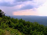
View from the Cherohala Skyway on the slopes of Hemlock Knob, looking southeast.
-
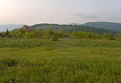
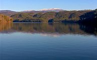
View from Huckleberry Knob, looking south
-
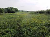
Hooper Bald
-
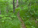
The Stratton Bald Trail (#54) approaching Stratton's summit
-
Salt Spring Mountain, viewed from US-129
-
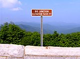
The Big Junction Overlook, near the summit of Big Junction


Resources
- Duncan, Barbara R. and Riggs, Brett H. Cherokee Heritage Trails Guidebook. University of North Carolina Press: Chapel Hill (2003). ISBN: 0-8078-5457-3
