Simms, Montana facts for kids
Quick facts for kids
Simms, Montana
|
|
|---|---|

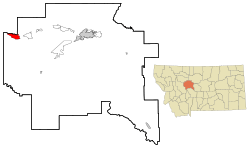
Location of Simms, Montana
|
|
| Country | United States |
| State | Montana |
| County | Cascade |
| Area | |
| • Total | 7.62 sq mi (19.73 km2) |
| • Land | 7.61 sq mi (19.71 km2) |
| • Water | 0.01 sq mi (0.02 km2) |
| Elevation | 3,570 ft (1,088 m) |
| Population
(2020)
|
|
| • Total | 361 |
| • Density | 47.43/sq mi (18.31/km2) |
| Time zone | UTC-7 (Mountain (MST)) |
| • Summer (DST) | UTC-6 (MDT) |
| ZIP code |
59477
|
| Area code(s) | 406 |
| FIPS code | 30-68575 |
| GNIS feature ID | 0776566 |
Simms is a small community in Montana, United States. It is known as a census-designated place (CDP). This means it's an area defined for counting people by the government. Simms is located in Cascade County.
In 2010, about 354 people lived in Simms. By 2020, the population grew slightly to 361 people. Simms is also part of the larger Great Falls, Montana area.
Contents
Exploring Simms: Location and Landscape
Simms is nestled in the Sun River valley. It is about 30 miles (48 km) west of Great Falls. The community is also near other towns like Choteau and Augusta.
The total area of Simms is about 7.7 square miles (19.9 square kilometers). Most of this area is land, with only a tiny bit of water.
Simms' Climate: A Semi-Arid Region
Simms has a semi-arid climate. This type of climate means it gets more rain than a desert but less than a humid area. It's often dry with hot summers and cold winters.
Simms' Past: A Look at Its History
The town of Simms is surrounded by natural landforms called buttes and benches. It was built in a low spot in the Sun River valley. This location was perfect for creating an irrigation system.
In 1902, President Theodore Roosevelt signed the Reclamation Act. This law helped start water projects across the country. In 1906, the Sun River Irrigation Project began in this area.
The town of Simms covers about 160 acres (0.65 square kilometers). It was named after Simms Creek. This creek flows into the Sun River about 1 mile (1.6 km) west of the town. The creek itself was named after two brothers who used to cut wood along the Sun River.
After the irrigation project started, Simms became an important area for growing grain and hay. Simms is an unincorporated community, which means it's not a separate city but part of Cascade County.
Simms' People: Understanding Demographics
| Historical population | |||
|---|---|---|---|
| Census | Pop. | %± | |
| 2020 | 361 | — | |
| U.S. Decennial Census | |||
In 2000, there were 373 people living in Simms. These people lived in 148 households, with 103 of them being families. The population density was about 48.5 people per square mile (18.7 people per square kilometer).
Most people in Simms identified as White. There were also people who identified as Native American, Asian, or from other racial backgrounds. Some residents also identified as Hispanic or Latino.
About 25.7% of households had children under 18 living with them. Many households (61.5%) were married couples living together. The average household had 2.52 people, and the average family had 3.06 people.
The population's age was spread out. About 27.1% were under 18 years old. The median age was 44 years. This means half the people were younger than 44 and half were older.
Learning in Simms: Education Opportunities
Simms has local schools for students.
Schools in Simms
- Sun River Middle/Simms High School
See also
 In Spanish: Simms (Montana) para niños
 | James B. Knighten |
 | Azellia White |
 | Willa Brown |

