Sun River facts for kids
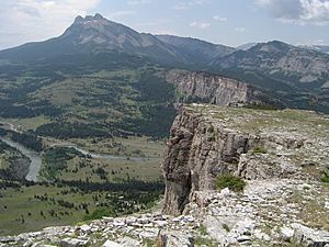
The Sun River (also known as the Medicine River) is a river in Montana, United States. It's a branch, or tributary, of the Missouri River and is about 130 miles (209 km) long. The river starts high up in the Rocky Mountains from two main streams: the North Fork and the South Fork. These two streams join together near Gibson Reservoir.
The Sun River flows east and southeast, passing by towns like Simms, Sun River, and Vaughn. It finally joins the Missouri River in the city of Great Falls.
Quick facts for kids Sun River |
|
|---|---|

The headwaters of the Sun River in the Rockies, near Gibson Reservoir
|
|
|
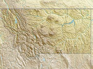
Location of the mouth of the Sun River in Montana
|
|
| Other name(s) | Medicine River, Pointed Rock River |
| Country | United States |
| State | Montana |
| Cities | Fairfield, Sun River, Vaughn, Great Falls |
| Physical characteristics | |
| Main source | North Fork Sun River Confluence of Open Creek and McDonald Creek, Lewis and Clark County 5,781 ft (1,762 m) 47°54′43″N 112°58′23″W / 47.91194°N 112.97306°W |
| 2nd source | South Fork Sun River Sun Lake, Lewis and Clark County 6,988 ft (2,130 m) 47°20′07″N 112°53′29″W / 47.33528°N 112.89139°W |
| River mouth | Missouri River Great Falls, Cascade County 3,314 ft (1,010 m) 47°29′42″N 111°18′43″W / 47.49500°N 111.31194°W |
| Length | 130 mi (210 km) |
| Basin features | |
| River system | Missouri River watershed |
| Basin size | 1,875 sq mi (4,860 km2) |
| Tributaries |
|
Contents
How the Sun River is Used
The Sun River is very important for watering farms in the area. This process is called irrigation. A special project called the Sun River Project helps to manage the water for this purpose. It helps water about 92,000 acres (372 square kilometers) of farmland.
The North and South Forks
The North Fork of the Sun River starts in the Bob Marshall Wilderness. It flows south for about 20 miles (32 km) until it meets the South Fork. Soon after they join, both forks flow into Gibson Reservoir, which is a lake created by Gibson Dam. From the dam, the water continues as the Sun River until it reaches the Missouri River.
The Sun River is also a "Class I river" from Gibson Dam to where it meets the Missouri River. This means people can use it for fun activities like fishing or boating.
River Flow Measurements
The amount of water flowing in the Sun River and its forks changes. Here's how much water flows at different points:
| River | Location | Water Flow |
|---|---|---|
| North Fork Sun River | Augusta, MT | 350 cu ft/s (9.9 m3/s) |
| South Fork Sun River | Augusta, MT | 360 cu ft/s (10 m3/s) |
| Sun River | Fort Shaw, MT | 929 cu ft/s (26.3 m3/s) |
History of the Sun River
The Sun River has a rich history, especially with Native American tribes and early explorers.
Native American Name
Native Americans called this river "The Medicine River." This name shows how important the river was to them.
Lewis and Clark Expedition
In 1806, Captain Meriwether Lewis, part of the famous Lewis and Clark Expedition, explored this river. He followed it down to the Missouri River. On July 11, 1806, he wrote in his journal about seeing many buffalo near the river. He believed there were at least 10,000 buffalo in a small area!
The city of Great Falls now covers part of the land where the Lewis and Clark Expedition had to carry their boats and supplies around the big waterfalls of the Missouri River in 1805. This difficult journey was called a portage.
 | Shirley Ann Jackson |
 | Garett Morgan |
 | J. Ernest Wilkins Jr. |
 | Elijah McCoy |


