
Slaughterville, Oklahoma facts for kids
Quick facts for kids
Slaughterville, Oklahoma
|
|
|---|---|
| Motto(s):
"Dedicated to Country Living"
|
|

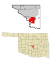
Location of Slaughterville in Cleveland County and Oklahoma
|
|
| Country | United States |
| State | Oklahoma |
| County | Cleveland |
| Area | |
| • Total | 39.00 sq mi (101.01 km2) |
| • Land | 38.63 sq mi (100.05 km2) |
| • Water | 0.37 sq mi (0.96 km2) |
| Elevation | 1,171 ft (357 m) |
| Population
(2020)
|
|
| • Total | 4,163 |
| • Density | 107.76/sq mi (41.61/km2) |
| Time zone | UTC-6 (Central (CST)) |
| • Summer (DST) | UTC-5 (CDT) |
| FIPS code | 40-67950 |
| GNIS feature ID | 2413296 |
Slaughterville is a town in Cleveland County, Oklahoma, United States. It is part of the larger Oklahoma City metropolitan area. In 2020, the town had a population of 4,163 people. This was a small increase of 0.6% since 2010.
Most homes in Slaughterville are on large plots of land. This helps the town keep its rural, country feel. Much of the area has trees and natural beauty. Residents and visitors enjoy the outdoor scenery.
Contents
History of Slaughterville
Slaughterville got its name from a grocery store. This store was run by a person named James Slaughter in the early 1900s.
How the Town Started
The area where Slaughterville is located was once called the Unassigned Lands. This was part of Indian Territory. In 1889, the land was opened for people to settle during the Land Run of 1889. The very first building in the area was built that same year.
Slaughterville did not officially become a town until 1970. The people decided to incorporate to avoid being taken over by nearby cities. These cities included Norman, Noble, or Lexington.
Town Size Changes
When Slaughterville first became a town, it covered about 27 square miles (70 square kilometers). In the 1980s, the town gave up about 40% of its land. However, it later added more land. By the year 2000, Slaughterville had grown to an area of about 38.108 square miles (98.70 square kilometers).
The Name Controversy
In 2004, the town's name caused some discussion. A group called People for the Ethical Treatment of Animals (PETA) asked Slaughterville to change its name. They suggested "Veggieville" instead. PETA even offered to donate $20,000 worth of veggie burgers as a reward.
The town council of Slaughterville listened to ideas from PETA members. They also heard from local citizens. After thinking about it, the council voted against changing the town's name.
Geography of Slaughterville
Slaughterville is located in the southern part of Cleveland County. To the north, it shares a border with the city of Norman. To the northwest, it borders Noble.
Part of the town's western edge touches the Canadian River. Across this river is McClain County.
Roads and Travel
U.S. Route 77 goes through Slaughterville. This road leads north about 33 miles (53 km) to the center of Oklahoma City. It also goes south about 6 miles (10 km) to Purcell.
Land and Water Area
According to the United States Census Bureau, Slaughterville covers a total area of about 38.46 square miles (99.6 square kilometers). Most of this area, about 38.11 square miles (98.7 square kilometers), is land. The remaining 0.35 square miles (0.9 square kilometers), or 0.91%, is water.
Population and People
| Historical population | |||
|---|---|---|---|
| Census | Pop. | %± | |
| 1980 | 1,953 | — | |
| 1990 | 1,843 | −5.6% | |
| 2000 | 3,609 | 95.8% | |
| 2010 | 4,137 | 14.6% | |
| 2020 | 4,163 | 0.6% | |
| U.S. Decennial Census | |||
In 2015, Slaughterville had 4,217 people living there. There were 1,431 households, which are groups of people living together. Out of these, 1,119 were families. The town had about 110.7 people per square mile (42.7 per square kilometer). There were 1,614 housing units, like houses or apartments.
Diversity of Residents
The people in Slaughterville came from different backgrounds:
- 86.1% were White.
- 6.6% were Native American.
- 7.2% were from two or more races.
- About 2.2% of the population identified as Hispanic or Latino.
Households and Families
Out of the 1,431 households:
- 35.6% had children under 18 living with them.
- 62.2% were married couples living together.
- 13.1% had a female head of household with no husband present.
- 21.8% were not families.
- 14.7% of all households were made up of single individuals.
- 4.0% had someone living alone who was 65 years old or older.
The average household had 2.95 people. The average family had 3.33 people.
Age Groups
The population was spread out across different age groups:
- 28.5% were under 18 years old.
- 9.1% were from 18 to 24 years old.
- 19.9% were from 25 to 44 years old.
- 30.0% were from 45 to 64 years old.
- 12.5% were 65 years old or older.
The median age in the town was 39 years. This means half the people were younger than 39 and half were older. For every 100 females, there were about 85.2 males.
Income Information
The median income for a household in Slaughterville was $50,982. For a family, the median income was $55,023. The per capita income for the town was $20,011. This is the average income per person.
About 7.4% of families and 11.4% of the total population lived below the poverty line. This included 15.3% of those under 18 years old. It also included 3.4% of those 65 years old or older.
Images for kids
-
Location of Slaughterville in Cleveland County and Oklahoma
See also
 In Spanish: Slaughterville (Oklahoma) para niños
