Sleaford Bay facts for kids
Quick facts for kids Sleaford Bay |
|
|---|---|

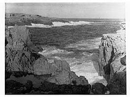
Sleaford Bay, ca 1935
|
|
| Location | Eyre Peninsula, South Australia |
| Coordinates | 34°53′54″S 135°46′02″E / 34.898337°S 135.76709°E |
| Type | Bay |
| Native name | Kuya Bidni Tannanna Error {{native name checker}}: parameter value is malformed (help) |
| Etymology | Sleaford, Lincolnshire |
| Basin countries | Australia |
| Designation | Marine park |
| Max. length | about 16 kilometres (9.9 mi) |
| Max. width | about 9 kilometres (5.6 mi) |
| Max. depth | about 53 metres (174 ft) |
| Islands | one |
| Settlements | Sleaford Lincoln National Park |
Sleaford Bay is a beautiful bay located in South Australia. You can find it on the southern coast of the Eyre Peninsula. This bay was named by a British explorer, Matthew Flinders, way back in 1802.
Discovering Sleaford Bay
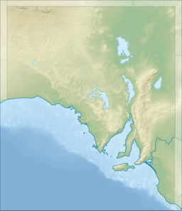
Sleaford Bay is found on the south coast of the Eyre Peninsula. It's about 21 kilometers (about 13 miles) southwest of a town called Port Lincoln.
The bay stretches between two important points of land. To the west, you'll find Cape Wiles. To the east, there's Cape Tournefort. Inside Sleaford Bay, there's also a smaller bay called Fishery Bay. It's located on the western side, a short distance north of Cape Wiles.
The Story Behind the Name
The bay got its name from a town in England called Sleaford, which is in Lincolnshire. The British explorer Matthew Flinders gave it this name in 1802.
Local Aboriginal people had their own names for the bay. The Nauo people called it Kuya Bidni. Another group, possibly the Pankala people, knew it as Tannanna.
Later, a French expedition led by Nicolas Baudin visited the bay. Baudin called it Anse des Nerlans. After Baudin passed away, his team members, Peron and Louis de Freycinet, changed the name to Baie Lavoisier.
From 1839 to 1841, a whaling station operated along the coast within Fishery Bay.
Living Near the Bay
The land around Sleaford Bay is home to two main areas. The western part of the coastline is the town of Sleaford. The eastern part is covered by the Lincoln National Park.
There's a boat ramp in Fishery Bay. This is a place where boats can be launched into the water.
Future Water Plans
In 2018, there was a plan to build a special plant at Sleaford Bay. This plant would turn seawater into fresh drinking water. It would be able to make 3 billion liters of water each year! Land for this project was bought in July, and it was expected to cost about $80 million. This location was one of several places that SA Water had considered for a water plant back in 2009.
Protecting the Bay
Sleaford Bay is an important natural area, so it has special protection. The entire bay is part of the Thorny Passage Marine Park. This park helps protect the ocean and the animals that live there. Also, the Lincoln National Park stretches right up to the water's edge on the eastern side of the bay.
 | Tommie Smith |
 | Simone Manuel |
 | Shani Davis |
 | Simone Biles |
 | Alice Coachman |


