Lincoln National Park facts for kids
Quick facts for kids Lincoln National ParkSouth Australia |
|
|---|---|
|
IUCN Category II (National Park)
|
|
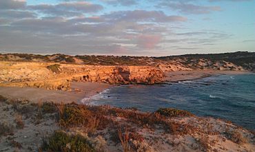
Limestone cliffs at Wanna
|
|
| Nearest town or city | Port Lincoln |
| Established | 28 August 1941 |
| Area | 216.38 km2 (83.5 sq mi) |
| Managing authorities | Department for Environment and Water |
| Website | Lincoln National Park |
| See also | Protected areas of South Australia |
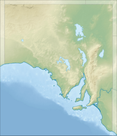
Lincoln National Park is a special protected area in South Australia. It's about 249 kilometers (155 miles) west of Adelaide, the state capital. The park is also just 9.5 kilometers (6 miles) south of Port Lincoln. It includes a large area on the Jussieu Peninsula and several islands nearby. This national park is important for its nature, Aboriginal history, and early European stories.
Contents
About Lincoln National Park
Lincoln National Park is found on the Jussieu Peninsula. This peninsula is at the very end of the Eyre Peninsula in South Australia. The park also includes some land on the main Eyre Peninsula and many islands along the coast. The parts of the park on Jussieu Peninsula are within areas called Lincoln National Park and Sleaford.
Jussieu Peninsula: Land and Coastline
Lincoln National Park covers most of the Jussieu Peninsula. The rest of the peninsula is a very wild and protected area called the Memory Cove Wilderness Protection Area. You can enter the national park by road from the west. This is where the peninsula connects to the mainland. The Sleaford Mere Conservation Park is next to the western edge of the national park.
You can drive into the park from both the north and south sides of this connecting land. The road on the south side is only for 4WD vehicles.
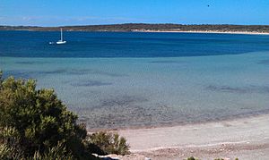
The northern coast of the peninsula curves towards Cape Donington. Here, you'll find the Cape Donington Lighthouse. This cape marks the southern entrance to Port Lincoln, a large and safe harbor where the city of Port Lincoln is located. The eastern coast of the park faces Spencer Gulf. It stretches from Cape Donington down to Taylor's Landing.
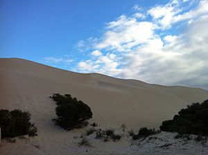
The southern edge of the park curves from Mary Ellis Wreck Beach in the west to Jussieu Bay in the east. The coastline changes a lot. You'll see huge sand dunes behind Sleaford Bay. There are also tall limestone cliffs on the east side of Jussieu Bay. The sea in this area can be very rough, with strong rips that can be dangerous.
Islands of the Park
Lincoln National Park also protects several islands located in the waters around the Jussieu Peninsula. These islands are:
- Bicker Isles and Horse Rock, found in the waters of Port Lincoln.
- Rabbit Island (in Louth Bay), Donington Island, Carcase Rock, an unnamed island in Shag Cove, Owen Island, and a small unnamed island south of Taylor Island in Spencer Gulf.
- Curta Rocks, Liguanea Island, and Albatross Island (just south of Thistle Island) in the Great Australian Bight.
Park Protection Level
Lincoln National Park is known as an IUCN Category II protected area. This means it's a very important place for nature. It's protected to keep its wild plants and animals safe for everyone to enjoy.
Park History
The land that is now Lincoln National Park has been protected for a long time.
On August 28, 1941, some land was set aside as a Flora and Fauna Reserve. This was done under a law called the Crown Lands Act 1929. This law helped protect plants and animals.
Later, on November 9, 1967, more land was added. It was officially named Lincoln National Park under the National Parks Act 1966.
On April 27, 1972, the park was updated under a new law, the National Parks and Wildlife Act 1972. This law added more islands and land to the park.
Between 1972 and 1992, the park grew even bigger. More land was added at Stamford Hill, Cape Donington, and Wanna. Many islands along the Jussieu Peninsula coast also became part of the park. In June 1999, the park's boundary was extended down to the low tide mark.
In 2004, a small part of the park around Memory Cove was separated. This area, along with some islands like Hopkins and Lewis, became the Memory Cove Wilderness Protection Area. This new area is even more strictly protected.
Past Uses of the Land
Aboriginal Use
The Aboriginal tribes of Barngala and Nauo were the first people to live in this region. They lived here for thousands of years. Scientists have found old sites in the park. These sites show where they worked with stone and where they left piles of shells from their meals, called middens.
European Discovery
European explorers first visited the Jussieu Peninsula and nearby islands in 1802. The British navigator, Matthew Flinders, explored the area first. Later that same year, the Baudin expedition to Australia also visited.
A stone monument called the Flinders Monument was built at Stamford Hill in 1844. Sir John Franklin dedicated it to Matthew Flinders. This monument is now a protected heritage site in South Australia.
Early European Settlement
After Flinders explored the area, a few Europeans started to settle here. Most settled near Cape Donington. The first grain crop was planted there in 1875. Other early jobs included cutting wood, grazing animals, and mining guano (bird droppings used as fertilizer).
Donington cottage is a building from that time that you can still visit today. The Cape Donington Lighthouse was built in 1905. It's a tall, concrete tower, 32 meters (105 feet) high, and it still works today.
On April 5, 1907, a small ship called the Mary Ellis was traveling from Port Adelaide to Venus Bay. It got caught in a big storm and was wrecked on a beach. This beach is now called Mary Ellis Wreck Beach. Even though the ship was completely destroyed, everyone on board survived.
Flora and Fauna
Flora: Plants of the Park
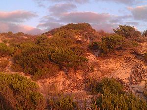
The national park is mostly covered by coastal mallee eucalypts. These are a type of eucalyptus tree that grows in a shrubby way. They often grow around granite rocks. The sand dunes on the southern coast have smaller shrubs.
Fauna: Animals of the Park
The national park is home to many animals and birds. Some live here all year, while others visit during certain seasons. You can often see kangaroos, wallabies, and emus in the park.
Feral foxes used to be common in the park. They were a danger to many native animals. But after a big effort to reduce their numbers, there are now far fewer foxes. Because of this, animals like goannas and bush stone curlews are increasing in number. Brush-tailed bettongs and malleefowl have also been brought back to the park. They are now becoming more common.
Migratory birds like stints and sandpipers spend their summers in the national park. They travel here from far away places like the Arctic Circle and Siberia.
You might also see Southern right whales in the water around the park. They migrate through the area between July and November. Australian sea lions can often be spotted resting on rocks and small islands off the coast.
Visitor Attractions and Services
Lincoln National Park offers many fun activities for visitors. These include bushwalking, four-wheel driving, camping, snorkeling, scuba diving, swimming, and fishing.
Walking Trails
As of 2010, there were 19 bushwalking trails in the park. These trails cover over 100 kilometers (62 miles)! The park's trails are also part of a bigger walking path called the Investigator Trail. This trail goes beyond the park to places like North Shields, Tulka, and Port Lincoln.
Four-wheel Drive Tracks
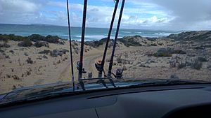
Many parts of the national park can only be reached by four-wheel drive vehicles. This includes the exciting sand dune track from Sleaford to Wanna.
Accommodation
If you want to stay overnight, there's one building available at Spalding Cove. There are also four official camping grounds: Fisherman's Point, September Beach, Surfleet Cove, and Taylor's Landing. Additionally, there are eight simpler camping spots without services.
See also
 In Spanish: Parque nacional Lincoln para niños
 | Roy Wilkins |
 | John Lewis |
 | Linda Carol Brown |


