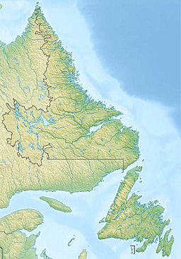
Smallwood Reservoir facts for kids
Quick facts for kids Smallwood Reservoir |
|
|---|---|
| Location | Labrador, Newfoundland and Labrador, Canada |
| Coordinates | 54°6′N 64°25′W / 54.100°N 64.417°W |
| Type | Reservoir |
| Primary outflows | Churchill River |
| Basin countries | Canada |
| Surface area | 6,527 km2 (2,520 sq mi) |
| Water volume | 32.64 km3 (26,460,000 acre⋅ft) |
| Surface elevation | 471 m (1,545 ft) |
The Smallwood Reservoir is a huge man-made lake in Labrador, Canada. It was built to help power the Churchill Falls Generating Station. Unlike many lakes, it's not held by one big dam. Instead, 88 smaller walls called dikes keep the water in. These dikes stretch for about 64 km (40 mi) along the Churchill River.
The reservoir is named after Joey Smallwood. He was the first leader, or Premier, of Newfoundland. With an area of 6,527 km2 (2,520 sq mi), it's the largest freshwater body in its province. It's also the second-largest reservoir in the world by its surface area.
Contents
Building the Smallwood Reservoir
Early Ideas for Power
People first thought about using the water power here in 1942. A company called H.G. Acres Company studied the area for the Aluminum Company of Canada. But back then, the location was very far away. Building a power station seemed too expensive and not possible.
How the Project Started
Later, new ways to send electricity over long distances were invented. This made the project possible. In July 1967, work began on the power station. This included building the main dam, control structures, and many dikes. This huge project was part of building the Churchill Falls Generating Station.
Where the Reservoir Is Located
The Smallwood Reservoir sits on the Labrador Plateau. This plateau is shaped like a saucer. It is about 457 to 579 m (1,499 to 1,900 ft) above sea level. Before the reservoir was built, this area had many wet, spongy lands called bogs. It also had many small lakes connected to each other.
The three biggest lakes were Ossokmanuan, Lobstick, and Michikamau. Ossokmanuan Lake became a reservoir for another power station called Twin Falls. The Churchill River drained most of this land.
The Churchill River's Journey
At the edge of the plateau, the Churchill River dropped 66 m (217 ft). Then, it dropped another 75 m (246 ft) at the main falls. After that, it fell another 158 m (518 ft) through the Bowdoin Canyon. This canyon was named after Bowdoin College in Maine. The college helped fund a trip to see the falls in 1891.
How the Reservoir Was Built
The reservoir needed 88 dikes to stop water from flowing out. The tallest dike is 36 m (118 ft) high. The longest dike is 6 km (3.7 mi) long.
Controlling Water Flow
The two main reservoirs use three special structures to control the water flow:
- The Gabbro Control Structure manages the Ossokmanuan reservoir.
- The Lobstick Control Structure manages the Smallwood Reservoir.
- The Whitefish Control Structure manages the forebay reservoirs.
These forebays also have spillways. Spillways are like overflow channels that prevent flooding.
Project Timeline
The whole project took 9 years to finish, from 1966 to 1974. At its busiest in 1970, 6,245 workers were on site. They lived in a main camp and eleven smaller camps. The project was actually finished five months earlier than planned!
See also
 In Spanish: Embalse de Smallwood para niños
 | Percy Lavon Julian |
 | Katherine Johnson |
 | George Washington Carver |
 | Annie Easley |


