Smith Mountain Lake facts for kids
Quick facts for kids Smith Mountain Lake |
|
|---|---|
 |
|
| Location | Bedford, Franklin, and Pittsylvania counties, Virginia |
| Coordinates | 37°03′26″N 79°35′47″W / 37.05722°N 79.59639°W |
| Type | Reservoir |
| Primary inflows |
|
| Primary outflows | Roanoke River |
| Basin countries | United States |
| Surface area | 32 sq mi (83 km2) |
| Average depth | 55 ft (17 m) |
| Max. depth | 250 ft (76 m) |
| Water volume | 2.8 km3 (2,300,000 acre⋅ft) |
| Shore length1 | 500 mi (800 km) |
| Surface elevation | 795 ft (242 m) |
| 1 Shore length is not a well-defined measure. | |
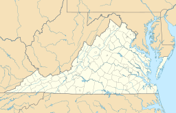
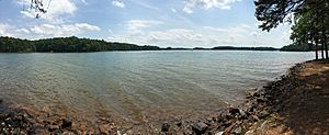
Smith Mountain Lake is a very large reservoir (an artificial lake) in the Roanoke Region of Virginia. It is located southeast of the City of Roanoke and southwest of Lynchburg. This lake was made in 1963 when the Smith Mountain Dam was built across the Roanoke River.
Most of the southern part of the lake is in Franklin County. A smaller part, including the dam itself, is in Pittsylvania County. The northern half of the lake is in Bedford County, with the Roanoke River acting as a dividing line. Smith Mountain Lake is a popular place for fun activities and has grown a lot in recent years. It is the biggest lake completely inside the state of Virginia.
Contents
History of Smith Mountain Lake
People first thought about building a dam on the Roanoke River and Blackwater River at Smith Mountain gorge in the late 1920s. The main idea was to create electricity. Building the Smith Mountain Dam started in 1960 and was finished in 1963. The lake filled up to its normal water level by March 1966.
The lake covers about 20,600 acres (83 km2) of land. It has over 500 miles (800 km) of shoreline, which is like the edge of the lake. The northern shore of the lake is entirely within Bedford County.
A historic place called the Gwin Dudley Home Site is located near the lake shore in Wirtz, Virginia. It was added to the National Register of Historic Places in 2008.
How the Lake Area Developed Over Time
For many years, through the 1960s and 1970s, the area around Smith Mountain Lake was mostly farms, especially tobacco farms. Marinas, which are places where boats are kept and rented, were the main way people could get to the lake. The first homes built around the lake were often small trailer parks or simple houses.
However, since the mid-1980s, more and more homes have been built. These new homes are often large houses right on the lake, or fancy apartments (condominiums). Some communities even have their own golf courses. Many people who work in Roanoke and Lynchburg have moved here. Also, many people who have retired, especially from the Northeast, have chosen to live by the lake.
By the late 1990s, with more people and more money in the area, new shops and businesses started to appear near the lake. Today, most new buildings along the shoreline are homes. Because of new rules and rising land prices, it has become harder for the public to access the lake. Some marinas that used to be open to everyone are now being sold for homes.
Only one main highway, State Route 122, crosses the lake. Other roads like State Route 24, State Route 116, and State Route 40 are nearby.
Who Manages the Lake's Power Plant?
American Electric Power (AEP) is a company that has a special permission, called a license, to run the Smith Mountain Project. This license is given by the Federal Energy Regulatory Commission (FERC), which is a government agency. The first license lasted for 50 years.
In 1998, AEP started the process to get a new license. To do this, they had to study many things to figure out how to manage the lake and its surroundings for the next license period. In December 2009, the FERC gave Appalachian Power (which is part of AEP) a new license to operate the power plant. This new license lasts for 30 years. It also includes plans for how to manage fun activities and protect the environment around the lake.
Protecting the Lake's Shoreline
In 1998, the FERC asked AEP to create a plan for managing the shoreline. This plan is called the Shoreline Management Plan (SMP). It sets rules for building and developing any property that is within the "project boundary" of the lake. This means the SMP rules are very important, even more than some local building rules.
AEP is the group that gives out permits (permissions) for building near the shoreline. If someone wants to build something different from the rules, their request is looked at by state and federal groups, like the Virginia Department of Game and Inland Fisheries.
Geography of Smith Mountain Lake
The Smith Mountain Lake area is in a wide valley. It is surrounded by the Blue Ridge Mountains in a rural part of south-central Virginia. Before the lake was made, farming and cutting down trees were the main jobs here.
Some of the communities near the lake include Moneta, Huddleston, Union Hall, White House, Penhook, and Goodview. The Booker T. Washington National Monument, a historic site, is located near the western end of the lake.
The water level of the lake usually changes by about one to two feet (0.3 to 0.6 m) during the day and night. This happens as water flows through the dam to make electricity and is sometimes pumped back. The highest normal level for the lake is 795 feet (242 m) above sea level. The usual level is about 794.2 feet (242.1 m). During times of long dry weather, the lake level can be much lower. For example, from 2001 to 2003, the lake was sometimes about six feet (1.8 m) below its normal level because there wasn't enough rain for five years.
Fun Activities and Public Access at the Lake
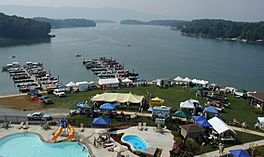
Smith Mountain Lake is a very popular place for people to have fun. Many activities happen here, like boating, water skiing, wakeboarding, riding personal watercraft (like jet skis), and sailing. Fishing is also very popular, especially for striped bass. The lake has even hosted big professional fishing competitions.
Smith Mountain Lake State Park opened in 1983. It has a beach and a special area for swimming. If you prefer land activities, there are four golf courses nearby.
Most people get to the lake through private properties. However, about a dozen private marinas offer different ways for the public to access the lake. Some of these might charge a fee, while others are free. (Some have recently become private homes instead of public access points).
There are also public places to get to the lake:
- The state park (on the Bedford County side) charges a fee.
- The Smith Mountain Community Park (on the Franklin County side) is free.
- There are also six government-managed boat launching ramps where you can put your boat in the water.
 | Bessie Coleman |
 | Spann Watson |
 | Jill E. Brown |
 | Sherman W. White |


