Smith Point County Park facts for kids
Quick facts for kids Smith Point County Park |
|
|---|---|

The Pavilion (a.k.a. Beach Hut) at Smith Point County Park, New York
|
|
| Location | Fire Island, New York |
| Operated by | Suffolk County, New York |
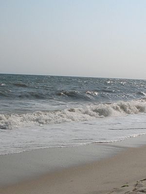
Smith Point County Park is a fun beach park facing the Atlantic Ocean. It's located on the eastern part of Fire Island, which is a long, thin island off the coast of Long Island in New York. This park is the biggest one owned by Suffolk County.
The park gets its name from Smith Point, a piece of land on the mainland that reaches into Bellport Bay. This land was named after William "Tangier" Smith. Back in the 1600s, he owned about 50 kilometers (30 miles) of ocean-front land in an area called the Manor St. George. The park itself does not own the Smith Point peninsula.
Contents
Exploring Smith Point Park
Smith Point Park is on Fire Island, which is a natural barrier island. It's a great spot for people who love sports, surfing, and just enjoying the beach. This park is very popular, with its white sands, ocean waves, and a nearby camping area. Many people from Suffolk County and tourists visit every summer.
Camping and Beach Fun
If you want to camp here, you need to make a reservation for a spot. All camping spots have water, and many also have electricity and sewer hookups. You can also camp on the "outer beach" (closer to the ocean) if you have a special permit and if beach conditions are safe. These spots are given out first-come, first-served.
A skilled team of lifeguards works at Smith Point, keeping everyone safe in the ocean. If you have a permit, you can drive off-road vehicles on the western part of the outer beach. It's important to always stay away from the fences that protect the nests of endangered shorebirds on the ocean and bay beaches.
The park often has special events during the summer months, which makes it even more exciting to visit!
Getting to the Park
You can get to the beach and the rest of the park using William Floyd Parkway. This road crosses Narrow Bay on the Smith Point Bridge. At the end of the parkway, there are large parking areas with tunnels that lead you right to the seashore.
There's also a special jeep road (you need a permit to use it) that goes to the end of the island. This road, along with the main road along the beach (Suffolk CR 75), was originally planned to be part of a bigger road called the Ocean Parkway Extension.
Nature and Wilderness
The park stretches from the eastern part of the Fire Island National Seashore Wilderness to a piece of land owned by the Town of Brookhaven. This area is a great place to start exploring the Fire Island National Seashore and its wild areas. A favorite activity is to walk a mile or so behind the sand dunes on a path called Burma Road, and then walk back along the ocean side. This old road leads to a spot called Old Inlet.
As you walk, you might see deer, pick beach plums (if it's the right season), listen to birds, and explore small pine tree areas.
The Fire Island Wilderness Visitor Center is located at the very end of William Floyd Parkway, right next to Smith Point County Park. This center is the eastern entrance to the Otis Pike Fire Island High Dune Wilderness. This wilderness area is the only one of its kind that is protected by the federal government in New York State.
Remembering TWA Flight 800

On July 17, 1996, TWA Flight 800, a large Boeing 747 airplane, crashed into the sea about 14 miles (22 kilometers) from the park. Sadly, everyone on board was lost.
A special place called the TWA Flight 800 International Memorial was built near the park's main building. It was opened on July 14, 2004. Families of those who were lost raised money to build this memorial. The memorial has beautiful gardens and flags from the 13 countries where the victims came from.
The memorial is made of curved black granite. On one side, it has the names of those who were lost. On the other side, there's a picture of a wave with 230 seagulls flying into the sky. In July 2006, a 10-foot (3-meter) tall lighthouse made of black granite was added. This lighthouse sits above a special tomb that holds some personal items of the victims.
Smith Point Park and Hurricane Sandy
In October 2012, a very strong storm called Hurricane Sandy brought high tides and storm surges. These powerful waves created several new openings, called inlets, in the land near Smith Point County Park. One opening formed on the east side of the park, close to Moriches Inlet. Another opening happened further west on Fire Island, at a place called Old Inlet within the Otis Pike Fire Island High Dune Wilderness. A third opening formed across Moriches Inlet, just inside Cupsogue Beach County Park.
The two openings that were outside the wilderness area, including the one in Smith Point County Park, were quickly closed. This was done with big projects that used special machines to move sand. However, the third opening at Old Inlet is still open. Officials from the National Park Service are still deciding whether to close it, since it's in a protected wilderness area. This opening was about 856 feet (261 meters) wide in April 2013. Openings at Old Inlet have happened before and have closed naturally over time.
 | Precious Adams |
 | Lauren Anderson |
 | Janet Collins |


