
South Bend, Nebraska facts for kids
Quick facts for kids
South Bend, Nebraska
|
|
|---|---|
|
Village
|
|

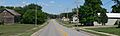
South Bend, seen from the west along Nebraska Highway 66
|
|

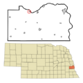
Location of South Bend, Nebraska
|
|
| Country | United States |
| State | Nebraska |
| County | Cass |
| Area | |
| • Total | 0.13 sq mi (0.35 km2) |
| • Land | 0.13 sq mi (0.35 km2) |
| • Water | 0.00 sq mi (0.00 km2) |
| Elevation | 1,043 ft (318 m) |
| Population
(2020)
|
|
| • Total | 92 |
| • Density | 686.57/sq mi (265.57/km2) |
| Time zone | UTC-6 (Central (CST)) |
| • Summer (DST) | UTC-5 (CDT) |
| ZIP code |
68058
|
| Area code(s) | 402 |
| FIPS code | 31-45680 |
| GNIS feature ID | 2399842 |
South Bend is a small village located in Cass County, Nebraska, in the United States. According to the 2020 census, 92 people lived there.
A key landmark in South Bend is a special bridge for people to walk across the Platte River. This bridge leads to the Schramm Park State Recreation Area. It was built in 2004 using the strong pillars of an old, unused Rock Island Railroad bridge. Even today, many trains, mostly carrying coal, still travel through the area on the BNSF Railway main line.
Contents
History of South Bend
The first people to settle permanently in the area that is now South Bend arrived in 1856. The village of South Bend was officially planned and mapped out, a process called platting, in 1857.
The town got its name from a curve, or "meander," in the nearby Platte River. The river makes a bend in that specific location.
Geography of South Bend
South Bend is located in Nebraska. The United States Census Bureau reports that the village covers a total area of about 0.13 square miles (0.35 square kilometers). All of this area is land, with no water.
Population and People in South Bend
| Historical population | |||
|---|---|---|---|
| Census | Pop. | %± | |
| 1880 | 232 | — | |
| 1890 | 132 | −43.1% | |
| 1900 | 141 | 6.8% | |
| 1910 | 125 | −11.3% | |
| 1920 | 143 | 14.4% | |
| 1930 | 99 | −30.8% | |
| 1940 | 100 | 1.0% | |
| 1950 | 100 | 0.0% | |
| 1960 | 86 | −14.0% | |
| 1970 | 86 | 0.0% | |
| 1980 | 107 | 24.4% | |
| 1990 | 93 | −13.1% | |
| 2000 | 86 | −7.5% | |
| 2010 | 99 | 15.1% | |
| 2020 | 92 | −7.1% | |
| U.S. Decennial Census | |||
South Bend Population in 2010
Based on the census from 2010, there were 99 people living in South Bend. These people lived in 41 different homes, and 28 of these were families.
The population density was about 761.5 people for every square mile (294.0 people per square kilometer). There were 47 housing units, which means places where people could live. On average, there were 361.5 housing units per square mile (139.6 per square kilometer).
Most of the people living in the village, 97.0%, were identified as White. About 3.0% of the population were from two or more racial backgrounds.
Households and Families
Out of the 41 households, 22.0% had children under 18 years old living with them. A large number, 61.0%, were married couples living together. About 7.3% of households had a female head of the house with no husband present. Also, 31.7% of the households were not families.
About 19.5% of all households were made up of just one person. Only 2.4% of households had someone living alone who was 65 years old or older. The average number of people in each household was 2.41, and the average family size was 2.82 people.
Age and Gender Distribution
The average age of people in the village was 44.8 years old.
- 17.2% of residents were younger than 18 years old.
- 7% were between 18 and 24 years old.
- 26.3% were between 25 and 44 years old.
- 30.3% were between 45 and 64 years old.
- 19.2% were 65 years old or older.
When looking at gender, 50.5% of the people in the village were male, and 49.5% were female.
Images for kids
-
South Bend, Nebraska, seen from the west.
-
Map showing the location of South Bend, Nebraska.
See also
 In Spanish: South Bend (Nebraska) para niños
