
Cass County, Nebraska facts for kids
Quick facts for kids
Cass County
|
|
|---|---|

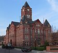
Cass County Courthouse in Plattsmouth
|
|

Location within the U.S. state of Nebraska
|
|
 Nebraska's location within the U.S. |
|
| Country | |
| State | |
| Founded | 1855 |
| Named for | Lewis Cass |
| Seat | Plattsmouth |
| Largest city | Plattsmouth |
| Area | |
| • Total | 566 sq mi (1,470 km2) |
| • Land | 557 sq mi (1,440 km2) |
| • Water | 8.4 sq mi (22 km2) 1.5%% |
| Population | |
| • Estimate
(2021)
|
27,017 |
| • Density | 48.5/sq mi (18.7/km2) |
| Time zone | UTC−6 (Central) |
| • Summer (DST) | UTC−5 (CDT) |
| Congressional district | 1st |
Cass County is a special area, like a district, in the state of Nebraska, USA. It has its own local government. In 2020, about 26,598 people lived here. The main city and county center is Plattsmouth. Plattsmouth is also the largest city in the county.
Cass County was created in 1855. It was named after General Lewis Cass. He was a famous American soldier and leader. Cass County is part of the larger Omaha–Council Bluffs area. This means it's connected to the big cities of Omaha and Council Bluffs.
If you see a Nebraska license plate with "20" at the start, it means the car is from Cass County. This number shows that Cass County had the 20th most registered vehicles when the system began in 1922.
Contents
Where is Cass County?
Cass County is located on the eastern side of Nebraska. Its eastern border touches the state of Iowa. The Missouri River flows between Cass County and Iowa. The county covers about 566 square miles. Most of this area is land, with a small part being water.
Main Roads
Many important roads run through Cass County. These roads help people travel easily across the county and to other places.
 Interstate 80
 U.S. Highway 6
 U.S. Highway 34
 U.S. Highway 75
 Nebraska Highway 1
 Nebraska Highway 43
 Nebraska Highway 50
 Nebraska Highway 63
 Nebraska Highway 66
 Nebraska Highway 67
Fun Outdoor Places
Cass County has several protected areas where people can enjoy nature. These include lakes and state parks.
- Beaver Lake
- Louisville State Recreation Area
- Eugene T. Mahoney State Park
- Platte River State Park
- Schilling Wildlife Management Area
Neighboring Counties
Cass County shares its borders with several other counties.
- Sarpy County – to the north
- Mills County, Iowa – to the northeast
- Fremont County, Iowa – to the southeast
- Otoe County – to the south
- Lancaster County – to the west
- Saunders County – to the northwest
Sometimes, people might get Cass County, Nebraska, mixed up with Cass County, Iowa. This happens because both counties are close to Omaha, Nebraska and get similar news and TV channels.
Who Lives in Cass County?
| Historical population | |||
|---|---|---|---|
| Census | Pop. | %± | |
| 1860 | 3,369 | — | |
| 1870 | 8,151 | 141.9% | |
| 1880 | 16,683 | 104.7% | |
| 1890 | 24,080 | 44.3% | |
| 1900 | 21,330 | −11.4% | |
| 1910 | 19,786 | −7.2% | |
| 1920 | 18,029 | −8.9% | |
| 1930 | 17,684 | −1.9% | |
| 1940 | 16,992 | −3.9% | |
| 1950 | 16,361 | −3.7% | |
| 1960 | 17,821 | 8.9% | |
| 1970 | 18,076 | 1.4% | |
| 1980 | 20,297 | 12.3% | |
| 1990 | 21,318 | 5.0% | |
| 2000 | 24,334 | 14.1% | |
| 2010 | 25,241 | 3.7% | |
| 2020 | 26,598 | 5.4% | |
| 2023 (est.) | 27,446 | 8.7% | |
| US Decennial Census 1790-1960 1900-1990 1990-2000 2010 |
|||
The population of Cass County has grown over the years. In 2020, there were 26,598 people living here. The county has about 48.5 people per square mile. Most people in Cass County are White. There are also smaller groups of Black, Native American, Asian, and other races. About 3.8% of the people are Hispanic or Latino.
The average age of people in Cass County is 37 years old. About 27.9% of the people are under 18 years old.
Towns and Villages
Cass County has several cities and many smaller villages. These are the communities where people live and work.
Cities
- Louisville
- Plattsmouth (This is the county seat, meaning it's the main administrative city.)
- Weeping Water
Villages
Other Communities
Some smaller communities in Cass County are not officially cities or villages.
- Cullom
- Factoryville
- Mynard
- Rock Bluff
- Wabash
County Divisions
Cass County is divided into smaller areas called precincts. This helps with local government and elections. The cities of Plattsmouth and Weeping Water are separate from these precincts.
- Avoca
- Center
- East Rock Bluff
- Eight Mile Grove
- Elmwood
- Greenwood
- Liberty
- City of Louisville
- Mount Pleasant
- Nehawka
- City of Plattsmouth
- Plattsmouth
- Salt Creek
- South Bend
- Stove Creek
- Tipton
- Weeping Water (City)
- Weeping Water
- West Rock Bluff
Images for kids
-
Cass County Courthouse in Plattsmouth
See also
 In Spanish: Condado de Cass (Nebraska) para niños
