Interstate 80 in Nebraska facts for kids
Quick facts for kids
Interstate 80 |
||||
|---|---|---|---|---|
|
I-80 highlighted in red
|
||||
| Route information | ||||
| Maintained by NDOR | ||||
| Length | 455.31 mi (732.75 km) | |||
| Existed | 1957–present | |||
| Major junctions | ||||
| West end | ||||
|
||||
| East end | ||||
| Location | ||||
| Counties: | Kimball, Cheyenne, Deuel, Keith, Lincoln, Dawson, Buffalo, Hall, Hamilton, York, Seward, Lancaster, Cass, Sarpy, Douglas | |||
| Highway system | ||||
| Main route of the Interstate Highway System Main • Auxiliary • Business Nebraska Highways
|
||||
Interstate 80 (I-80) is a major highway that crosses the state of Nebraska. It runs from the Wyoming state border in the west all the way to Omaha in the east. Nebraska was the very first state to finish building its main Interstate Highway System. This happened on October 19, 1974.
I-80 in Nebraska has more than 80 exits. It is the only Interstate Highway in the state that goes from one end to the other. Nebraska does not have a main north-south interstate route. Except for a short part of I-76 near the Colorado state line, I-80 is the only main (two-digit) Interstate Highway in Nebraska.
Contents
History of I-80 in Nebraska
I-80 in Nebraska follows a very old path. It was built along the route of the Great Platte River Road. This means it follows the same way as many famous historic trails. These include the Oregon Trail, the California Trail, and the Mormon Trail.
Planning for the Interstate began in 1957. This was after the government gave money for the project. The Nebraska State Highway Commission led the planning. They held meetings all over the state to decide where the road would go. There were "control points" in Omaha and Scottsbluff that had to be included. But the rest of the route could change.
Many meetings were held in cities like Grand Island, Kearney, and North Platte. People discussed if the highway should be north or south of the Platte River. They also talked about whether it should follow U.S. Highway 30. Debates about the route continued into the 1960s.
The first contract to build the Interstate was given in 1957. A 6.5-mile (10.5 km) section near Gretna was the first part finished that year. The first long section to open was 50 miles (80 km) long. It stretched between Dodge Street in Omaha and the West Lincoln interchange in Lincoln. This part opened in 1961.
The last section of I-80 in Nebraska was finished on April 1, 1974. This was celebrated with a "Golden Link" ceremony near Sidney. A brass connector was put into the road. This event was like the golden spike ceremony. That ceremony completed the Transcontinental Railroad in 1869.
The total length of I-80 in Nebraska is 455.27 miles (732.70 km) long. It cost about $435 million to build.
How I-80 Changed Nebraska
Building I-80 led to big changes in Nebraska. In 1957, the Nebraska Legislature decided to split up the Department of Roads and Irrigation. They created three new agencies. One of these was the Department of Roads. This was the first time an agency in Nebraska was only in charge of planning, building, and taking care of highways.
The Interstate project also made the state focus on other highways. New safety features were added to roads across the state. These included paved shoulders and wider safety areas next to the road. In 1965, the state legislature also asked for a study. This study looked at what was needed for every public road in Nebraska. This included state highways, county roads, and city streets.
Speed Limits Over Time
Here are the speed limits that have been in place on I-80 in Nebraska since it opened in 1957.
| Year | Speed limit (mph) |
Speed limit (km/h) |
Truck speed limit (mph) |
Truck limit (km/h) |
|---|---|---|---|---|
| 1960 | 70 | 113 | ||
| 1964 | 75 | 121 | 65 | 105 |
| 1974 | 55 | 89 | ||
| 1987 | 65 | 105 | ||
| 1995 | 75 | 121 | ||
What I-80 Looks Like
Special Names for Sections
The entire Interstate Highway System was named the "Dwight D. Eisenhower System of Interstate and Defense Highways" in 1990. The first signs for this name in Nebraska were put up in 1993.
Some parts of I-80 in Nebraska have special names. The spot where I-80 meets US-34 is called a "Purple Heart Memorial Highway." Also, the South 108th Street bridge over I-80 in Omaha is called the "Purple Heart Bridge." Both of these honor all the people who have received the Purple Heart award. A section of I-80 in Nebraska is also known as a Blue Star Memorial Highway.
Road Features and Scenery
In Nebraska, I-80 has 82 places where you can get on or off (called interchanges). There are 442 bridges that go over or under the road. You can also find 25 rest areas and one scenic overlook. These are usually spaced about 35 to 50 miles (56 to 80 km) apart.
The land next to I-80 in Nebraska is home to many plants. There are 28 types of grasses and forbs (flowering plants). You can also see 31 types of shrubs, 12 kinds of coniferous trees (like pine trees), and 39 types of deciduous trees (trees that lose their leaves). These are planted in the middle section of I-80.
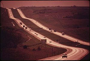
There are 570 signs along the way to give you information and directions. Small signs with the interstate shield are placed every half-mile (0.8 km) for a long stretch. They are also placed every fifth of a mile (0.3 km) as you head east. Most of the route goes through flat plains. A section between Lincoln and Grand Island is very straight with almost no curves.
Auxiliary Routes
Interstate 80 has three smaller routes in Nebraska. These are called auxiliary routes. One goes around the city of Omaha, another goes through Omaha, and the third is a short road into Lincoln.
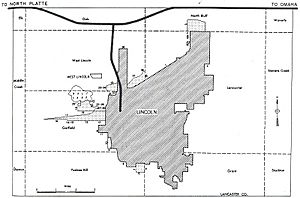
 I-180 is a short road that goes into downtown Lincoln. It shares its path with US-34 for its entire length.
 I-480 is a loop route in Omaha. It starts from I-29 in Council Bluffs and goes west towards I-80. It is the inner of two loop roads in Omaha. It shares its path with US-75 for about 2.5 miles (4.0 km). It also shares with US-6 for less than 1 mile (1.6 km) as it crosses the Missouri River into Iowa.
 I-680 is a loop that goes around the northwest part of Omaha. It is the outer of the two Omaha loops. A section of this road was first called I-280. But because it went into Iowa and had the same number as another I-280, it was renamed I-680.
 | Anna J. Cooper |
 | Mary McLeod Bethune |
 | Lillie Mae Bradford |


