Douglas County, Nebraska facts for kids
Quick facts for kids
Douglas County
|
|||
|---|---|---|---|

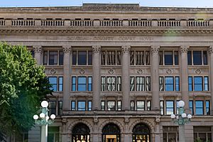
Douglas County Courthouse in Omaha
|
|||
|
|||

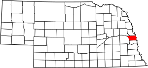
Location within the U.S. state of Nebraska
|
|||
 Nebraska's location within the U.S. |
|||
| Country | |||
| State | |||
| Founded | November 23, 1854 | ||
| Named for | Stephen A. Douglas | ||
| Seat | Omaha | ||
| Largest city | Omaha | ||
| Area | |||
| • Total | 339 sq mi (880 km2) | ||
| • Land | 328 sq mi (850 km2) | ||
| • Water | 11 sq mi (30 km2) 3.2%% | ||
| Population
(2020)
|
|||
| • Total | 584,526 | ||
| • Estimate
(2023)
|
589,540 |
||
| • Density | 1,724.3/sq mi (665.7/km2) | ||
| Time zone | UTC−6 (Central) | ||
| • Summer (DST) | UTC−5 (CDT) | ||
| Congressional district | 2nd | ||
Douglas County is a special area called a county in the state of Nebraska, USA. In 2020, about 584,526 people lived here. It's the county with the most people in Nebraska, home to almost 30% of everyone in the state! The main city, called the county seat, is Omaha. Omaha is also the biggest city in Nebraska.
Douglas County was started in 1854. It was named after Stephen A. Douglas, who was a very important US Senator from Illinois.
This county is part of a larger area called the Omaha-Council Bluffs Metropolitan Statistical Area. This means it's connected to nearby cities in both Nebraska and Iowa.
For a long time, Nebraska used a special system for license plates. Douglas County had the number "1" because it had the most cars registered in 1922. This system changed in 2002 for Douglas and two other big counties.
Contents
Where is Douglas County Located?
Douglas County is on the eastern side of Nebraska. Its eastern border is right next to the state of Iowa, across the Missouri River. The Elkhorn River flows through the western-central part of the county. The Platte River forms part of its western border.
The U.S. Census Bureau says the county covers about 339 square miles. Most of this (328 square miles) is land, and about 11 square miles (3.2%) is water.
Main Roads in Douglas County
Many important roads help people travel through Douglas County. These include major interstate highways and US routes.
 Interstate 80
 Interstate 480
 Interstate 680
 U.S. Highway 6
 U.S. Highway 75
 U.S. Highway 275
 Nebraska Highway 31
 Nebraska Highway 36
 Nebraska Highway 50
 Nebraska Highway 64
 Nebraska Highway 85
 Nebraska Highway 92
 Nebraska Highway 133
Public Transportation Options
You can travel in and out of Douglas County using different types of public transport.
- Amtrak California Zephyr (train service at Omaha station)
- Burlington Trailways (bus service at Omaha Bus Station)
- Express Arrow (bus service at Omaha Bus Station)
- Jefferson Lines (bus service at Omaha Bus Station)
- Metro Transit (local bus service in Omaha)
Neighboring Counties
Douglas County shares its borders with several other counties:
- Dodge County – to the northwest
- Washington County – to the north
- Pottawattamie County, Iowa – to the east (across the river)
- Sarpy County – to the south
- Saunders County – to the west
Nature and Parks
Douglas County has some beautiful natural areas where people can enjoy the outdoors.
- Bluestem Prairie Preserve
- Two Rivers State Recreation Area
How Many People Live Here?
The number of people living in Douglas County has grown a lot over the years.
| Historical population | |||
|---|---|---|---|
| Census | Pop. | %± | |
| 1860 | 4,328 | — | |
| 1870 | 19,982 | 361.7% | |
| 1880 | 37,645 | 88.4% | |
| 1890 | 158,008 | 319.7% | |
| 1900 | 140,590 | −11.0% | |
| 1910 | 168,546 | 19.9% | |
| 1920 | 204,524 | 21.3% | |
| 1930 | 232,982 | 13.9% | |
| 1940 | 247,562 | 6.3% | |
| 1950 | 281,020 | 13.5% | |
| 1960 | 343,490 | 22.2% | |
| 1970 | 389,455 | 13.4% | |
| 1980 | 397,038 | 1.9% | |
| 1990 | 416,444 | 4.9% | |
| 2000 | 463,585 | 11.3% | |
| 2010 | 517,110 | 11.5% | |
| 2020 | 584,526 | 13.0% | |
| 2023 (est.) | 589,540 | 14.0% | |
| US Decennial Census 1790-1960 1900-1990 1990-2000 2010-2019 |
|||
What the 2020 Census Showed
In 2020, the census counted 584,526 people in Douglas County. This means there were about 1,724 people living in each square mile.
The census also looked at the different backgrounds of people.
- About 68.8% of people were White.
- About 11.5% were Black or African American.
- About 1.2% were Native American.
- About 4.3% were Asian.
- A small number (0.1%) were Pacific Islander.
- About 2.8% were from two or more races.
- About 12.9% of the people were Hispanic or Latino (of any race).
What the 2010 Census Showed
The 2010 census counted 517,110 people. The population density was about 1,574 people per square mile.
The racial makeup in 2010 was:
- 76.4% White
- 11.6% Black or African American
- 0.7% Native American
- 2.7% Asian
- 0.1% Pacific Islander
- 5.7% from other races
- 2.8% from two or more races
- 11.2% of the population was Hispanic or Latino.
Many people in Douglas County have ancestors from different countries.
- About 30% had German ancestry.
- About 15% had Irish ancestry.
- About 8.0% had English ancestry.
- About 4.9% had Italian ancestry.
The average income for a household in 2010 was $51,878. For families, it was $67,666. The average income per person was $28,092. About 13.1% of all people, and 9.4% of families, lived below the poverty line.
Cities and Towns in Douglas County
Douglas County has several cities and smaller communities.
Cities
- Bennington
- Omaha (This is the county seat, where the main county government offices are.)
- Ralston
- Valley
Villages
Census-Designated Places
These are areas that are like towns but are not officially incorporated as cities or villages.
- King Lake
- Venice
Unincorporated Communities
These are smaller communities that are not part of any city or village.
Schools in Douglas County
Many different school districts serve the students in Douglas County.
- Arlington Public Schools
- Bennington Public Schools
- Douglas County West Community Schools
- Elkhorn Public Schools
- Fort Calhoun Community Schools
- Fremont Public Schools
- Gretna Public Schools
- Millard Public Schools
- Omaha Public Schools
- Ralston Public Schools
- Westside Community Schools
- Yutan Public Schools
The Nebraska School for the Deaf used to be in Douglas County.
Images for kids
See also
 In Spanish: Condado de Douglas (Nebraska) para niños
 | Shirley Ann Jackson |
 | Garett Morgan |
 | J. Ernest Wilkins Jr. |
 | Elijah McCoy |


