Dawson County, Nebraska facts for kids
Quick facts for kids
Dawson County
|
|
|---|---|
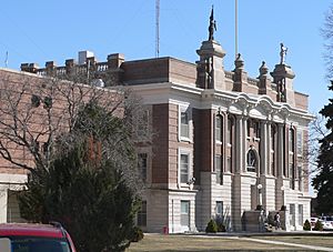
Dawson County Courthouse in Lexington
|
|
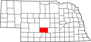
Location within the U.S. state of Nebraska
|
|
 Nebraska's location within the U.S. |
|
| Country | |
| State | |
| Founded | 1860 (authorized by Territorial Legislature) 1871 (authorized by proclamation of Acting Governor) |
| Named for | Jacob Dawson |
| Seat | Lexington |
| Largest city | Lexington |
| Area | |
| • Total | 1,019 sq mi (2,640 km2) |
| • Land | 1,013 sq mi (2,620 km2) |
| • Water | 6.3 sq mi (16 km2) 0.6%% |
| Population
(2020)
|
|
| • Total | 24,111 |
| • Density | 23.661/sq mi (9.136/km2) |
| Time zone | UTC−6 (Central) |
| • Summer (DST) | UTC−5 (CDT) |
| Congressional district | 3rd |
Dawson County is a county located in the state of Nebraska in the United States. In 2020, about 24,111 people lived here. The main city and county seat is Lexington.
Dawson County is part of the Lexington, NE Micropolitan Statistical Area. This means it's a smaller city area with a central city and nearby communities that are closely connected.
If you look at Nebraska license plates, cars from Dawson County have the number 18. This is because Dawson County had the 18th largest number of registered vehicles when the license plate system started in 1922.
Contents
History of Dawson County
Dawson County was first created by the state's government in 1860. It officially became a county in 1871. This happened when the acting Governor, William James, made an official announcement.
There are a couple of ideas about how the county got its name. The county's own website says it was named after Jacob Dawson. He was the first postmaster in a settlement called Lancaster County, Nebraska. However, other sources suggest it was named after John Littleton Dawson. He was a Congressman from Pennsylvania.
Geography and Nature in Dawson County
Dawson County is located near the middle of Nebraska. It is in the part of the state that uses the Central Time Zone.
According to official records, the county covers an area of about 1,019 square miles. Most of this area, about 1,013 square miles, is land. The rest, about 6.3 square miles, is water.
Main Roads in Dawson County
You can travel through Dawson County using several important roads:
 Interstate 80
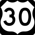
 U.S. Highway 30
 U.S. Highway 283
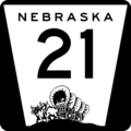
 Nebraska Highway 21
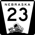
 Nebraska Highway 23
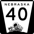
 Nebraska Highway 40
 Nebraska Highway 47
Public Transportation
If you need to travel by bus, you can use:
- Burlington Trailways
- Express Arrow
Parks and Wildlife Areas
Dawson County has several protected areas where you can enjoy nature:
- Bitterns Call State Wildlife Management Area
- Dogwood State Wildlife Management Area
- East Willow Island State Wildlife Management Area
- Gallagher Canyon State Recreation Area
Neighboring Counties
Dawson County shares its borders with these other counties:
- Buffalo County – to the east
- Phelps County – to the southeast
- Gosper County – to the south
- Frontier County – to the southwest
- Lincoln County – to the west
- Custer County – to the north
People in Dawson County
The number of people living in Dawson County has changed over the years. Here's how the population has grown:
| Historical population | |||
|---|---|---|---|
| Census | Pop. | %± | |
| 1860 | 16 | — | |
| 1870 | 103 | 543.8% | |
| 1880 | 2,909 | 2,724.3% | |
| 1890 | 10,129 | 248.2% | |
| 1900 | 12,264 | 21.1% | |
| 1910 | 15,961 | 30.1% | |
| 1920 | 16,004 | 0.3% | |
| 1930 | 17,875 | 11.7% | |
| 1940 | 17,890 | 0.1% | |
| 1950 | 19,393 | 8.4% | |
| 1960 | 19,405 | 0.1% | |
| 1970 | 19,771 | 1.9% | |
| 1980 | 22,304 | 12.8% | |
| 1990 | 19,940 | −10.6% | |
| 2000 | 24,365 | 22.2% | |
| 2010 | 24,326 | −0.2% | |
| 2020 | 24,111 | −0.9% | |
| US Decennial Census 1790-1960 1900-1990 1990-2000 2010 2020 |
|||
In 2020, there were 24,111 people living in Dawson County. The county had about 24 people per square mile. Most people (72.7%) were White. Other groups included Black or African American (5.5%), Native American (2.5%), and Asian (1.1%). About 35.8% of the population identified as Hispanic or Latino.
There were about 8,965 households in the county. About 27.1% of these households had children under 18 living with them. Many households (58.8%) were married couples. The average household had 2.71 people.
The median age in the county was 34 years old. This means half the people were younger than 34, and half were older. About 29.2% of the population was under 18 years old.
Communities in Dawson County
Dawson County has several towns and villages where people live.
Cities
- Cozad
- Gothenburg
- Lexington (This is the main city and county seat)
Villages
Other Communities
- Willow Island (a census-designated place)
- Buffalo (an unincorporated community)
- Darr (an unincorporated community)
- Josselyn (an unincorporated community)
Images for kids
See also
 In Spanish: Condado de Dawson (Nebraska) para niños
 | Sharif Bey |
 | Hale Woodruff |
 | Richmond Barthé |
 | Purvis Young |


