Phelps County, Nebraska facts for kids
Quick facts for kids
Phelps County
|
|
|---|---|

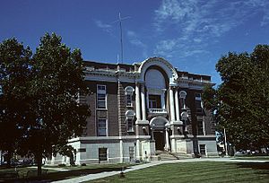
Phelps County Courthouse in Holdrege
|
|

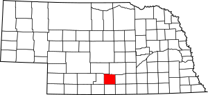
Location within the U.S. state of Nebraska
|
|
 Nebraska's location within the U.S. |
|
| Country | |
| State | |
| Founded | 1873 |
| Named for | William Phelps |
| Seat | Holdrege |
| Largest city | Holdrege |
| Area | |
| • Total | 540 sq mi (1,400 km2) |
| • Land | 540 sq mi (1,400 km2) |
| • Water | 0.6 sq mi (2 km2) 0.1%% |
| Population
(2020)
|
|
| • Total | 8,968 |
| • Density | 16.61/sq mi (6.41/km2) |
| Time zone | UTC−6 (Central) |
| • Summer (DST) | UTC−5 (CDT) |
| Congressional district | 3rd |
Phelps County is a county located in the state of Nebraska in the United States. In 2020, about 8,968 people lived there. The main town and county seat (the place where the county government is) is Holdrege.
Phelps County was created in 1873. It was named after William Phelps, who was a steamboat captain and one of the first people to settle in the area.
If you look at Nebraska license plates, Phelps County is shown by the number 37. This is because it had the 37th highest number of registered vehicles when the license plate system started in 1922.
Contents
Geography of Phelps County
Phelps County has gently rolling hills. Most of the land is used for farming. The land slopes down towards the east and drops off near the Platte River, which flows along the northern border of the county.
The total area of Phelps County is about 540 square miles. Almost all of this is land, with only a very small amount (0.6 square miles) being water.
Main Roads
Train Travel
- Amtrak's California Zephyr train stops at the Holdrege station.
Neighboring Counties
- Kearney County – to the east
- Franklin County – to the southeast
- Harlan County – to the south
- Furnas County – to the southwest
- Gosper County – to the west
- Dawson County – to the northwest
- Buffalo County – to the northeast
Protected Natural Areas
These areas help protect wildlife and nature.
- Atlanta Marsh National Wildlife Management Area
- Cottonwood Federal Waterfowl Production Area
- Johnson Federal Waterfowl Production Area
- Jones Federal Waterfowl Production Area
- Lake Seldom Wildlife Refuge
- Lynder Federal Waterfowl Production Area
- Richardson Lagoon State Wildlife Management Area
- Sacramento-Wilcox State Wildlife Management Area
Population of Phelps County
| Historical population | |||
|---|---|---|---|
| Census | Pop. | %± | |
| 1880 | 2,447 | — | |
| 1890 | 9,869 | 303.3% | |
| 1900 | 10,772 | 9.1% | |
| 1910 | 10,451 | −3.0% | |
| 1920 | 9,900 | −5.3% | |
| 1930 | 9,261 | −6.5% | |
| 1940 | 8,452 | −8.7% | |
| 1950 | 9,048 | 7.1% | |
| 1960 | 9,800 | 8.3% | |
| 1970 | 9,553 | −2.5% | |
| 1980 | 9,769 | 2.3% | |
| 1990 | 9,715 | −0.6% | |
| 2000 | 9,747 | 0.3% | |
| 2010 | 9,188 | −5.7% | |
| 2020 | 8,968 | −2.4% | |
| US Decennial Census 1790-1960 1900-1990 1990-2000 2010 |
|||
In 2000, there were 9,747 people living in Phelps County. There were 3,844 households, which are groups of people living together in one home. The average number of people in each household was about 2.47.
About 26.5% of the people living in the county were under 18 years old. The median age was 39 years. This means half the people were younger than 39 and half were older.
Towns and Villages
City
- Holdrege (This is the county seat)
Villages
Other Communities (Unincorporated)
These are smaller places that are not officially cities or villages.
Townships
Townships are smaller areas within the county, often used for local government.
- Anderson
- Center
- Cottonwood
- Divide
- Garfield
- Industry-Rock Falls
- Laird
- Lake
- Prairie
- Sheridan
- Union
- Westmark
- Westside
- Williamsburg
See also
 In Spanish: Condado de Phelps (Nebraska) para niños
 | Selma Burke |
 | Pauline Powell Burns |
 | Frederick J. Brown |
 | Robert Blackburn |

