Furnas County, Nebraska facts for kids
Quick facts for kids
Furnas County
|
|
|---|---|

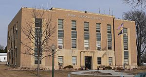
Furnas County Courthouse in Beaver City
|
|

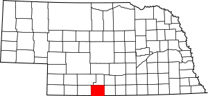
Location within the U.S. state of Nebraska
|
|
 Nebraska's location within the U.S. |
|
| Country | |
| State | |
| Founded | 1873 |
| Named for | Robert W. Furnas |
| Seat | Beaver City |
| Largest city | Cambridge |
| Area | |
| • Total | 721 sq mi (1,870 km2) |
| • Land | 719 sq mi (1,860 km2) |
| • Water | 1.5 sq mi (4 km2) 0.2%% |
| Population | |
| • Estimate
(2021)
|
4,636 |
| • Density | 6.6/sq mi (2.5/km2) |
| Time zone | UTC−6 (Central) |
| • Summer (DST) | UTC−5 (CDT) |
| Congressional district | 3rd |
Furnas County is a place in the state of Nebraska, USA. It is like a large district within the state. As of 2020, about 4,636 people live there.
The main town, or county seat, of Furnas County is Beaver City. The county was named after Robert Wilkinson Furnas. He was an important person who served as the second governor of Nebraska.
When you see a Nebraska license plate, Furnas County has a special number: 38. This number was given because it had the 38th largest number of registered vehicles back in 1922.
Contents
Geography of Furnas County
Furnas County is located in the southern part of Nebraska. Its southern border touches the northern border of Kansas. The Republican River flows through the middle of the county, moving from west to east.
The total area of Furnas County is about 721 square miles. Most of this area, about 719 square miles, is land. A small part, about 1.5 square miles, is water.
Main Roads in Furnas County
Many important roads pass through Furnas County. These roads help people travel and connect different communities.
Neighboring Counties
Furnas County shares its borders with several other counties. These are its neighbors:
- Harlan County (to the east)
- Norton County, Kansas (to the south)
- Decatur County, Kansas (to the southwest)
- Red Willow County (to the west)
- Frontier County (to the northwest)
- Gosper County (to the north)
- Phelps County (to the northeast)
People of Furnas County
| Historical population | |||
|---|---|---|---|
| Census | Pop. | %± | |
| 1880 | 6,407 | — | |
| 1890 | 9,840 | 53.6% | |
| 1900 | 12,373 | 25.7% | |
| 1910 | 12,083 | −2.3% | |
| 1920 | 11,657 | −3.5% | |
| 1930 | 12,140 | 4.1% | |
| 1940 | 10,098 | −16.8% | |
| 1950 | 9,385 | −7.1% | |
| 1960 | 7,711 | −17.8% | |
| 1970 | 6,897 | −10.6% | |
| 1980 | 6,486 | −6.0% | |
| 1990 | 5,553 | −14.4% | |
| 2000 | 5,324 | −4.1% | |
| 2010 | 4,959 | −6.9% | |
| 2020 | 4,636 | −6.5% | |
| 2021 (est.) | 4,604 | −7.2% | |
| US Decennial Census 1790-1960 1900-1990 1990-2000 2010-2013 |
|||
In 2000, there were 5,324 people living in Furnas County. These people lived in 2,278 homes. About 1,489 of these homes were families. The county had about 7 people per square mile.
Most people in the county were White (98.22%). A small number of people were from other backgrounds. For example, 0.41% were Native American and 0.23% were Asian. About 1.15% of the population identified as Hispanic or Latino.
Many people in Furnas County have German (45.6%) or American (13.8%) heritage. Other common backgrounds include English, Irish, and Swedish.
About 28% of homes had children under 18 living there. Many homes (57.2%) were married couples living together. The average home had 2.28 people.
The age of people in the county varied. About 24.1% were under 18 years old. About 23.8% were 65 years or older. The average age was 44 years old.
Communities
Furnas County has several towns and villages where people live.
Cities
- Arapahoe
- Beaver City (This is the county seat, the main town)
- Cambridge
Villages
- Edison
- Hendley
- Holbrook
- Oxford (part of this village is in Furnas County)
- Wilsonville
Unincorporated communities
These are smaller places that are not officially cities or villages.
See also
 In Spanish: Condado de Furnas para niños
 | Delilah Pierce |
 | Gordon Parks |
 | Augusta Savage |
 | Charles Ethan Porter |

