South Cle Elum, Washington facts for kids
Quick facts for kids
South Cle Elum, Washington
|
|
|---|---|

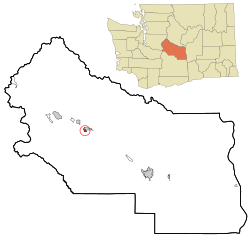
Location of South Cle Elum, Washington
|
|
| Country | United States |
| State | Washington |
| County | Kittitas |
| Area | |
| • Total | 0.40 sq mi (1.04 km2) |
| • Land | 0.40 sq mi (1.04 km2) |
| • Water | 0.00 sq mi (0.00 km2) |
| Elevation | 1,923 ft (586 m) |
| Population
(2020)
|
|
| • Total | 559 |
| • Density | 1,398/sq mi (537.5/km2) |
| Time zone | UTC-8 (Pacific (PST)) |
| • Summer (DST) | UTC-7 (PDT) |
| ZIP code |
98943
|
| Area code(s) | 509 |
| FIPS code | 53-65765 |
| GNIS feature ID | 1526142 |
| Website | Town of South Cle Elum |
South Cle Elum is a small town in Kittitas County, Washington, United States. It is located in the central part of Washington state. In 2020, about 559 people lived there. This town is known for its history with railroads.
Contents
History of South Cle Elum
How the Town Began
South Cle Elum started because of a big railway project. In 1909, the Chicago, Milwaukee & Puget Sound Railway was building a new line across the country. They needed a special stop called a "division point" near Cle Elum. This stop would help manage trains between different sections of the railway.
The railway decided to build its main line about a mile south of the city of Cle Elum. This new area was then planned out and called South Cle Elum. Workers built maintenance shops for trains and places for railway workers to live. A train station was also built. South Cle Elum officially became a town on August 28, 1911.
Geography and Location
Where is South Cle Elum?
South Cle Elum is located at coordinates 47°11′8″N 120°57′11″W / 47.18556°N 120.95306°W. It is a small town with a total area of about 0.40 square miles (1.04 square kilometers). All of this area is land.
Neighboring Towns
South Cle Elum is surrounded by other towns. Here are some of them:
 |
Ronald Roslyn |
Cle Elum |  |
|
| Thorp |
Population and People
How Many People Live Here?
The number of people living in South Cle Elum has changed over the years. Here is a look at the population from different years:
| Historical population | |||
|---|---|---|---|
| Census | Pop. | %± | |
| 1920 | 587 | — | |
| 1930 | 338 | −42.4% | |
| 1940 | 340 | 0.6% | |
| 1950 | 442 | 30.0% | |
| 1960 | 383 | −13.3% | |
| 1970 | 374 | −2.3% | |
| 1980 | 449 | 20.1% | |
| 1990 | 457 | 1.8% | |
| 2000 | 457 | 0.0% | |
| 2010 | 532 | 16.4% | |
| 2020 | 559 | 5.1% | |
| U.S. Decennial Census | |||
In 2010, there were 532 people living in South Cle Elum. There were 235 households, which are groups of people living in one home. About 28.5% of these homes had children under 18. The average age of people in the town was about 42.8 years old.
Fun Places to Visit
Exploring South Cle Elum
- Former Milwaukee Road Depot: This old train station was built in 1909. It has been fixed up and is now a museum. You can see old railway items there. There is even a cafe that looks like the old "beanery" where railway workers used to eat.
- The Iron Horse State Park: This park used to be the path for the Milwaukee Road railway. Now, it's a great place for people to hike, ski, or ride horses. Near the old train station, there is a special trail. It shows where important railway buildings, like the roundhouse, once stood.
- Former Milwaukee Road Bunkhouse: This building used to be where railway workers slept. Today, it is a bed and breakfast.
Famous People from South Cle Elum
- Douglas Albert Munro: He was a hero during World War II. He was the first and only person from the United States Coast Guard to receive the Medal of Honor. This is a very high award for bravery. He earned it for his actions during the Battle of Guadalcanal.
- The Smith Family of S & S Logging: This family was featured on the TV show Ax Men on the History Channel. They live in South Cle Elum.
See also
 In Spanish: South Cle Elum (Washington) para niños
 | Roy Wilkins |
 | John Lewis |
 | Linda Carol Brown |

