South Fork Clearwater River facts for kids
Quick facts for kids South Fork Clearwater River |
|
|---|---|

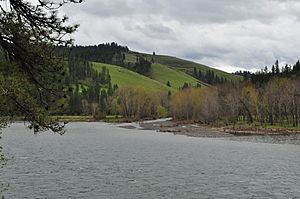
The river at the Chief Looking Glass Village site near Kooskia
|
|
|
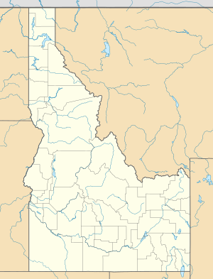
Location of the mouth of the South Fork Clearwater River in Idaho
|
|
| Country | United States |
| State | Idaho |
| Physical characteristics | |
| Main source | Confluence of American and Red Rivers Near Elk City, Nez Perce National Forest 3,901 ft (1,189 m) 45°48′30″N 115°28′29″W / 45.80833°N 115.47472°W |
| River mouth | Clearwater River Kooskia, Idaho County 1,224 ft (373 m) 46°08′45″N 115°58′57″W / 46.14583°N 115.98250°W |
| Length | 62 mi (100 km) |
| Basin features | |
| Basin size | 1,175 sq mi (3,040 km2) |
| Tributaries |
|
The South Fork Clearwater River is a river in north-central Idaho, United States. It flows for about 62-mile (100 km), which is like driving from one end of a big city to the other. This river is an important part of the larger Clearwater River system.
The South Fork Clearwater River helps drain a large area of land, about 1,175 square miles (3,040 km2). This is a huge area, bigger than many towns! It eventually joins with the Middle Fork Clearwater River to form the main Clearwater River. The Clearwater River then flows into the Snake River, which is a major river in the western United States.
Contents
Where Does the River Start?
The South Fork Clearwater River begins where two smaller rivers meet. These are the American River and the Red River. This meeting point is in the Nez Perce National Forest. It's at a high elevation of about 3,901 ft (1,189 m), which is higher than many mountains.
The American River
The American River is about 20-mile (32 km) long. It starts even higher up, at about 5,200 ft (1,600 m). It flows generally south until it meets the Red River. Sometimes, people think of the American River as the very beginning of the South Fork Clearwater River.
The Red River
The Red River is a bit longer, about 25 mi (40 km). It starts at an elevation of about 6,100 ft (1,900 m). This river flows towards the northwest before joining the American River.
Journey of the South Fork Clearwater River
After the American and Red Rivers join, the South Fork Clearwater River flows west. It travels through a deep canyon. Idaho State Highway 14 follows along this canyon.
What Rivers Join In?
As the river continues, other smaller streams and rivers add their water.
- The Crooked River joins from the left side.
- Newsome Creek joins from the right side.
- Near the town of Golden, Tenmile Creek flows in from the left.
- Further west, Johns Creek joins from the left.
- Meadow Creek adds its water from the right.
- Mill Creek also joins from the left.
Deep Canyons and Northern Flow
The canyon around the river gets very deep. It can be as deep as 2,000 ft (610 m) in some places. This is like looking down from a very tall skyscraper! The river then turns north near Grangeville.
From Grangeville, the river flows mostly north. It passes by the towns of Harpster and Stites. Finally, it reaches its end at Kooskia. Here, it flows into the main Clearwater River. This happens at an elevation of 1,224 ft (373 m).
History of the River and Fish
For a while, there was a dam on the South Fork Clearwater River. This was the Grangeville (Harpster) Dam, built in 1910. Its purpose was to create hydroelectricity, which is electricity made from the power of moving water.
Bringing Back the Fish
In 1963, the dam was taken down. This was a big step to help the river's fish. Removing the dam allowed fish like Chinook salmon and steelhead trout to swim freely again. These fish need to travel up and down the river to lay their eggs.
Today, the entire South Fork Clearwater River is free-flowing. There are no dams or big diversions blocking its path. This means fish and other wildlife can move naturally throughout the river system.
 | Delilah Pierce |
 | Gordon Parks |
 | Augusta Savage |
 | Charles Ethan Porter |


