Kooskia, Idaho facts for kids
Quick facts for kids
Kooskia, Idaho
|
|
|---|---|

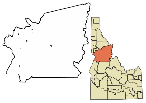
Location of Kooskia in Idaho County, Idaho.
|
|
| Country | United States |
| State | Idaho |
| County | Idaho |
| Area | |
| • Total | 0.69 sq mi (1.78 km2) |
| • Land | 0.63 sq mi (1.64 km2) |
| • Water | 0.06 sq mi (0.15 km2) |
| Elevation | 1,627 ft (496 m) |
| Population
(2010)
|
|
| • Total | 607 |
| • Density | 1,048.97/sq mi (405.30/km2) |
| Time zone | UTC-8 (Pacific (PST)) |
| • Summer (DST) | UTC-7 (PDT) |
| ZIP code |
83539
|
| Area code(s) | 208 |
| FIPS code | 16-44110 |
| GNIS feature ID | 2411556 |
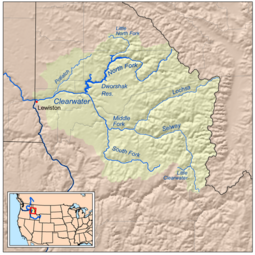
Kooskia (pronounced KOO-skee) is a small city in Idaho County, Idaho, United States. It is located where the South and Middle forks of the Clearwater River meet to form the main river. In 2010, the city had a population of 607 people.
Contents
History of Kooskia
The area where Kooskia is now located was once home to Chief Looking Glass and his group of Nez Perce Native Americans. Their village was a short distance from the current city. This village was inside the boundaries of the reservation created in 1863.
Just before the Nez Perce War, an American General was sent to arrest Chief Looking Glass. During a conflict, many Nez Perce people died, and their village was destroyed. Because of this event, Chief Looking Glass joined the Nez Perce in the war.
The name Kooskia likely comes from the Nez Perce word "koos-koos-kia." This word refers to the Clearwater River, which is smaller than the nearby Snake River. The town was first called Stuart, named after James Stuart, a Nez Perce surveyor and merchant.
When the railroad arrived in 1899, its station was named "Kooskia." This was because there was already another railroad station called "Stuart" in Idaho. For about ten years, the town was known by both names. In 1909, it was officially renamed Kooskia.
Kooskia is located within the Nez Perce Indian Reservation. In November 1895, the U.S. government opened parts of the reservation for white settlement. This was similar to how lands were opened in Oklahoma several years earlier.
The Kooskia Tramway
In 1903, a special transport system called an aerial tramway started operating from Kooskia. This tramway connected Kooskia to the higher Camas Prairie. It could carry a lot of grain, up to 190,000 pounds (about 86,000 kg) per day, using thirty buckets. There were warehouses at both ends of the tramway to store the grain.
After the Camas Prairie Railroad was finished in 1909, the tramway was used less and less. It finally stopped running in 1939. The tramway climbed towards a place called Lowe (later Winona). Some old maps even called Kooskia "Tramway." In 1907, the tramway had a big accident when a cable broke, but luckily, no one was hurt.
Kooskia Internment Camp
During the last two years of World War II, a place called the Kooskia Internment Camp was located about 30 miles (48 km) northeast of the city. This camp was originally a remote work camp for the Civilian Conservation Corps in the 1930s. Later, it was used by the Federal Bureau of Prisons.
In 1943, it became a camp for Japanese men who were living in the U.S. but were not citizens. They were called "enemy aliens" during the war. The camp was so far away in the western Bitterroot Mountains that it did not need fences or guard towers. Today, the site is an archaeological project. It is 6 miles (9.7 km) northeast of Lowell on U.S. 12, along the north bank of the Lochsa River.
Kooskia National Fish Hatchery
The Kooskia National Fish Hatchery was built in the 1960s. It is about 1.5 miles (2.4 km) southeast of the city, on the east bank of Clear Creek. This hatchery helps raise fish.
Geography and Climate
According to the United States Census Bureau, Kooskia covers a total area of 0.69 square miles (1.78 square kilometers). Most of this area, about 0.65 square miles (1.68 square kilometers), is land. The rest, about 0.04 square miles (0.10 square kilometers), is water.
Kooskia has an oceanic climate. This means it generally has mild temperatures and rainfall throughout the year. However, it gets drier in late summer, almost making it a warm-summer Mediterranean climate.
| Climate data for Kooskia (1989-2006) | |||||||||||||
|---|---|---|---|---|---|---|---|---|---|---|---|---|---|
| Month | Jan | Feb | Mar | Apr | May | Jun | Jul | Aug | Sep | Oct | Nov | Dec | Year |
| Record high °F (°C) | 55 (13) |
68 (20) |
75 (24) |
83 (28) |
91 (33) |
99 (37) |
107 (42) |
106 (41) |
99 (37) |
87 (31) |
76 (24) |
55 (13) |
107 (42) |
| Mean daily maximum °F (°C) | 38 (3) |
43.5 (6.4) |
52.5 (11.4) |
59.3 (15.2) |
66.5 (19.2) |
73 (23) |
84.9 (29.4) |
86.5 (30.3) |
76.9 (24.9) |
60.9 (16.1) |
45 (7) |
36.4 (2.4) |
60.3 (15.7) |
| Mean daily minimum °F (°C) | 25.3 (−3.7) |
25.6 (−3.6) |
31.3 (−0.4) |
36.3 (2.4) |
43 (6) |
48.5 (9.2) |
53.6 (12.0) |
52.8 (11.6) |
46 (8) |
36.5 (2.5) |
29.5 (−1.4) |
23.6 (−4.7) |
37.7 (3.2) |
| Record low °F (°C) | −6 (−21) |
−11 (−24) |
6 (−14) |
22 (−6) |
28 (−2) |
34 (1) |
38 (3) |
30 (−1) |
27 (−3) |
9 (−13) |
−6 (−21) |
−14 (−26) |
−14 (−26) |
| Average precipitation inches (mm) | 2.06 (52) |
1.51 (38) |
2.25 (57) |
3.15 (80) |
3.94 (100) |
2.5 (64) |
1.27 (32) |
0.82 (21) |
1.08 (27) |
2.05 (52) |
2.46 (62) |
1.81 (46) |
24.91 (633) |
| Average snowfall inches (cm) | 4.2 (11) |
0.6 (1.5) |
1.5 (3.8) |
0.4 (1.0) |
0 (0) |
0 (0) |
0 (0) |
0 (0) |
0 (0) |
0 (0) |
2.1 (5.3) |
3.2 (8.1) |
12 (30) |
| Average precipitation days | 14 | 11 | 13 | 15 | 14 | 13 | 6 | 5 | 6 | 10 | 14 | 14 | 135 |
| Source: WRCC | |||||||||||||
Population Changes
| Historical population | |||
|---|---|---|---|
| Census | Pop. | %± | |
| 1900 | 68 | — | |
| 1910 | 301 | 342.6% | |
| 1920 | 405 | 34.6% | |
| 1930 | 411 | 1.5% | |
| 1940 | 490 | 19.2% | |
| 1950 | 629 | 28.4% | |
| 1960 | 801 | 27.3% | |
| 1970 | 809 | 1.0% | |
| 1980 | 784 | −3.1% | |
| 1990 | 692 | −11.7% | |
| 2000 | 675 | −2.5% | |
| 2010 | 607 | −10.1% | |
| 2020 | 514 | −15.3% | |
| U.S. Decennial Census | |||
The population of Kooskia has changed over the years. In 1900, there were only 68 people. The population grew to over 800 people in the 1960s and 1970s. By 2010, the population was 607, and in 2020, it was 514.
2010 Census Details
In 2010, Kooskia had 607 people living in 272 households. There were 149 families. The city had about 934 people per square mile (361 people per square kilometer).
Most of the people in Kooskia were White (90.0%). About 4.9% were Native American, and 0.5% were Asian. About 4.4% of the population identified as two or more races. People of Hispanic or Latino background made up 2.1% of the population.
Out of the 272 households:
- 26.1% had children under 18 living with them.
- 40.4% were married couples.
- 9.6% had a female head of household with no husband present.
- 4.8% had a male head of household with no wife present.
- 45.2% were not families.
About 37.1% of all households were made up of single individuals. 18% of households had someone aged 65 or older living alone. The average household had 2.17 people, and the average family had 2.79 people.
The average age in Kooskia was 46.4 years.
- 20.9% of residents were under 18.
- 5.9% were between 18 and 24.
- 20.9% were between 25 and 44.
- 30.1% were between 45 and 64.
- 22.1% were 65 years or older.
The population was almost evenly split between males (50.6%) and females (49.4%).
Famous People from Kooskia
- Skip Brandt – He used to be a member of the Idaho Senate, which is part of the state government.
- Chaske Spencer – An actor known for his roles in movies like The Twilight Saga and the TV show Banshee.
Highways in Kooskia
 – U.S. 12 connects Kooskia to Lewiston (to the west) and Missoula (to the east).
 – SH 13 connects Kooskia to Grangeville (to the south).
See also
 In Spanish: Kooskia para niños
 | Jewel Prestage |
 | Ella Baker |
 | Fannie Lou Hamer |


