South Williamson, Kentucky facts for kids
Quick facts for kids
South Williamson, Kentucky
|
|
|---|---|
|
Census-designated place (CDP)
|
|

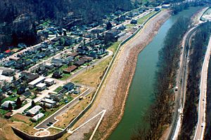
The town is protected by a floodwall along the Tug Fork River
|
|

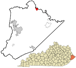
Location in Pike County and the state of Kentucky.
|
|
| Country | United States |
| State | Kentucky |
| County | Pike |
| Area | |
| • Total | 1.97 sq mi (5.11 km2) |
| • Land | 1.97 sq mi (5.11 km2) |
| • Water | 0.00 sq mi (0.00 km2) |
| Elevation | 705 ft (215 m) |
| Population
(2020)
|
|
| • Total | 562 |
| • Density | 284.70/sq mi (109.92/km2) |
| Zip codes |
41503, 41514 & 41527
|
| Area code(s) | 606 |
| FIPS code | 21-72264 |
| GNIS feature ID | 2629682 |
South Williamson is a small community located in the Appalachian Mountains of northeastern Pike County, Kentucky, United States. It is called a census-designated place (CDP). This means it is an area that looks like a town but does not have its own local government.
South Williamson sits right on the border with West Virginia. The Tug Fork River separates it from a town called Williamson, West Virginia. The community is found near U.S. Route 119. It is about 23 miles east of Pikeville, Kentucky and 28 miles southwest of Logan, West Virginia.
The area around South Williamson includes other Kentucky communities. These are Goody, Forest Hills, Toler, and Belfry. In the 1990s, people living here voted against becoming an officially incorporated town. Another idea to become a town was suggested in 2015. The name Johnsonville was proposed for this new town.
The local economy in South Williamson mostly depends on a few key industries. These include coal mining, transportation, healthcare, and retail stores.
You can find the Southside Mall in South Williamson.
Contents
History of South Williamson
Famous Family Feud
In the late 1800s, the area around Pike County and nearby Mingo County, West Virginia was the setting for a very famous dispute. This was the Hatfield-McCoy feud. It was a bitter fight between two families that lasted from 1878 to 1891. This feud has become a well-known part of American history.
Protecting Against Floods
South Williamson is protected by a large floodwall. The US Army Corps of Engineers built this wall. They built it after a very bad flood along the Tug Fork River in 1977.
The floodwall has special gates that can be closed to stop water. So far, these gates have only been used two times. The first time was in 2002 during a big flood in the region. The second time was in 2003, because people expected the river to get much higher.
Healthcare Services
South Williamson is home to an important medical center. It is called Appalachian Regional Healthcare's Tug Valley Regional Medical Center. This hospital provides healthcare services to the community.
Local Schools
Students in South Williamson attend schools in the area. These include:
- Belfry Elementary
- Belfry Middle
- Belfry High School
See also
 In Spanish: South Williamson para niños
 | Roy Wilkins |
 | John Lewis |
 | Linda Carol Brown |

