South Yuba River State Park facts for kids
Quick facts for kids South Yuba River State Park |
|
|---|---|

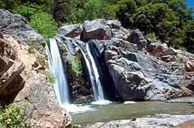
A waterfall on the South Fork Yuba River in South Yuba River State Park
|
|
| Lua error in Module:Location_map at line 420: attempt to index field 'wikibase' (a nil value). | |
| Location | Nevada County, California, USA |
| Area | 11,000 acres (45 km2) |
| Governing body | California Department of Parks and Recreation |
South Yuba River State Park is a beautiful place located along the South Fork of the Yuba River in the Sierra Nevada mountains of Northern California. It's found within Nevada County.
Contents
Discover South Yuba River State Park
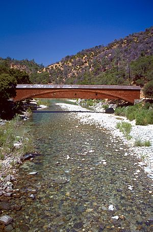
This park covers about 22 miles (35 kilometers) of the South Yuba River Canyon. It stretches from Malakoff Diggins State Historic Park all the way down to Bridgeport. At Bridgeport, you'll find the park's visitor center and the famous Bridgeport Covered Bridge.
Park Size and Management
The park protects over 11,000 acres (about 44.5 square kilometers) of land. The California Department of Parks and Recreation manages about 2,000 acres (8 square kilometers) of this land. The rest, about 9,000 acres (36 square kilometers), is managed by the federal Tahoe National Forest.
How to Get There
You can reach South Yuba River State Park from Highway 20 if you're coming from west of Grass Valley. Or, you can use Highway 49 if you're coming from north of Nevada City.

The Bridgeport Covered Bridge on the South Fork Yuba River in South Yuba River State Park
|
What Makes the Park Special?
South Yuba River State Park is known for many exciting things:
- Amazing Scenery: The wild and scenic Yuba River flows over huge granite rocks and through calm, green areas along the riverbanks. You can explore these beautiful spots by walking, hiking, or mountain biking.
- Natural Wonders: Learn about the park's interesting geology and the huge granite rock formations. Discover the many different plants, forests, and wildflowers. It's also a great place for birdwatching and seeing other animals.
- Gold Rush History: The park has strong connections to the gold mining days and the California Gold Rush of the 1800s. You can even see demonstrations of gold panning! Many people moved to this area during the Gold Rush, starting in 1849.
- Historic Bridges: Several old bridges from the 19th century are found along this part of the South Fork. These include the 1862 Bridgeport Covered Bridge and the 1865 Purdon Crossing bridge.
- Independence Trail: This is a special hiking trail that is also accessible for wheelchairs, making it easy for everyone to enjoy nature.
- Cool Swimming Holes: When summer temperatures get very hot, the natural swimming holes in the park are a popular spot to cool off and have fun.
 | Delilah Pierce |
 | Gordon Parks |
 | Augusta Savage |
 | Charles Ethan Porter |

